Phoksundo Lake on the Upper Dolpo Trek: Depth, Route and Rest Day
Published Oct 29, 2026 Updated Oct 29, 2026 8 min read
Quick answer
Phoksundo Lake is a turquoise, landslide-dammed lake at 3,600 m (11,811 ft) in Shey Phoksundo National Park. Our 24-day Upper Dolpo trek reaches it on Day 6, rests there on Day 7 and leaves along the cliffs on Day 8.
Three days up the Suli Gad from Dunai, past a waterfall that drops out of the cloud, the valley opens on a lake the colour of glacier ice. What Phoksundo is, how deep it really is, and how to spend your two nights on its shore.
Every Upper Dolpo trek has a moment when people stop talking, and on our route it's the first view of Phoksundo Lake on Day 6. Phoksundo Lake is also the last easy-going stop before the Upper Dolpo trek turns serious: after it come the restricted area, the camping and the high passes. This guide covers the lake itself; for the season, see the best time to trek Upper Dolpo.
Key facts
Altitude3,600 m (11,811 ft) at the lakeshore camp
Area494 ha, a Ramsar wetland of international importance since 23 September 2007
Depth145 m (476 ft) in 2004; 136.2 m (447 ft) in 2019
Formed byA landslide that dammed the valley
Waterfall167 m (548 ft), just south of the lake
On our routeArrive Day 6, rest Day 7, leave by the cliff trail Day 8
VillageRingmo, a Bon village at the lake's southern end
What is Phoksundo Lake?
Phoksundo Lake is a high mountain lake in Shey Phoksundo National Park, formed when a landslide dammed the valley. The Ramsar site covers 494 ha and has been a Ramsar wetland of international importance since September 2007.
Phoksundo Lake's Ramsar file, compiled by the Department of National Parks and Wildlife Conservation and WWF Nepal, describes the dam as debris from a collapsed section of mountainside about 2.5 km by 1.5 km, possibly brought down by an earthquake. The lake once stood about 20 m higher. Today it sits at 3,600 m (11,811 ft) on our itinerary, and in winter it freezes for around four months, from December to March.
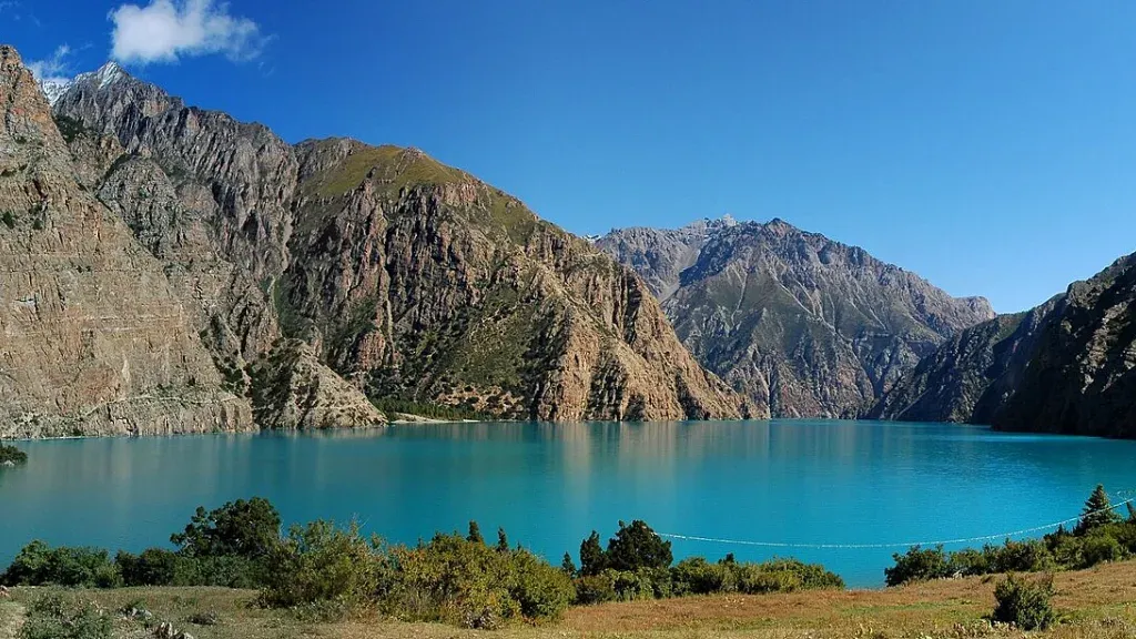
The colour is what people remember. Photos of Phoksundo Lake look edited, and they aren't; on a clear day the water really is that deep turquoise against dry brown cliffs. Cloud changes it fast, so if the sky is clear when you arrive, take your photos then rather than waiting for the evening.
Phoksundo Lake from the lakeshore camping area. Photo: Carsten Nebel, public domain, via Wikimedia Commons.
How deep is Phoksundo Lake?
Phoksundo Lake's depth depends on the survey. Nepal's Department of Hydrology and Meteorology measured 145 m (476 ft) in 2004 and 136.2 m (447 ft) in 2019, while a 2008 survey gave 202.41 m (664 ft).
The 145 m figure from 2004 is the one in the Ramsar file and on our own package page, and it replaced a much older estimate of about 600 m. The 2008 survey took 36 depth readings. The 2019 survey, carried out for the Department of Hydrology and Meteorology, took almost 4,000 on a grid across the lake and found a maximum of 136.2 m.
So the line you will read on almost every trek page, including our own package page, that Phoksundo is Nepal's deepest lake, only holds for the 2008 figure. The 2004 and 2019 figures both come in below Rara Lake, 169.93 m (558 ft) deep in the department's 2023 survey, and Shey Phoksundo National Park's own 2019 booklet calls Phoksundo the second deepest. I'd rather tell you that than repeat a record that isn't true. It's still a very deep lake for its size, and you won't be swimming in it.
How do you reach Phoksundo Lake on the Upper Dolpo trek?
On our route you reach Phoksundo Lake in four trekking days from the Juphal airstrip, 2,475 m (8,120 ft): down to Dunai, then up the Suli Gad and Phoksundo Khola valleys through Chhekpa and Chunuwar.
3
Juphal to Dunai, 2,140 m (7,021 ft)
About 10 km from the airstrip along the Thuli Bheri to the district headquarters.
4
Dunai to Chhekpa, 2,687 m (8,816 ft)
About 15 km, 6–7 hours. Your Shey Phoksundo National Park permit is checked on the way, where you enter the park.
5
Chhekpa to Chunuwar, 3,000 m (9,843 ft)
About 12 km, 5–6 hours, with lunch at Rechi. Before Chunuwar, two rivers of very different colours meet to form the Phoksundo River.
6
Chunuwar to Phoksundo Lake, 3,600 m (11,811 ft)
About 9 km, 5–6 hours, through cedar forest and past Palam, Ringmo's winter settlement, then up beside the waterfall to the lake.
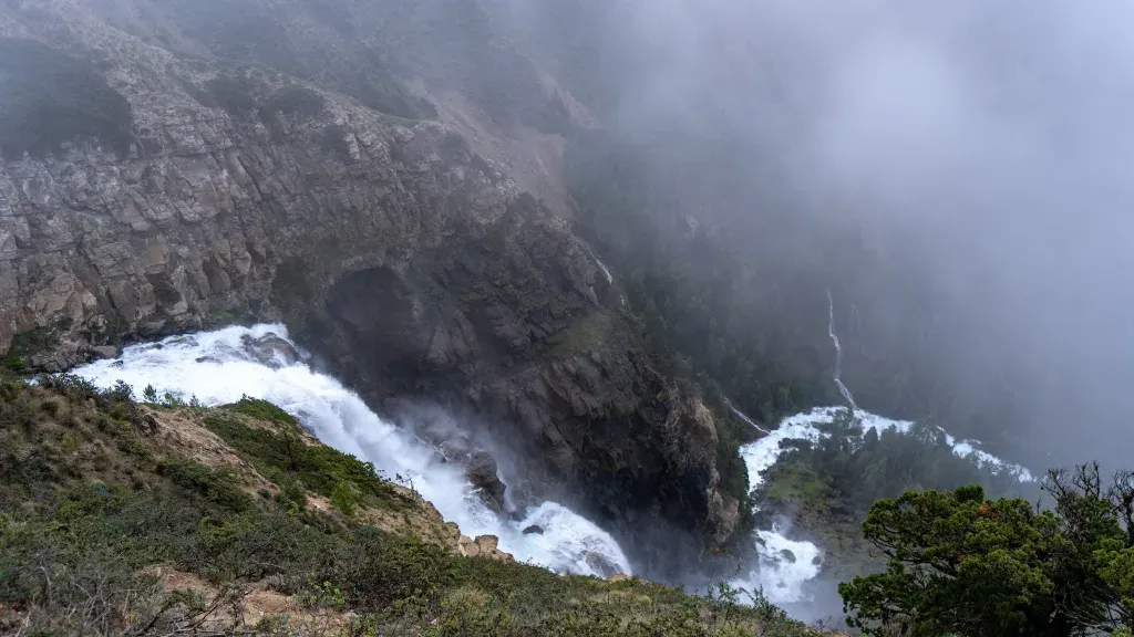
Day 6 is the one to save your energy for: it climbs about 600 m from Chunuwar and ends with the first view of the lake. The waterfall itself drops 167 m (548 ft) about 500 m south of the lake, and the Ramsar file records it as the largest in Nepal, citing a 1989 study.
A waterfall in cloud in the Phoksundo valley. Photo: North Nepal Travel & Trek.
What should you do on the rest day at Phoksundo Lake?
Day 7 at Phoksundo Lake is a rest and acclimatisation day. Use it for an easy shore walk, a visit to Ringmo village and the Tshowa gompa, and an early night before the trail enters the restricted area.
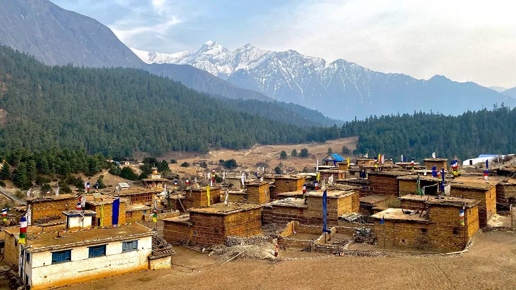
Ringmo sits at the southern end of the lake, a short walk from the camp. The Ramsar file counted 42 households there, and it is a Bon village, so walk around its chortens and mani walls anticlockwise. Our guide to Upper Dolpo culture covers Ringmo and Tshowa in more detail.
Boating isn't permitted on Phoksundo Lake, and you won't miss it. The best things to do are slow: walk the shore path past the chortens at the southern end, sit above the lake in the afternoon, and drink a lot of water. You have climbed about 1,125 m from Juphal in four days, and Day 9 takes you to 4,717 m (15,476 ft), so treat the rest day as part of your acclimatisation.
On Day 8 the Upper Dolpo trek leaves Phoksundo Lake on a narrow cliff trail above the water, then drops to the Phoksundo Khola and climbs to Sallaghari, 3,630 m (11,909 ft): about 7 km, 5–6 hours.
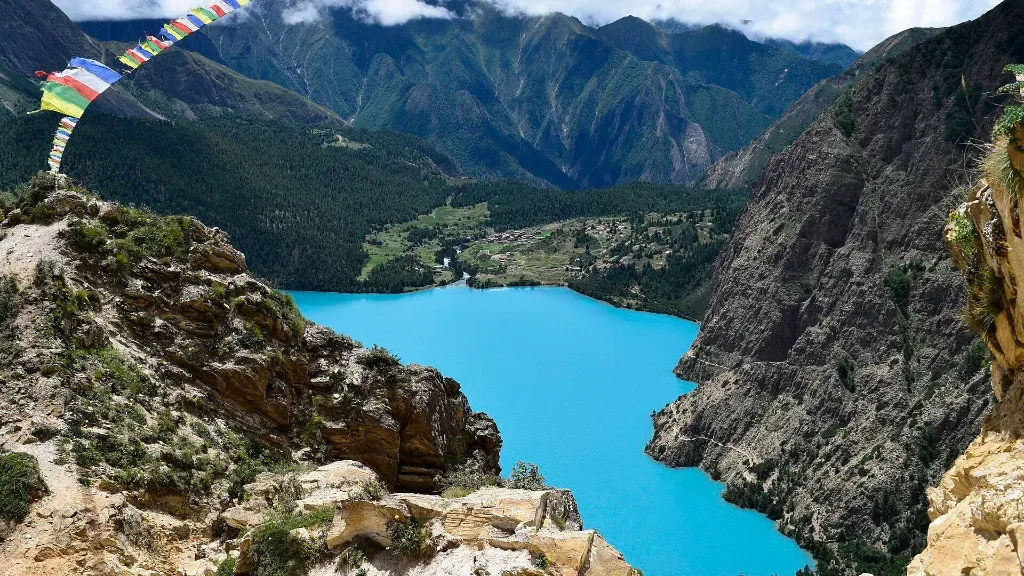
This section is the old salt-trading path between Dolpo and Tibet, and it marks your entry into the Upper Dolpo restricted area. From the high points above the lake you look straight down onto the water, and once you turn up the valley there are views towards Kanjirowa Himal, 6,612 m (21,693 ft). The Upper Dolpo restricted-area permit covers you from here on.
Heads up
The cliff trail above Phoksundo Lake is narrow and exposed in places, with a long drop to the water. It isn't technical, but it isn't the place for a phone in one hand. Keep to the inside, let pack animals pass on the uphill side, and tell your guide before Day 8 if you're uneasy with heights so they can walk beside you.
Phoksundo Lake's Ramsar file lists snow leopard, musk deer, grey wolf and blue sheep in the surrounding mountains, and water birds such as tufted duck, ferruginous duck, red-crested pochard and ruddy shelduck on the lake itself.
You are far more likely to see blue sheep on the slopes than a snow leopard, but the lake and its meadows are protected precisely because they support these animals. The same file names the main pressures on the lake: overgrazing, fuelwood and dung collection, and waste from the village. Writing in The Himalayan Times in 2020, Kai Weise noted that the Dolpo community had protested a road planned to the lake.
What that means for trekkers is simple: camp only in the designated areas by the lake, which is Shey Phoksundo National Park's rule, and use the toilet tent the crew sets up. What to carry out yourself is in our Upper Dolpo packing list.
Frequently asked questions
Phoksundo Lake is at 3,600 m (11,811 ft) at the lakeshore camp on our Upper Dolpo itinerary. The Ramsar file gives an average of 3,611.5 m for the site.
Probably not. Only a 2008 survey (202.41 m) put Phoksundo Lake ahead of Rara Lake. The 2004 (145 m) and 2019 (136.2 m) government figures are both shallower than Rara Lake, measured at 169.93 m (558 ft) in 2023.
Day 6 of our 24-day route. You arrive from Chunuwar, rest by the lake on Day 7, and leave on Day 8 by the cliff trail towards Sallaghari.
Boating isn't permitted on Phoksundo Lake, and we don't swim in it: the water is very cold and very deep, at 3,600 m (11,811 ft). Walking the shore is the way to enjoy it.
Our Lower Dolpo Circuit reaches Ringmo and the lake on the Lower Dolpo and Shey Phoksundo National Park permits. On the Upper Dolpo trek, the Upper Dolpo restricted area begins on the Day 8 trail beyond the lake.
Yes. Our 17-day Lower Dolpo Circuit spends time at Ringmo and Phoksundo Lake without entering the Upper Dolpo restricted area, so it needs fewer days and a much cheaper permit.
A native of the Annapurna region, he brings over 17 years of firsthand experience leading treks across the mountains of Nepal. His deep local roots and proven guiding expertise make him a trusted authority on authentic Himalayan adventures.