Annapurna Base Camp Trek (7 Days) — Cost, Itinerary & Guide for 2026
The 7-day Annapurna Base Camp trek from Pokhara starts via Jhinu Danda (hom...
OVERVIEW & HIGHLIGHTS
The 14-Day Upper Mustang Trek starts from Kathmandu via Pokhara & Jomsom into the trans-Himalayan rain shadow of the Tibetan Plateau, Nepal's "Forbidden Kingdom." Two permits are required: an Annapurna Conservation Area Project (~25 USD) permit & a Restricted Area Permit (USD 50 per day), now available under a revised system. Similarly, you can trek alone with a guide as of March 22, 2026. Ancient Tibetan-influenced Thakali and Loba communities in villages of Chele, Syanboche, and Ghami offer deep cultural exposure.
The trek is moderate, following ancient trade trails and wind-carved canyon paths that avoid dusty jeep roads. Steady elevation gains lead through dramatic eroded Red cliff landscapes and man-made ancient sky caves to the walled medieval city of Lo Manthang, the spiritual and cultural heart of Upper Mustang. The highest point, Marang La Pass at 4,230m (13,878 ft), offers sweeping views across the arid Mustang plateau toward the Tibetan Himalayan ranges.
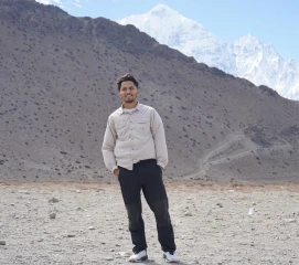
Niranjan Adhikari, Trekking Guide
Upper Mustang Trek route and logistics are drawn from 12+ years guiding North Nepal high-altitude expeditions. Mohan founded North Nepal Trek in 2015; since then, Niranjan Adhikari has guided multiple Dhaulagiri Circuit expeditions.
Catching a 25-minute flight to Pokhara after breakfast in the hotel falls in the morning schedule; however, you can also take a tourist bus, which takes about 7- 8 hours. Pokhara is also one of the most beautiful cities in Nepal. Exploring and enjoying the lakeside town at the base of the Annapurna Himalayas is the best thing you can do in Pokhara.
Photo: Fewa Lake with the view of Machhapuchre mountain and other peak in Pokhara.
We drive from Pokhara to Jomsom by jeep. We start early in the morning, and driving via a Jeep is a fast and scenic option that takes approximately 6-7 hours.
Starting from the Lakeside, the drive follows hilly highways through various small settlements, including Dhikur Pokhari and Beni. After passing through these areas, the journey reaches Tatopani, a popular stop for lunch and relaxation. Tatopani is known for its natural hot water springs, where travelers can take a break and unwind.

From Tatopani, the road continues through the stunning Mustang region, with spectacular views of mountains, hills, and waterfalls. The terrain becomes rugged and narrow after Beni, adding a sense of adventure to the trip. As the jeep makes its way through scenic villages like Marpha and Kagbeni, the ever-changing landscape keeps travelers captivated.
After driving for 6-7 hours, the journey concludes in Jomsom, where we can rest and enjoy the views of the Himalayas as well as the Mustang Valley.
Flight:
We will catch an early morning flight to Jomsom, where magnificent views of snow-capped mountain ranges await our arrival. Upon reaching Jomsom, located at an altitude of 2,780 meters, we will carry our bags and begin our trek towards Kagbeni, also known as the "desert of Nepal."
If we fly to Jomsom, then we will trek even on the first day of our Upper Mustang Trek. The trek route to Kagbeni takes us along the bank of the Kali Gandaki River, and we will pass through the small settlement of Eklo Bhatti (2,740m) while crossing several bridges over tributaries.
After enjoying the stunning views throughout the day, we will reach Kagbeni at an altitude of 2,810m. From here, trekkers can enjoy excellent views to the north towards the Kingdom of Mustang.
We will start our fourth day of the Upper Mustang hike after breakfast in Kagbeni, heading towards the village of Chele. The trek covers a distance of 15.3 kilometers (9.5 miles) and typically takes 6 to 7 hours to complete on foot. Chele, our destination for the day, is located at an elevation of 3,050 meters and offers magnificent views of the rugged Mustang landscape.

The trail follows the eastern side of the valley, running alongside the Kali Gandaki River. The initial path is a jeep track that is quieter than the first day, as Kagbeni marks the turning point for traffic heading to Muktinath. The route continues, with some steep uphill climbs reminding trekkers of the physical challenges ahead. Though the path is dusty and arid, the scenery is breathtaking, with clear views of the majestic Nilgiri and Tukuche peaks.
As we continue, we pass through Kalobhir, famous for its Sky Caves and a rock tunnel that marks an ancient river route. The trail alternates between the riverbed and the valley side, with the riverbed offering a slightly easier walk. Along the way, we encounter Tangbe, a traditional Gurung village known for its narrow alleys and whitewashed houses. The apple orchards and fields of barley and buckwheat surrounding the village add to the scenic beauty of the area.
After a short descent and climb from Tangbe, we reach Chhusang, a village located at the confluence of the Kali Gandaki rivers. Chhusang is notable for its long prayer wall that divides the village and the Cave Monastery on its northern edge, a fascinating site to explore. From here, the trail continues along the eastern side of the valley, occasionally elevated on stone gabions for support.
As we approach Chele, we cross a steel bridge over the river, with views of the cliff that looms ahead. The remnants of the river's old path through a rock tunnel can still be seen, though the water no longer flows through it. There are two final routes to Chele: a shorter, steeper climb or a longer, gentler ascent along the jeep track.
Chele is a beautiful village, offering panoramic views of the valley we have followed for the past two days. Surrounded by barren hills, rocky cliffs, and the Kali Gandaki River, Chele marks the end of this day’s trek and sets the stage for the adventures ahead in Upper Mustang.
On the fifth day of our Upper Mustang trek, we start early from Chele, packing lunch as there are no restaurants on our route. We start with a steep climb on our way from Chele to Syangboche. Our path takes us over several passes: Taklam La (3,624m), Dejong La (3,660m), Bhena La (3,830m), and Yamda La (4,010m).
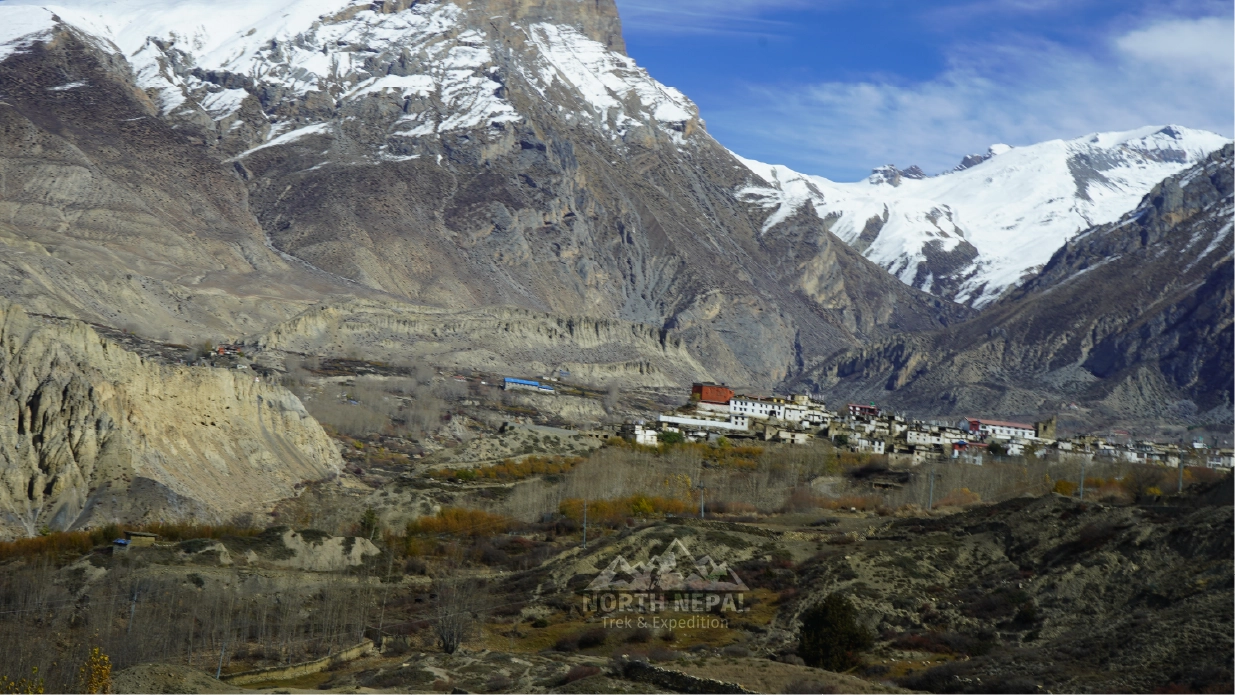
Photo: Arid landscape and snowy mountain en route Syanboche.
As we climb, we pass through Ghyakar village, part of a new route created after recent road construction. The trail offers stunning mountain views and dramatic landscapes. We then reach Samar village, which provides excellent views of Mount Nilgiri and serves as a resting point for pack animals.
From Samar, we have two options to reach Syangboche: via Bhena La or through Chungsi Cave. The Chungsi Cave route is recommended, offering unique views and a quieter path. This option allows us to enjoy the tranquil Himalayan surroundings and adds some excitement to our journey.
Our trek continues past monasteries and dry pastures, with Gyakar Village visible on our left. We then traverse desert-like terrain and small, isolated communities before reaching Yamda La pass. After a brief rest, we descend towards Gheling village, known for its white and ochre mud and stone buildings typical of Mustang architecture.
Throughout the day, we experience a variety of landscapes, from dry hills to high mountain passes, each with its breathtaking views. While challenging, the trail gives us a true taste of Mustang's unique environment and culture.
As evening nears, we arrive in Syangboche, located at 3,800 meters above sea level. After trekking for 6 -7 hours, we covered 11.5 km from Chele on a constant uphill trek. Here, we check into our accommodations for a well-earned rest after the day's significant elevation gain and distance covered.
On the fourth day of our Upper Mustang trek, we begin after breakfast in Syangboche, setting our sights on Ghami village. The journey covers 9.3 kilometers (5.7 miles) and typically takes 5 to 6 hours due to the challenging terrain.
Photo: Clustered tiny sand cliffs at Ghami in Upper Mustang
Our path immediately leads us over the Syangboche La pass at 3,850 meters. We then continue to ascend, crossing Nyi La at 4,020 meters before descending to Ghemi La at 3,765 meters. This constant up and down makes for a demanding but rewarding day of trekking.
The trail follows the traditional route, taking us through villages like Tamagaon, Ghiling, Chhunggar, and Jhaite. As we trek, we're treated to breathtaking views of the Himalayan landscape and vast blue skies. The semi-arid desert environment we traverse is reminiscent of the Tibetan plateau, offering a unique trekking experience. Walking on the arid landscape with the sight of sparse settlements, the Upper Mustang trek can be overwhelming sometimes. But you gotta keep the spirit high. Upper Mustang is blessed with its unique beauty and warm welcome from the local people.
Near Nyi La, we reach a viewpoint that provides spectacular vistas of the Mustang region and Himalayan peaks, including Annapurna and Dhaulagiri. The sight of barley and buckwheat fields amidst the dry, cold desert creates a striking contrast.
Our journey takes us through beautiful forests and past scattered tea houses. We follow trails through poplar groves and more barley fields before reaching Nyi Pass at 4,010 meters. From here, the path descends directly to Ghami village, one of the largest and most picturesque settlements in the Upper Mustang region.
Throughout the day, we're immersed in the culture and nature of Upper Mustang. The route offers insights into the preserved ancient traditions and lifestyles of these remote Himalayan villages. We follow the Kali Gandaki River at times, adding to the diverse scenery we encounter.
As evening approaches, we arrive in Ghami, where we'll spend the night. This beautiful village provides a well-earned rest after our day of trekking through varying elevations and terrains. Here, we can reflect on the day's journey and prepare for the adventures that await us in the coming days of our Upper Mustang trek.
On the seventh day of our trek, we start after breakfast in Ghami, setting out for Charang (Tsarang) village. Today's journey covers ~ 6 kilometers (4 miles) and typically takes 5 to 6 hours, challenging us with varied terrain and significant elevation changes.
Photo: Tsarang Chortens or memorials en route Lo Manthang (source)
Our path begins with a steep, somewhat slippery trail that leads us to the longest mani wall in Upper Mustang. This ancient prayer wall is not only a remarkable sight but also holds great cultural significance, marking the influence of Padmasambhava, the founder of Tibetan Buddhism, in this region.
We then cross a steel bridge over the Ghami Khola, facing a steep uphill climb towards Choya La pass at 3,870 meters - the most demanding part of today's trek. The effort is well rewarded at the top, where we're treated to breathtaking views of the Annapurna range, Dhaulagiri, Tukuche, Nilgiri, and other Himalayan giants.
From the pass, we traverse fairly rough terrain that offers perfect viewpoints of the isolated trans-Himalayan valley. The landscape is stark and beautiful, with little vegetation or signs of human habitation, resembling a high-altitude desert.
As we approach Tsarang (also known as Charang), situated at 3,560 meters above sea level, we enter through a chorten gate, a traditional Buddhist monument. Charang, Mustang's second-largest town, is known for its medieval fort and striking red gompa (monastery). The village sits atop the Charang Chu canyon, providing dramatic views of the surrounding landscape.
Throughout our journey, we encounter numerous Chortens, earning this area the nickname "Land of Chortens." These Buddhist shrines dot the landscape, adding to the cultural richness of our trek.
Upon reaching Tsarang, we have the opportunity to explore its old palace and the Tsarang monastery, which is associated with the Gelug sect of Buddhism. These historical sites offer fascinating insights into the area's ancient culture and traditions.
As evening approaches, we settle into our teahouse accommodations in Tsarang. Here, we can rest and reflect on a day filled with challenging hikes, breathtaking vistas, and deep cultural experiences. Our trek from Ghami to Charang has not only taken us through stunning Himalayan landscapes but also allowed us to explore the hidden treasures of Upper Mustang's rich heritage.
On this day, we depart from Tsarang (Charang) after breakfast, setting our sights on the legendary Lo Manthang. Today's journey covers 11 kilometers (6.8 miles) and typically takes 5 to 6 hours, with mostly flat and gradually ascending terrain.
Photo: View of Lo Manthang, agriculture field, and dry hills in the Upper Mustang region.
Our path leads us to Lo La pass at 3,960 meters, the highest point of today's trek. From this windy vantage point, we catch our first glimpse of Lo Manthang, the walled capital of Mustang. Founded in 1380 by Ame Pal, this historic city stands as a testament to the region's rich cultural heritage. As we descend from the pass towards Lo Manthang, the trail becomes a bit dusty but remains relatively short. Upon entering the city, we're immediately immersed in the ancient Tibetan culture that has thrived here for centuries.
Lo Manthang, situated at 3,800 meters, is the highlight and final destination of our Mustang trek. This isolated Tibetan settlement, home to about 900 Lhoba people, is surrounded by protective walls, earning it the moniker "walled city of Upper Mustang." The area is known for its cultural richness, with influences from Tibetan and Newari traditions.
Near Lo Manthang, archaeologists have discovered twelve caves containing ancient Buddhist paintings, some dating back to the 13th century. These artistic treasures, along with numerous stupas, showcase the area's deep spiritual roots.
As we explore Lo Manthang, we'll encounter mud-brick houses, ancient monasteries, and breathtaking high-altitude desert landscapes punctuated by pockets of green. This remote region offers a unique blend of natural beauty and cultural depth, providing us with truly unforgettable experiences.
It's worth noting that Upper Mustang, including Lo Manthang, is a restricted area requiring special permits for foreign visitors. These regulations help preserve the unique culture and environment of this remarkable place.
As we settle into our accommodations in Lo Manthang, we can reflect on our journey through Upper Mustang, from the challenges of the trek to the cultural riches we've encountered. This day marks a significant milestone in our adventure, bringing us face-to-face with one of Nepal's most fascinating and well-preserved ancient cultures.
On the ninth day in Upper Mustang region, we take a break from long-distance hiking and trek on a day trip to Choser cave from Lo Manthang. The cave sits at an altitude of around 4,000 meters, offering us another chance to acclimate while exploring a fascinating historical site.
Photo: Typical Lo Manthang Vilalge house and Shija Jhong Cave at Chhoser.
Our journey to Choser cave covers varied terrain, with mostly flat and gradually ascending paths similar to previous days. The 11-kilometer round trip typically takes 4 to 5 hours, allowing us ample time to explore the cave system and surrounding area.
As we trek, we're treated to breathtaking views of the high-altitude desert landscape that characterizes Upper Mustang. From vantage points along the way, we can see Lo Manthang's walled city nestled in the valley below, a sight that reinforces the unique charm of this ancient kingdom.
Choser Cave, also known as Shija Jhong Cave, is part of a vast network of man-made caves in the region. The complex features a five-story structure with over 40 rooms connected by narrow passages and wooden ladders. Inside, we find walls adorned with ancient Buddhist paintings, providing insight into the area's rich spiritual heritage.
These caves have served multiple purposes over their 3,000-year history, including as burial chambers, meditation spaces, and refuges during conflicts. Their strategic location near the Tibetan border adds to their historical significance.
As we explore the caves and surrounding area, we gain a deeper appreciation for the resilience of the people who have called this harsh yet beautiful landscape home for millennia. The day trip to Choser Cave complements our trekking experience, offering a unique perspective on Upper Mustang's cultural and historical depth.
In the evening, we return to our accommodations in Lo Manthang, where we can rest and prepare for the next leg of our journey. This day of exploration adds another layer to our Upper Mustang adventure, combining physical activity with cultural immersion in a way that epitomizes the essence of trekking in this remarkable region.
On the tenth day of our Upper Mustang trek, we leave Lo Manthang and head towards Dhakmar. This is one of our longer days, covering 17.2 kilometers (10.6 miles) and taking 6 to 7 hours.
We start by trekking alongside high mountains and through gorges. Our first stop is Ghar Gumba, an ancient monastery at 3,931 meters, built in the 8th century by Guru Padmasambhava, it's linked to the Nyingma school of Buddhism.
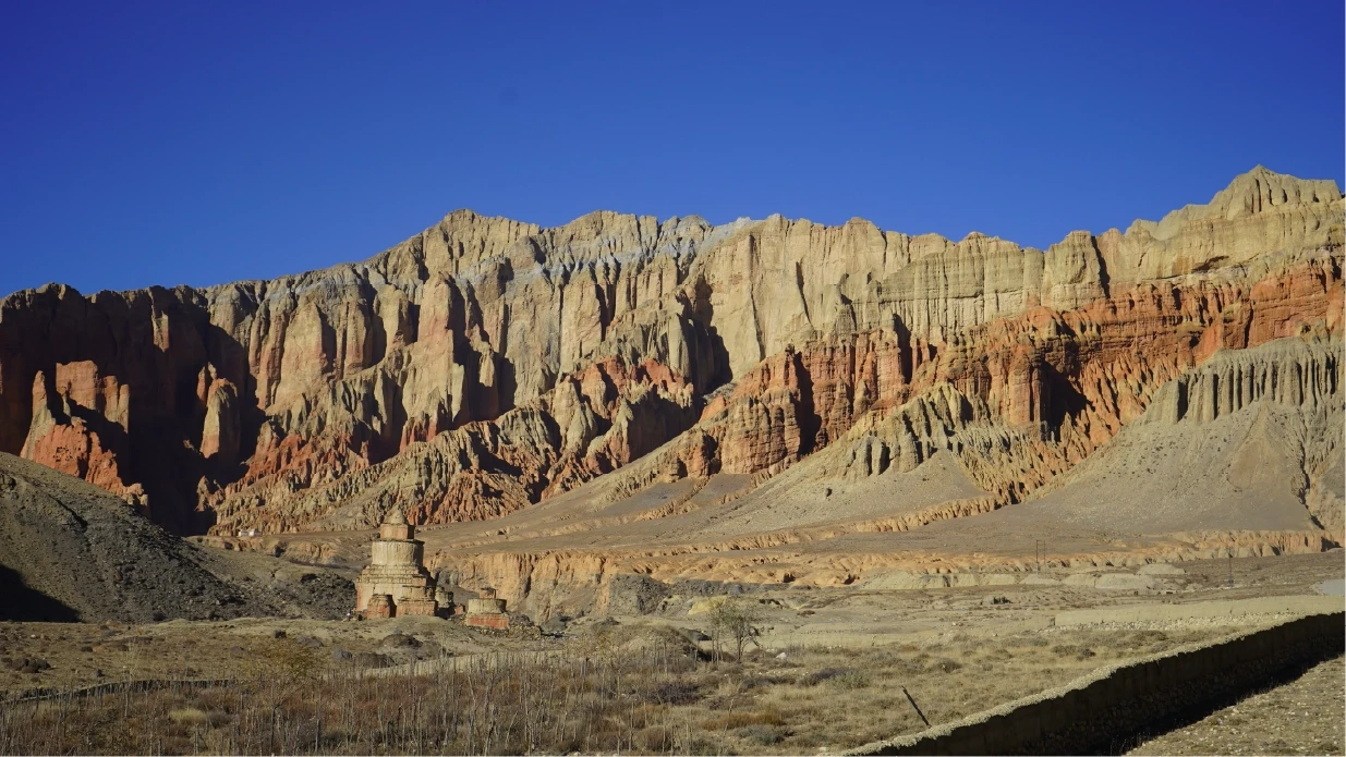
Photo: Red-colored Cliff in Dhakmar.
After Ghar Gumba, we climb to Marang La pass (also called Chogo La) at 4,230 meters - the highest point of our entire trek. The views here are impressive, showing off the Himalayas and the rough landscape of Upper Mustang.
We then cross Muila pass at 4,170 meters. Along the way, we see bright red cliffs that stand out against the barren surroundings.
We pass through small villages like Samduling, where we can see how the isolated location of Upper Mustang has helped keep old traditions alive. The area's culture is still closely tied to Tibet, which we notice in the buildings, customs, and religious practices.
Near Dhakmar, we visit some old monasteries with interesting rock paintings. People say wishes made here come true.
We end our day in Dhakmar, at 3,820 meters above sea level. After a long day of hiking and seeing new sights, we rest here for the night. The trek from Lo Manthang to Dhakmar has been tough but rewarding, showing us more of Upper Mustang's history and culture.
We leave Dhakmar after breakfast and walk to Ghiling. The trip is 14.3 kilometers (8.8 miles) long and takes about 5 to 6 hours. The path goes up and down.
Photo: Red-colored Cliff in Dhakmar.
We start by seeing the longest mani wall in Mustang and the old chortens. After 30 minutes, we get to Ghami village, which has high cliffs and caves nearby. From Ghami, we walk uphill for 1.5 to 2 hours, then go downhill to Ghiling.
We cross the Ghami La (3,765m) and Nyi La (4,020m) passes. The views from these passes are very good. We walk through Jhaite, Chhunggar, and Tamagaon villages.
The last part to Ghiling is downhill and takes about an hour. Ghiling is at 3,570 meters high. In Ghiling, we can look around the village, see monasteries on hills, look at sky caves, and see buckwheat fields.
This day's walk shows us more of Upper Mustang's Buddhist culture and old ways of life. We see different landscapes and learn about the area's history as we walk.
On the twelfth day of our Upper Mustang trek, we start from Ghiling after breakfast. We're heading to Chuksang, which is 17.2 kilometers (10.6 miles) away. The walk takes about 6 to 7 hours, mostly on flat or downhill paths.
Photo: Farming in the center of desert landscape of Ghiling. (source)
We begin by climbing up to Syangboche La Pass at 3,850 meters. From there, we take a different route to see the Chungsi cave near a deep valley. This cave is special because it has stone carvings of gods inside, the most famous one being Padmasambhava.
After the cave, we reach Samar village, where we stop for lunch. On the way to Samar, we see high mountains, the well-known Ranchung monastery cave, and Chhyungkar Chorten.
From Samar, we keep walking and cross two more passes: Dajong La at 3,660 meters and Taklam La at 3,624 meters. Then we go through Chele village before finally reaching Chuksang.
Chuksang is lower than where we started - it's at 2,980 meters, which is 590 meters below Ghiling. As we walk, we pass through small villages where we can see how local people live.
Today is the last day of trekking, as we say goodbye to Upper Mustang and head to Jomsom in Lower Mustang. We start from Chhusang and walk 22 kilometers (13.6 miles) to reach Jomsom. This is one of our longest days, but the path is mostly flat, so it's not too hard. It usually takes 6 to 7 hours.
Photo: Jomsom Airport
We follow the Kali Gandaki River, passing through villages like Tangbe, Kagbeni, and Eklebhatti. The Kali Gandaki valley is very beautiful and was once an important trading route between India and Tibet. Along the way, we might see fossilized ammonites called "Shaligram."
We stop for lunch in Kagbeni, where we can visit a small monastery and look back up the valley to Upper Mustang, where we've spent the last 10 days. After Kagbeni, we're back on the Annapurna Circuit Trek path.
As we walk, we notice changes in how people live and their customs. This shows us how different Lower Mustang is from Upper Mustang.
Our trek ends in Jomsom, a busy trading town at 2,720 meters above sea level. Here, we can rest and think about our journey through the Kingdom of Lo, and prepare for our journey to Pokhara.
On the last day of your trip, you can opt for a jeep from Jomsom to Pokhara or take a direct flight. Either way, you are back in Pokhara by night and can enjoy the city if you wish to do so.
Photo: Rupse Waterfall enroute Upper Mustang road.
Best Season: March to November suits Upper Mustang well since it sits in a rain shadow – even the monsoon months stay relatively dry here, unlike most of Nepal. A special Restricted Area Permit is required and must be arranged in advance.
Unforgettable Upper Mustang and Mardi Himal Treks with Flawless Organization
May 2025 • Solo
I completed the 10-day Upper Mustang Trek with North Nepal Travel & Trek, and the experience was perfect in every way. The agency organized every detail with great professionalism, but the true added value was being able to complete the entire trek on trails, almost completely avoiding the dusty road used by jeeps and motorbikes. This is a rare and highly valuable aspect, made possible only thanks to the expertise of North Nepal Travel & Trek’s guides.
A special thank you goes to my guide Zeewan, who, with passion, skill, and great care, turned the trek into a truly authentic and meaningful experience. I was able to fully enjoy the breathtaking landscapes and the unique atmosphere of the Tibetan villages along the route.
I was so satisfied with this agency that just a few days later, I chose to rely on them again for another trek: the Mardi Himal Trek, which was also flawlessly organized.
I highly recommend this agency and warmly thank Zeewan for guiding me with such dedication and passion.
Apr 2025 • Family
We had an extraordinary experience exploring the Upper Mustang region, thanks to the excellent organization provided by Mohan’s agency. From the very beginning, we felt warmly welcomed and well taken care of. We would especially like to highlight our guide, Jiban — a kind, attentive, and highly professional person. His deep knowledge of the area and local culture enriched every step of the trek, as he shared detailed insights about each village, local traditions, and all the trails we followed.
We sincerely appreciate the care and support we received, and we will definitely count on you again for our next adventure.
Thank you from the bottom of our hearts!
Apr 2025 • Family
I couldn’t be happier with my decision to book the Upper Mustang trek with this agency. Mohan, the manager, was exceptionally professional and supportive both before and after the trek. Our guide, Jiban, was simply outstanding—knowledgeable, attentive, and genuinely passionate. I would highly recommend this agency to anyone considering the trek. Thank you for everything!
Our 14-day itinerary is structured with gradual elevation gains and a full acclimatization day in Lo Manthang (3,840m) — used for exploring the walled city, monasteries, and optional side hikes to Choser Cave — to ensure proper preparation before crossing Marang La Pass at 4,230m. Guides conduct daily health assessments for early symptoms of Acute Mountain Sickness (AMS) using pulse oximeters and observation. Standard protocol mandates immediate descent to lower elevations if severe AMS symptoms appear. We plan the route to stay within the safe acclimatization window throughout the trans-Himalayan rain shadow.
In cases of severe injury, acute altitude illness, or extreme weather conditions in the remote Upper Mustang region, our office in Pokhara coordinates immediate emergency response. We maintain direct communication with certified helicopter rescue operators and have established evacuation routes from key villages including Lo Manthang, Ghami, and Jomsom, which has an airstrip. Guides carry satellite communication devices where mobile coverage is unreliable. Rapid coordination with insurance providers and Nepali authorities ensures the fastest possible extraction to medical facilities in Pokhara or Kathmandu.
Comprehensive travel insurance is mandatory for the Upper Mustang trek. Your policy must include emergency helicopter evacuation from remote high-altitude locations up to at least 4,500m, medical treatment for altitude-related illness and injury, and trip cancellation or interruption coverage. Given the isolation of the trans-Himalayan restricted area, rescue costs from villages like Lo Manthang or Dhakmar can be substantial without proper coverage. Purchase your policy in your home country before departure and share the emergency contact numbers with our office and your guide before the trek begins.
Secure the Upper Mustang Trek for 2026/2027 before the seat gets fully booked.
Upper Mustang is known for its distinctive Tibetan Buddhist culture, ancient monasteries, whitewashed villages, caves, chortens, mani walls and the historic walled city of Lo Manthang. The region was formerly the Kingdom of Lo and remained closed to foreign visitors until 1992, helping preserve its unique cultural heritage.
People in Upper Mustang primarily speak local Tibetan-influenced languages and dialects. Nepali is also widely understood, while English is spoken to varying degrees by people working in tourism.
Upper Mustang is a restricted area because of its sensitive location near the Tibetan border and the importance of protecting its cultural heritage, traditional communities and fragile environment. Foreign trekkers require a Restricted Area Permit and must travel with a licensed guide.
The trek takes you through traditional villages, ancient monasteries, Buddhist shrines, chortens and historic settlements. You can also experience local hospitality, traditional architecture and the distinctive Tibetan-influenced lifestyle of the people of Mustang.
Pack layered clothing, a warm down jacket, fleece, thermal base layers, a waterproof or windproof jacket, comfortable trekking boots, warm socks, gloves, a hat, sunglasses, sunscreen, a reusable water bottle, headlamp, personal medicines and a sleeping bag suitable for cold mountain nights.
Yes. Essential trekking equipment can generally be rented or purchased in Kathmandu or Pokhara. We recommend arranging important cold-weather gear before leaving for the trek rather than relying on small shops along the Upper Mustang route.
Yes. Porter service is available on request. One porter can carry luggage for two trekkers, with the load kept within a reasonable and ethical weight limit. You should carry only your daily essentials in your daypack.
Our Upper Mustang Trek package is currently USD 1,400 per person for two people, with lower per-person rates available for larger groups. The final price depends on group size, transportation, accommodation and services included in your selected itinerary.
The package includes the Upper Mustang Restricted Area Permit, ACAP, trekking accommodation, three meals during the trek, private or shared jeep transportation according to the itinerary, a licensed guide and guide expenses, seasonal fruits, a trek certificate and applicable government taxes.
Personal expenses such as snacks, beverages, hot showers, Wi-Fi, personal trekking equipment, travel insurance, tips and emergency evacuation are not included. Transportation or accommodation outside the stated itinerary may also be extra.
We accept international bank transfers, credit and debit cards through our payment gateway, and cash payments in USD or NPR. A 25–30% deposit is required to confirm the booking and begin the necessary arrangements.
Carry Nepali Rupees for personal expenses along the trail. Exchange your money in Kathmandu or Pokhara before starting the trek because currency exchange and card payment options are limited in remote Mustang villages.
Yes. Our current group rates are based on group size, with larger groups receiving a lower per-person price while maintaining the same guide, transportation and safety arrangements.
We recommend booking 2–3 months in advance during the main trekking seasons. Early booking helps secure your preferred departure date, guide, transportation and accommodation, especially during spring and autumn.
Yes. We can adjust the itinerary according to your available time, fitness level and interests. Extra acclimatization days, cultural visits, side trips and alternative routes can be incorporated where practical.
No. Foreign trekkers cannot independently arrange the Upper Mustang Restricted Area Permit. The trek must be organized through a registered Nepali trekking agency and you must travel with a licensed guide.
Yes. As of March 22, 2026, a foreign traveller can trek Upper Mustang without another trekking partner. However, Upper Mustang remains a restricted area, so you still need the appropriate permit and a licensed guide. Solo trekking does not mean independent unguided trekking.
You need a valid passport, the required passport details and photographs, along with other documents required for the permit application. We handle the permit processing and let you know exactly what documents are needed before your trek.
Cancellation terms depend on how close the cancellation is to the departure date and whether permits, transportation and accommodation have already been arranged. We provide the applicable cancellation conditions when confirming your booking. Travel insurance is strongly recommended to protect against unforeseen trip interruptions.
Spring (March–May) and autumn (September–November) are excellent seasons for Upper Mustang. The weather is generally stable, visibility is good and the mountain landscapes are clear.
Yes. Upper Mustang lies in the rain shadow of the Annapurna and Dhaulagiri ranges, so it receives considerably less rainfall than much of Nepal during the monsoon. June to August can therefore be a good period for trekking, although road and weather conditions on the approach should still be considered.
Winter trekking is possible but considerably more challenging. Temperatures can become very cold, snowfall may affect high passes and some lodges may close as local residents move to warmer areas. We generally recommend spring, summer/monsoon or autumn for a more practical trekking experience.
Upper Mustang has a dry, high-altitude climate. Days can be sunny and relatively warm, while mornings, evenings and nights are much colder. Strong winds commonly develop during the afternoon, particularly in the exposed valleys.
The Upper Mustang Trek is moderate to adventurous. The trail is not technically difficult, but trekkers walk for several consecutive days at elevations generally above 3,000 meters, cross high passes and deal with dry, windy and sometimes rugged terrain. Good physical fitness is recommended.
Yes, beginners with good general fitness can complete the trek. Previous high-altitude trekking experience is helpful but not essential. Regular walking, hiking, running or cycling before the trek will help you handle the consecutive trekking days more comfortably.
Altitude sickness is possible because much of the trek takes place above 3,000 meters, with the highest passes reaching over 4,000 meters. Ascending gradually, maintaining a sensible pace, drinking enough fluids and reporting symptoms such as persistent headache, nausea, dizziness or unusual fatigue to your guide are important.
Build endurance before the trek with regular walking, hiking, running or cycling. Include leg-strengthening exercises and, if possible, practice uphill walking while carrying a light backpack. You don’t need technical climbing skills, but you should be comfortable with several hours of walking on consecutive days.
Yes. We strongly recommend comprehensive travel insurance covering high-altitude trekking, medical treatment, emergency evacuation, trip cancellation and baggage loss. Check the altitude limit and emergency evacuation conditions carefully before purchasing your policy.
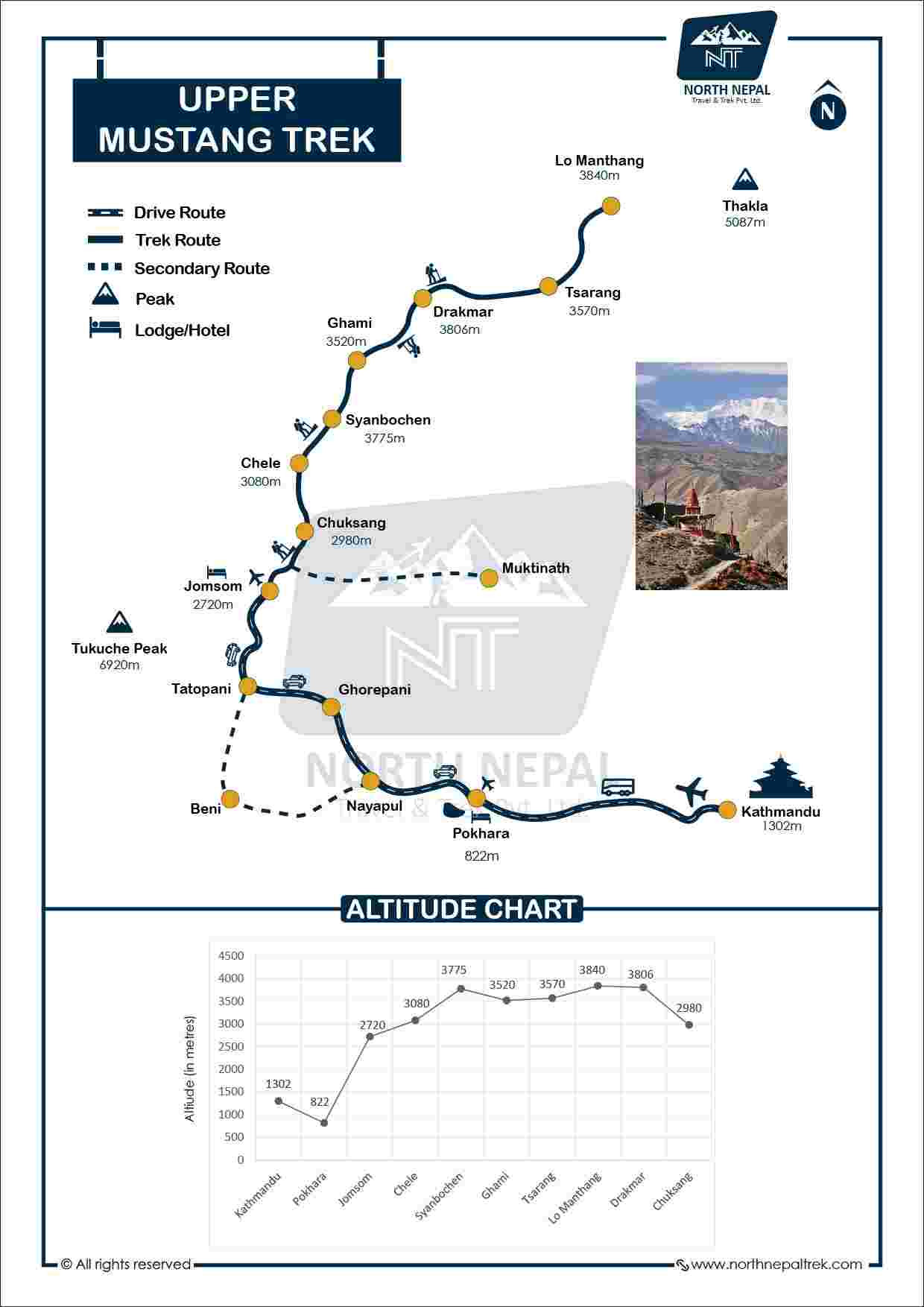
The classic route follows Pokhara → Jomsom → Kagbeni → Chele → Syanboche → Ghami → Tsarang → Lo Manthang → Dhakmar → Ghiling → Chuksang → Jomsom → Pokhara, with the exact overnight stops depending on the final itinerary.
Our standard Upper Mustang Trek takes 14 days, including travel between Pokhara and Jomsom. The itinerary includes approximately 10 trekking days and covers the major villages, cultural sites and landscapes of the former Kingdom of Lo.
The highest point on the standard route is Marang La, at approximately 4,230 meters. The trek therefore requires sensible pacing and proper acclimatization even though it doesn’t involve technical climbing.
Depending on weather and visibility, you can see Annapurna I, Dhaulagiri I, Nilgiri, Tukuche Peak and other Himalayan peaks. The dry landscape and open valleys provide wide mountain views along much of the route.
Yes. Upper Mustang can be combined with routes such as the Annapurna Circuit, Nar Phu Valley or Lower Mustang. These combinations require additional days and should be planned according to fitness, season and road conditions.
Foreign trekkers need two main permits:
Upper Mustang Restricted Area Permit (RAP)
Annapurna Conservation Area Permit (ACAP)
TIMS is not currently active for this Upper Mustang itinerary and should not be listed as a required permit.
The Upper Mustang RAP is currently USD 50 per person per day for foreign nationals. The fee applies to the days covered by the restricted-area permit.
The revised USD 50-per-person-per-day system came into effect on November 19, 2025, replacing the previous flat-fee structure.
No. The USD 50 daily fee covers only the Upper Mustang Restricted Area Permit. The Annapurna Conservation Area Permit is a separate requirement and is charged separately.
The restricted area begins at Kagbeni. Trekkers must complete the required permit and checkpoint formalities before continuing north toward Upper Mustang.
We arrange the permit through the authorized government process on your behalf. You provide the required passport information and documents, and we complete the permit arrangements before you enter the restricted area.
Yes. If you want to remain inside the restricted area beyond the period covered by your permit, an extension can be arranged through the authorized agency. The applicable fee is USD 50 per additional day.
Yes. A jeep road connects Jomsom with Lo Manthang. However, road conditions vary, and many trekkers still choose sections of the traditional trail where practical to experience the landscape and villages away from the road.
The usual approach is Pokhara to Jomsom, followed by travel north through Kagbeni and the Upper Mustang region. Depending on the itinerary, transportation may involve a private or shared jeep, with flight options to Jomsom subject to weather and operational conditions.
Yes. Our standard package includes private or shared jeep transportation between Pokhara and Jomsom according to the selected itinerary. Additional transportation outside the agreed itinerary may cost extra.
Accommodation is mainly in family-run teahouses and local lodges. Rooms are generally simple twin-sharing rooms with basic facilities. Lo Manthang and larger settlements usually offer better accommodation options than the smaller villages.
Hot showers are available in many villages for an additional charge, although availability varies between lodges. Some places provide bucket hot water rather than a conventional shower.
Teahouses generally serve dal bhat, Tibetan-style dishes such as momos, thukpa and tingmo, noodles, rice, vegetables, eggs, bread and other basic meals. Vegetarian food is widely available.
Meals are generally prepared fresh at the lodges. For better hygiene at altitude, choose freshly cooked hot food and drink boiled, filtered or properly purified water. Carrying water purification tablets or a filter as a backup is sensible.
Yes. Village shops have limited selections, so carrying energy bars, dried fruit, chocolates or other preferred snacks is useful during longer walking days.
Mobile coverage is available in larger settlements such as Jomsom, Kagbeni and Lo Manthang, but the signal can become weak or disappear in remote sections of the trail.
Some lodges provide Wi-Fi for an additional fee, but speeds and reliability vary. Trekkers should not expect continuous internet access throughout the route.
Upper Mustang’s dry Himalayan landscape supports wildlife adapted to high-altitude conditions. Depending on the location and season, trekkers may encounter birds of prey, Himalayan mammals and other wildlife, although sightings are never guaranteed.
Upper Mustang is a high-altitude desert landscape shaped by wind, erosion and the rain-shadow effect of the Annapurna and Dhaulagiri ranges. Its barren cliffs, deep valleys, caves and colorful rock formations create a landscape very different from the forested trekking routes elsewhere in Nepal.