Gosaikunda Lake Trek: A Place of Religious Prominence
Gosaikunda Lake is a pilgrimage site for devotees of Lord Shiva located in the Langtang region. Duri...
OVERVIEW & HIGHLIGHTS
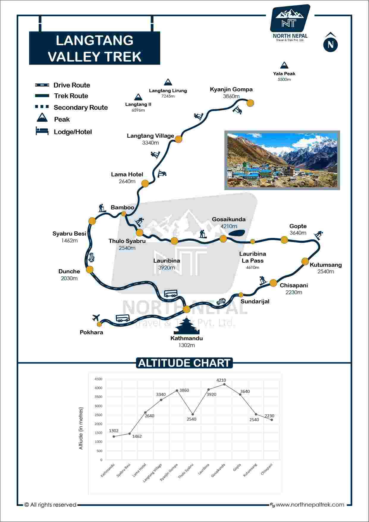
The Langtang Valley Trek is a short and moderate-level trekking journey that takes you on a lifetime adventure in the Langtang region. This trek is very close to the Kathmandu Valley, and we can start trekking after driving for 7 - 8 hours. While the Langtang Valley Trek is short, it offers you a variety of experiences like walking through rhododendrons and bamboo forests, walking along the streams, a trek filled with stunning glacier and mountain views, Tamangs & the Sherpa Buddhist cultures with their traditional way of life, and much more. The real name of Langtang is Lamtang, which you can see on the signboard at the start of the Langtang trek and at the entrance of Langtang National Park.
Download the season-specific packing checklist before you lace up your trekking boots for the Langtang trek.
Langtang Valley trek is slowly becoming popular, and people compare it to the Annapurna Base Camp trek of the Annapurna Region. Langtang trekking is suitable for beginners with reasonable fitness levels, and experienced trekkers can challenge themself with Tserko Ri and Ganja La Pass.
Mohan Raj Bhandari, Founder/Managing director
Since founding North Nepal Trek in 2015, Mohan Raj Bhandari has kept a close eye on the Langtang Valley Trek, and our senior guides shares firsthand insight from personally leading this trek, so you know exactly what to expect before you go.
From Syabrubesi, we will start our trekking early in the morning after breakfast. The trek from Syabrubesi to Ghoda Tabela covers 22 km and takes us 7 - 8 hours of hiking at an average pace. We will pass through villages like Bamboo and Rimche and arrive at Lama Hotel. Lama Hotel isn't a hotel but the name of a small village. We arrive at Lama Hotel after 4 hours of trekking from Syabrubesi.
According to locals, a monk used to stay there meditating inside the cave. People passing there teased him, calling Lama is staying at his hotel, hence the name Lama Hotel.
We will have lunch at the Lama Hotel, rest there, and trek to Ghoda Tabela. It takes 3 - 4 hours from the Lama Hotel to reach Ghoda Tabela.
During this section of the Langtang trek, you will see the mesmerizing views of Lirung, Ganesh Himal, Langtang, etc. As we complete the forest section of the trek, we make a steep climb that takes us to Ghoda Tabela.

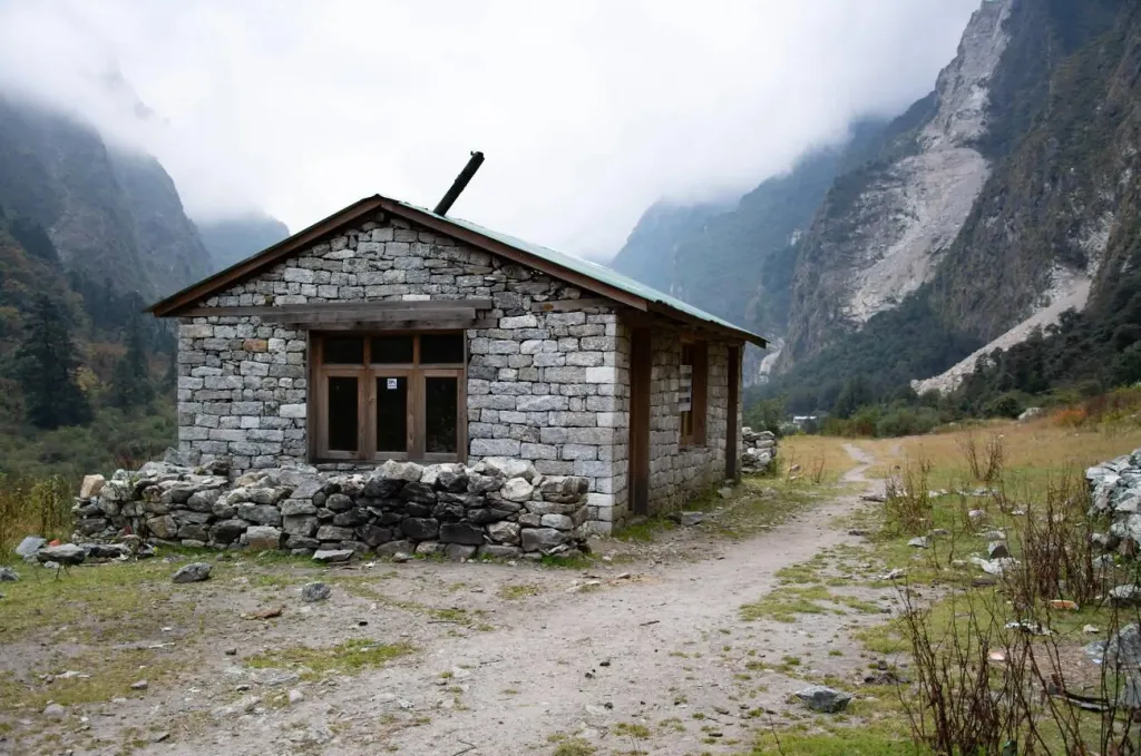
Photo: Abandoned Tea House near GhodaTabela.
Today is the most accessible day of the five days of Langtang trekking, comparatively more accessible than other days. We start our trek after having breakfast at Ghoda Tabela. From Ghoda Tabela Kanjiyn Gompa is a 14-km hike that takes 6 -7 hours. The trek begins with a slight downhill, which changes to a steep climb to Langtang Village. Langtang village is situated at an altitude of 3,430 m (11,254 ft) and is surrounded by stone walls to protect crops like potatoes, wheat, buckwheat, etc from wildlife.
After exploring Langtang village, we will trek towards Mundu and have lunch here. This trek section will fill you with cultural richness, and you will witness many mani walls and prayer flags. Mundu is another famous place for overnight stays. From Mundu, the hike to Kanjin Gompa is 2 - 3 hours. After resting here, we will start trekking and enter the rhododendron forest after crossing the bridge. Walking half an hour through the forest and yak farms takes us to Kyanjin Gompa.
Kyanjin Gompa is situated at 3,830 m | (12,566 ft) and offers beautiful views of mountains such as Mt Langtang Lirung, Ganchhenpo, and more.
The famous government-owned ancient Cheese factory is also from Kyanjin Gompa. You can visit the factory and try organic cheese without any added flavors or preservatives.
After exploring the valley, we will stay here for the night.

Photo: Kyanjin Gompa.
Today is the best day for the five days Langtang trekking. We will wake up early and hike to Kyanjin Ri I. If you follow this itinerary, then today is the trek's highest point. However, the highest viewpoints are Kyanjin Ri II, 4,700 m, and Tsergo Ri, 5,033 m. Unlike Kyanjin Ri I, very strong winds blow here, so trekking there is only possible in the best weather conditions. Hence, we don't recommend this for everyone.
It takes 3 - 4 hours to trek from Kyanji Gompa to Kyanjin Ri. From Kyanjin Ri, we can see the mesmerizing view of Mount Langtang Lirung, Makalu, Lhotse, Langtang Lirung, Cho Oyu, Sisapangma, and Dorje Lakpa.
The largest glacier in this region, Lirung Tsang Glacier, is also visible from here. Lirung Tsang Glacier also feeds water to the Langtang River.
After exploring and clicking photos in the Kyanjin Ri, we will trek back to Kyanjin Gompa and have lunch here. After resting, we will start our trek to the Lama Hotel. We follow the same route, and it takes us 6 -7 hours to reach Lama Hotel from Kyanjin Gompa. The total trekking distance for today, including the trek to Kyanji Ri and back to Lama Hotel, is 19 km, and we can complete it in 7 - 8 hours of trek. Overnight stay at Kyanjin Gompa.

Photo: Views from Kyanjin Ri
Today is the final day of our 5 days Langtang trekking itinerary. From Lama Hotel we trek back to Syabrubesi. The trek takes 3 - 4 hours at a moderate pace, covering a distance of 10 km. From Syabrubesi we will find a local Jeep or bus and drive back to Kathmandu.
Mohan was extremely accommodating and went above and beyond to help us with everything I did in Nepal. He is the go-to guy for everything and I owe many of my best experience in Nepal to him. Highly recommend this travel company. Also, shout out to Bharat who was an excellent guide!
Itineraries are structured with gradual elevation gain and strategically paced stops at locations like Forest Camp, Low Camp, and High Camp to support natural acclimatization before reaching high-altitude viewpoints. Guides conduct routine daily health assessments to monitor for early symptoms of Acute Mountain Sickness (AMS). If severe symptoms appear, standard safety protocol mandates an immediate descent to lower elevations.
In cases of severe injury, acute altitude illness, or unexpected extreme weather along the Mardi Himal trail, emergency helicopter evacuation is coordinated directly through local rescue operators in strict compliance with CAAN regulations. Evacuations are initiated promptly upon evaluation by your guide in direct coordination with our Pokhara command center and regional operations office.
All trekkers must hold comprehensive travel insurance covering emergency medical treatment, high-altitude trekking and glacier hiking (up to 6,000 m), and emergency helicopter rescue/evacuation. Insurance details must be submitted prior to the departure of the trek to streamline emergency logistics if required.
Secure the Langtang Valley Trek for 2026/2027 before the seat gets fully booked.
The Langtang Trek is a Himalayan trekking route north of Kathmandu in Nepal's Rasuwa District. The trail moves from lower subtropical forests into rhododendron and alpine landscapes, with traditional Tamang and Tibetan-influenced villages along the way.
The route is known for its relatively easy access from Kathmandu, mountain scenery and the combination of Himalayan nature and local culture.
The Langtang region lies north of Kathmandu in Rasuwa District, close to Nepal's northern border with Tibet.
The supplied itinerary describes a 5-day trekking program from Kathmandu to Kyanjin Gompa and back, reaching Kyanjin Gompa at approximately 3,830m.
However, the source material also identifies a 10-day Langtang itinerary elsewhere on the website and gives Tserko Ri at approximately 5,033m as its high point. Therefore, the duration and maximum altitude should be stated according to the specific Langtang package being sold rather than presented as one universal figure.
The Langtang Valley Trek is generally Moderate. The 5-day version is considerably more compressed than a standard longer itinerary, so it can feel fast-paced, particularly for first-time trekkers.
A reasonable level of fitness and preparation for several hours of walking each day is recommended.
The trek combines:
The source material contains two different high-point references. The 5-day itinerary identifies Kyanjin Ri at 4,773m, while the site's longer Langtang itinerary identifies Tserko Ri at approximately 5,033m.
The landscape changes significantly with elevation. Lower sections pass through lush hills, forests and cultivated areas, while the upper valley becomes progressively drier and more alpine as you approach the high Himalayan terrain.
One of Langtang's advantages is its accessibility from Kathmandu combined with a strong mix of mountain scenery, national-park landscapes and Tamang culture.
It is also less crowded than some of Nepal's most heavily travelled routes, while still offering substantial high-altitude trekking.
The best seasons are spring and autumn.
Spring generally offers pleasant trekking conditions and blooming rhododendrons, while autumn is known for clearer mountain views and more stable weather.
Summer and winter are possible, but conditions can become significantly more challenging.
Mountain weather can change quickly. A sunny morning can turn cloudy, snowy or windy as you gain elevation.
Trekkers should therefore be prepared for changing conditions rather than relying solely on the forecast at lower elevations.
Winter trekking is possible, but the conditions are much colder at higher elevations. The supplied information notes that some teahouse and lodge owners move to lower elevations during winter to avoid the extreme cold.
Accommodation availability should therefore be checked carefully before planning a winter departure.
The Langtang Trek requires a Langtang National Park permit and the applicable TIMS registration.
The supplied source specifically identifies this as the canonical permit answer for Langtang and notes that the permit costs are included in the 5-day Langtang Trek package.
The main trekking starting point is Syabrubesi, a village on the Bhote Koshi River.
From Kathmandu, the journey to Syabrubesi takes approximately 6 to 7 hours by road, depending on traffic, road conditions and the type of vehicle.
Both local buses and private jeeps are used.
The traditional approach is an overland journey from Kathmandu to Syabrubesi by local bus or private jeep.
A faster alternative is a helicopter flight from Kathmandu to Kyanjin Gompa, which the supplied material describes as taking approximately 20 minutes and providing an aerial view of the Himalayan landscape.
Yes. The Langtang route has teahouses and lodges along the main trekking corridor.
One of the well-known overnight stops is Lama Hotel, which has become closely associated with the route.
The food reflects the region's Tibetan and Himalayan influences. Depending on the lodge, you can find:
The exact menu varies between lodges and elevations.
Yes. Kyanjin Gompa is one of the principal Buddhist cultural sites on the route.
The region also contains chortens and other Buddhist structures. The supplied 5-day itinerary does not include the Sing Gompa detour, but it can be relevant to longer or differently structured Langtang itineraries.
The supplied material describes Langtang as having a long history of Tibetan settlement and identifies Langtang National Park as Nepal's first Himalayan national park, established in 1976.
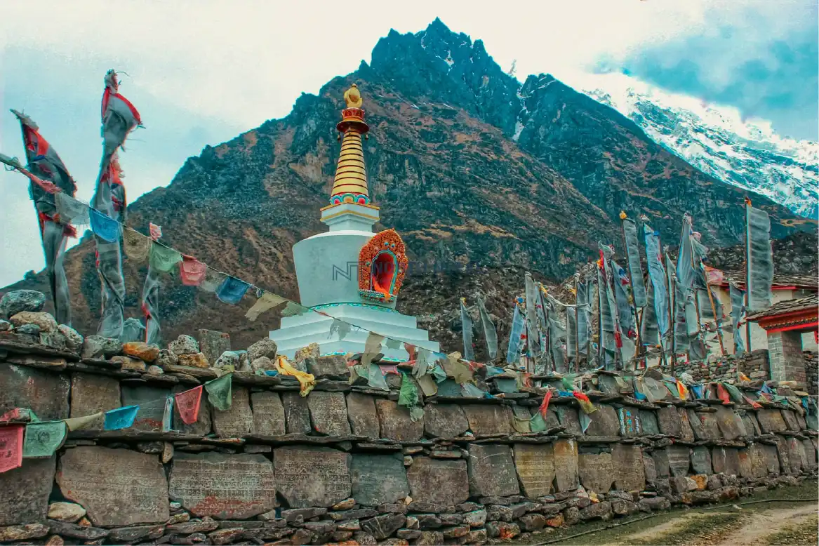
Yes. The region contains numerous monasteries, gompas and chortens. Kyanjin Gompa is one of the major Buddhist sites associated with the Langtang trekking route.
Tamang culture in Langtang is strongly influenced by Tibetan Buddhism. Religious traditions, village life, architecture and local customs remain an important part of the trekking experience.
The supplied information identifies Tarna and Janai Purnima among the notable festivals associated with the region.
Tarna is associated particularly with the Langtang area and Guru Rinpoche, while Janai Purnima is celebrated throughout Nepal and has particular significance at Gosaikund, where pilgrims gather for ritual bathing.
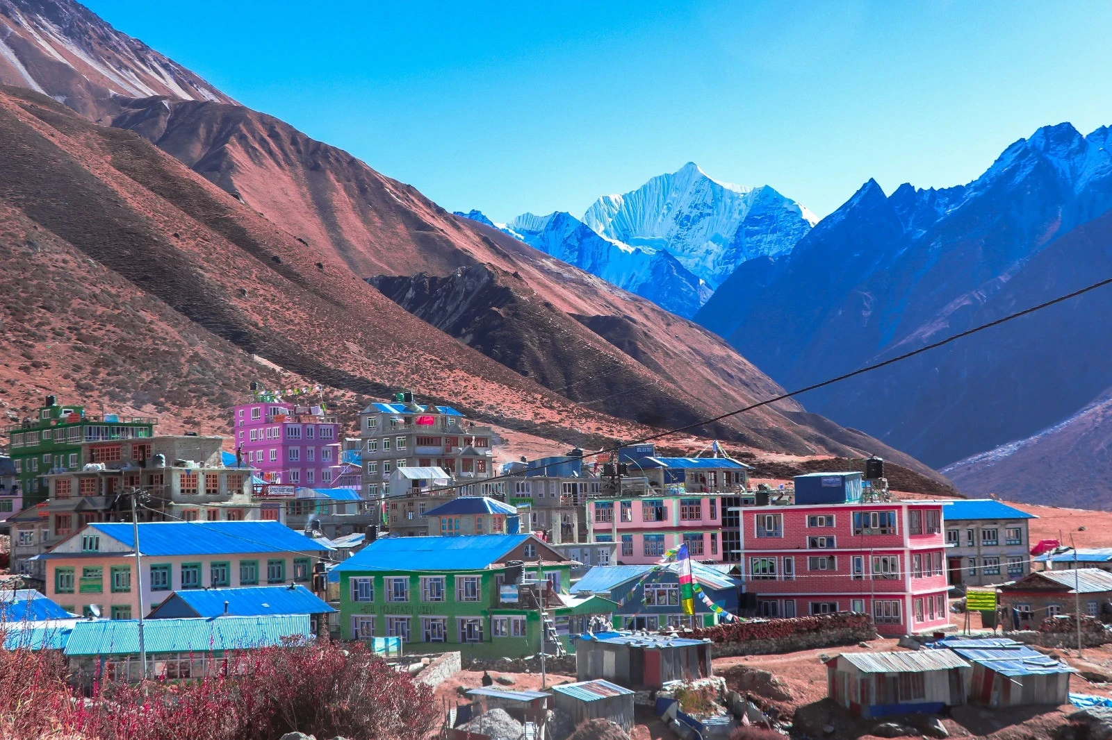
The 2015 earthquake had a major impact on Langtang's villages and local economy. The source notes that many traditionally built houses were replaced or modified, with tin roofs increasingly used because they offer greater earthquake resistance than traditional stone roofing.
The region has continued rebuilding while maintaining much of its cultural identity and trekking infrastructure.
Yes. Altitude is a genuine safety consideration, particularly on itineraries that climb above 4,000m.
The original source incorrectly described 4,773m as a safe altitude and suggested there was little risk of altitude sickness. That claim should not be used. At these elevations, trekkers need to ascend sensibly, monitor symptoms and follow their guide's advice.
The answer depends on the itinerary.
A 5-day itinerary reaching approximately 4,773m is a relatively aggressive schedule, and it should not be marketed as requiring no acclimatization simply because the trek is short.
Longer Langtang itineraries allow a more gradual ascent and are generally preferable for travellers who want more time to adjust to altitude.
Tell your guide immediately if you experience symptoms such as headache, nausea, dizziness, unusual fatigue or loss of appetite.
If symptoms worsen, the appropriate response may involve stopping the ascent, descending and arranging medical or evacuation support when necessary.
The region has rural medical facilities and dispensaries, which can provide assistance for minor injuries and common illnesses.
They should not be treated as a substitute for comprehensive emergency medical care, particularly in remote high-altitude sections.
Yes. Bottled mineral water is available at teahouses, while boiled water is a safer practical option for trekkers who want to avoid untreated sources.
Water purification methods can also be carried as a backup.
Because the trek is rated Moderate, you should be comfortable walking for several hours each day over uneven terrain and sustained uphill sections.
Regular walking, hill training, stair climbing and cardiovascular exercise in the weeks before departure are useful preparation.
The supplied packing guidance recommends:
Because weather changes quickly in the mountains, your clothing system should allow you to add or remove layers throughout the day.
Mobile reception is generally available in lower sections of the Langtang region, but coverage becomes increasingly unreliable as you climb toward the higher mountains.
Do not depend on continuous mobile connectivity during the trek.
Yes. Teahouses can provide charging facilities, although additional fees may apply.
A power bank is useful for keeping phones, cameras and other devices running when lodge electricity is unavailable.
The combination of rhododendron forests, alpine vegetation and high Himalayan habitats supports diverse plant and animal life.
The red panda is one of Langtang's best-known wildlife species and an important part of the region's conservation identity.