8 Days Tsum Valley Trek
This eight-day trek package takes you into the remote Tsum Valley, a sacred Buddhist valley encompas...
OVERVIEW & HIGHLIGHTS
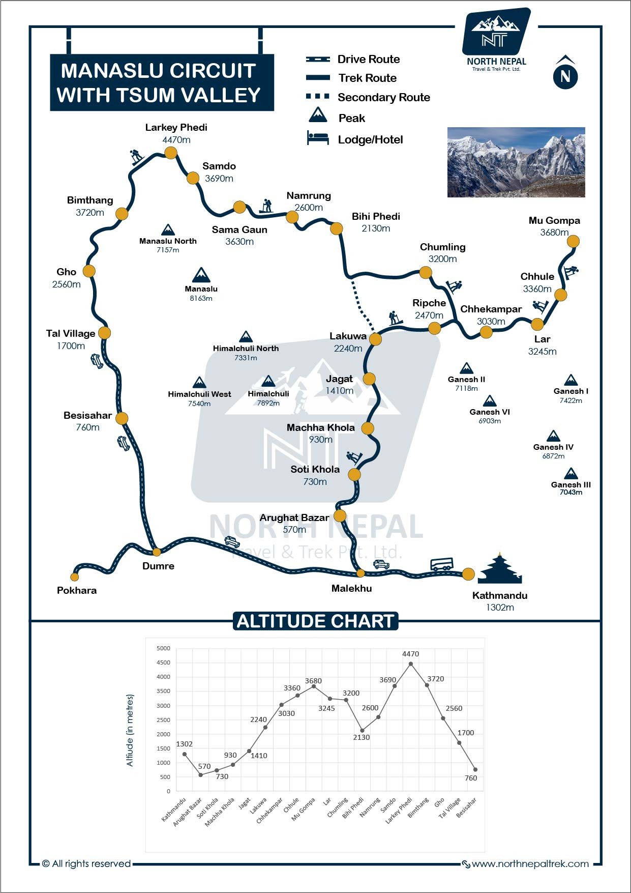
The 18-Day Manaslu Circuit and Tsum Valley Trek package is a stunning journey through Nepal’s Manaslu Conservation Area, combining the sacred Tsum Valley and the full Manaslu Circuit around Mount Manaslu (8,163 m). Starting along the Budhi Gandaki River, the route explores remote Gurung and Tsumba villages, ancient Buddhist monasteries, and crosses the high Larkya La Pass (5,106 m). Less crowded and rich in Tibetan culture, it offers panoramic views of Manaslu, Ganesh Himal, and Himalchuli.
You need four permits: the Manaslu Restricted Area Permit, the Tsum Valley Restricted Area Permit, the Manaslu Conservation Area Permit (MCAP) and the Annapurna Conservation Area Permit (ACAP). All four, and a licensed guide, are included in the package price, and we arrange them in Kathmandu before you set off. The trek is graded moderate to challenging, with teahouse accommodation every night. In autumn (September–November) the restricted area permits cost USD 100 for Manaslu and USD 40 for Tsum Valley, each for the first 7 days; from December to August they drop to USD 75 and USD 30. The full breakdown is in the permit table below.
Itinerary Summary & Elevations
| Day | Route | Distance | Walking time | Sleep at | Day's high point |
|---|---|---|---|---|---|
| 1 | Kathmandu/Pokhara → Jagat (drive) | 182 / 200 km by road | 10–11 hrs drive | Jagat 1,340 m (4,396 ft) | 1,340 m |
| 2 | Jagat → Lokpa | 16 km | 6–7 hrs | Lokpa 2,240 m (7,349 ft) | 2,240 m |
| 3 | Lokpa → Chumling | 10 km | 5–6 hrs | Chumling 2,386 m (7,828 ft) | 2,386 m |
| 4 | Chumling → Chhekampar | 11 km | 6–7 hrs | Chhekampar 3,031 m (9,944 ft) | 3,031 m |
| 5 | Chhekampar → Nile | 11.5 km | 5–6 hrs | Nile 3,361 m (11,027 ft) | 3,361 m |
| 6 | Nile → Mu Gompa → Lamagaun | 16 km | 6–7 hrs | Lamagaun 3,200 m (10,499 ft) | Mu Gompa 3,700 m (12,139 ft) |
| 7 | Lamagaun → Ripchet | 14 km | 7–8 hrs | Ripchet 2,470 m (8,104 ft) | 3,200 m |
| 8 | Ripchet → Deng | 21 km | 6–7 hrs | Deng 1,860 m (6,102 ft) | 2,470 m |
| 9 | Deng → Namrung | 17 km | 6–7 hrs | Namrung 2,630 m (8,629 ft) | 2,630 m |
| 10 | Namrung → Lho → Shyala | 14 km | 5–6 hrs | Shyala 3,520 m (11,549 ft) | 3,520 m |
| 11 | Shyala → Pungyen Gompa → Samagaun | 19 km | 7–8 hrs | Samagaun 3,530 m (11,581 ft) | Pungyen Gompa about 4,000 m (13,123 ft) |
| 12 | Samagaun → Manaslu Base Camp → Samagaun | 14 km | 7–8 hrs | Samagaun 3,530 m | Manaslu Base Camp 4,800 m (15,748 ft) |
| 13 | Rest and acclimatisation at Samagaun | — | Short walks | Samagaun 3,530 m | 3,530 m |
| 14 | Samagaun → Samdo | 8 km | 3–4 hrs | Samdo 3,875 m (12,713 ft) | 3,875 m |
| 15 | Samdo → Dharamsala (Larkya Phedi) | 12 km | 4–5 hrs | Dharamsala 4,460 m (14,633 ft) | 4,460 m |
| 16 | Dharamsala → Larkya La → Bimthang | 24 km | 10–11 hrs | Bimthang 3,720 m (12,205 ft) | Larkya La 5,106 m (16,752 ft) |
| 17 | Bimthang → Tilije | 18 km | 6–7 hrs | Tilije 2,300 m (7,546 ft) | 3,700 m |
| 18 | Tilije → Dharapani, drive to Kathmandu/Pokhara | 8 km walk | 2–3 hrs + drive | — | 2,300 m |
Walking times are for a steady group pace and don't include lunch stops. This trek provides quite a different experience compared to the more popular Annapurna Circuit Trek, combined with Tilicho Lake.
For this route specifically: bring a sleeping bag rated to about −15 °C (5 °F), because teahouse rooms are unheated. Carry traction spikes for Larkya La in case of snow (your guide will advise before you leave). Bring a power bank, since charging costs extra above Samagaun. Our full trekking packing list covers the rest.
Rajendra Rai, Trekking Guide
Since founding North Nepal Trek in 2015, Mohan Raj Bhandari has watched this 18-day route grow into one of the most rewarding ways to see the Manaslu region. Rajendra Rai, who has personally guided groups through Tsum Valley's monasteries and over the 5,106 m Larkya La Pass, shares firsthand insight into pacing this longer, culturally rich circuit safely.
We start our day after breakfast, setting out from Jagat towards the village of Lokpa, situated at an elevation of 2,240 m (7,349 ft). The trek takes us through the picturesque villages of Salleri (1,353 m) and Sirdibas (1,420 m), where we reach the second checkpoint of the trek.
After crossing a large suspension bridge over the Budhi Gandaki River, we come to the point where the paths split - one leading to the Manaslu Circuit trek, the other to the Tsum Valley trek. We'll be taking the Tsum Valley route.

Photo: Entrance to Tsum Valley
The journey from Jagat to Lokpa covers around 6–7 hours of walking through the stunning Himalayan landscape. Along the way, we're treated to breathtaking views of the snowy peaks of Mount Ganesh and Mount Shringi as the trail winds through narrow valleys and lush green vegetation. It's a truly scenic and pleasant trek.
Finally, we reach Lokpa, where we'll spend the night. As we settle in, we can't help but admire the impressive mountain vistas all around us, excited to continue our journey into the Tsum Valley the next day.
After breakfast, we start our trek from Lokpa to Chumling. The first section from Lokpa to Ghadhi Khola (6.8km) takes 3.5 hours. It begins with an easy, peaceful 40-minute (1.5km) walk across a small suspension bridge and a second cantilever bridge along the Sheyar Khola. It leads to a steeper but newly-improved section with stairs and resting areas taking just 20 minutes. The trail continues uphill for 20 minutes and is shortly inclined for another 20 minutes until Ghadhi Khola.

Photo: View of Ganesh Himal from Chumling
The section from Ghadhi Khola to Chumling (1.8km) is an easy 45-minute walk. As you approach Chumling, the trail provides wider views of the valley, including the Ganesh Himal range, pine forests, green meadows, and symbols of old human settlements like mani walls and prayer flags.
You cross the cantilevered bridge, a reminder of Tsum Valley's isolation. Before reaching Chumling, you cross a suspension bridge over the Shiar Khola and finally climb into the open valley.
The total distance of the trek is 10.1km, and it takes about 5 easy hours to reach Chumling from Lokpa. Overnight stay at Chumling.
The trek from Chumling to Chhekampar takes us deeper into the remote and beautiful upper part of Tsum Valley. Along the way, we'll notice the houses and people have an even more substantial Tibetan influence, as the local Gurung, Tamang, and Tsum communities have their origins in Tibet.

Photo: View from Chhekampar Village
Starting the trek after breakfast, we'll first hike 6.25 km in 2 hours to reach Dumje, a good spot for a tea break before the steeper ascent to Gho village for lunch. This section offers stunning views of the Ganesh Himal range to the south, including the Baudha and Himal Chuli peaks. Chhokang Paro is the last checkpoint of the Tsum Valley trek.
After Gho, the trail becomes more challenging. The section from Gho to Chaurikharka is considered the most difficult, with steep inclines and the risk of rockslides.
Once at Chaurikharka, we can rest before the final 3 km, 1 hour, and walk to Chhekampar at 3,031m. This last stretch winds through the deep valley, alpine forests, and traditional Buddhist symbols, welcoming us to our destination for the night.
The trek from Chumling to Chhekampar covers 11 km and takes approximately 6.5 hours. It's a challenging but rewarding journey that immerses us deeper into the stunning, isolated landscapes of the upper part of Tsum Valley. Overnight stay at Chhekampar.
The morning starts with stunning views of the Ganesh Himal and Manaslu ranges, including peaks like Buddha and Himalchuli. After breakfast, we set out towards the village of Nile at 3,361m.
Today is one of the easier days on the trek, as the trail is mostly flat and relaxing, winding through several picturesque villages. Along the way, we'll pass many ancient mani walls and prayer wheels, symbols of this region's strong Buddhist culture and beliefs.

Photo: Nile Village
Before leaving Chhekampar, we must register at the police checkpost in the middle of the village. Then, we'll cross small settlements like Chhokang, Lamagaun, Bursi, Lar, Phurpey, Chhule, and Pungdun, where a large prayer wheel stands.
We'll also explore monasteries like Rachen Gompa and the cave where the famous Buddhist scholar Milarepa once meditated, reminders of the spiritual significance of this area near the Tibetan border.
The total distance of 11.5 km from Chhekampar to the Nile should take around 5-6 hours of easy walking, including 1 hour and 20 minutes to reach Nagakyu village (3.2 km), 30 minutes to Lama Gau (2 km), 1 hour to Phurpey Choeren (3 km), and a final 1 hour to the Nile (3.3 km).
Overall, this is a relatively relaxed day of trekking through the serene and spiritual landscapes of the Upper Tsum Valley, with plenty of cultural and historical sights to appreciate along the way. Overnight stay at Nile.
After breakfast in Nile village, we'll start hiking towards Mu Gompa. Mu Gompa is an ancient Buddhist monastery up in the mountains, and it's one of the top sights in the Tsum Valley.

Photo: Mu Gompa
The hike from Nile to Mu Gompa is 6.4 km, and it will take us 2-3 hours to get there. As we climb higher, the views of the snowy mountain peaks around us will become more and more beautiful. We'll pass through alpine meadows with colorful flowers and cross a few small bridges over streams.
When we reach Mu Gompa, we can explore the old monastery and see the old paintings and statues inside. It's very peaceful and sacred, sitting high up in the mountains.
After spending time at Mu Gompa, we'll head back the same way we came. The walk back to the Nile will take around 1.5-2 hours.
Instead of going back to Chhekampar, we'll stop for the night in a village called Lamagaun. Lamagaun is at 3,200 meters elevation and is a center in the upper part of the Tsum Valley.
The hike from Nile to Lamagaun will take about 1.5-2 hours. In Lamagaun, we can see old Buddhist monuments like mani walls and chortens and explore the local culture more before resting at night.
Overall, this round trip from Nile to Mu Gompa and then to Lamagaun is 16 km long and will take us 6-7 hours of walking. Overnight stay at Lamagaun.
Starting from the village of Lamagaun, we take an alternate route to hike to Sipchet/Ripchet. The opportunity to return via an alternate path makes this route unique, so we make a loop here. It allows trekkers to see more of the beautiful Tsum Valley landscape from a fresh perspective rather than simply retracing their steps.

Photo: View from Lamagaun
By taking the return path, we get to appreciate the valley in an entirely new way, not trekked by most trekkers. The scenery and overall experience will differ from when we initially headed from Ripchet.
This new route gives us a more well-rounded understanding and deeper connection with the region. We'll pass through more traditional Tibetan-style villages and monasteries and cross bridges during this route. We cover around 14 km and take approximately 5-6 hours to reach Ripchet. Sipchet and Ripchet villages are very close to each other, so we can choose to stay overnight at Sipchet or Ripchet.
Today, we leave the Tsum Valley section and enter the Manaslu region. We will start our trek from Ripchet and follow the downhill path via Lokpa. After passing through Lokpa, we will cross the Gampul Bridge, allowing us to join the classical Manaslu Circuit route.

Photo: Deng Village
From there, we will continue walking along the trail, following the traditional route of the Manaslu Circuit Trek.
As we converge on the Manaslu Circuit Trail, you may see more mules and other trekkers. The trail will lead us to the Pewa Khola, where we ascend gradually through the forest. Continuing, we will cross the Budhi Gandaki River on a bridge. After trekking for 6 hours and covering 21 km, we will reach the small village of Deng at 1,860 m (6,102 ft). Overnight stay at a guesthouse.
We start our trek from Deng to Namrung after breakfast. First, we will follow the steep mountain valley, with the Budi Gandaki River squeezing through narrow gorges and over big waterfalls.

Photo: Namrung Village
During the trek, we can enjoy the stunning views of Siring Himal and the beautiful Mani walls. This entire section is within the Manaslu Conservation Area so we might spot some rare flora and fauna along the way.
Finally, after we pass through beautiful dense forests, we reach the village of Namrung, covering 17 km in around 6–7 hours of trekking.
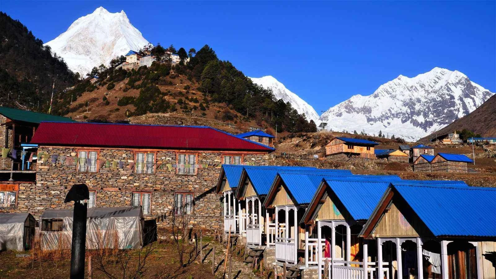
After breakfast, we'll begin our trek towards the settlement of Lihi. The trail will lead us down to the Lidanda Glaciers before we reach the beautiful hamlet of Sho, situated at an elevation of 3000 meters. We'll be treated to breathtaking Ngadi Chuli and Manaslu vistas along the way, making for a genuinely stunning afternoon. The route from Namrung to Shyala is the best for a mesmerizing view of Mt.Manaslu.

Photo: Shyala
Along the way, we'll pass through the forest of dense rhododendron trees, following the banks of the river. Throughout the trek, we'll be surrounded by stunning landscapes, including mani walls, beautiful local fields and houses, and lush fir and oak forests. From Sho, we'll continue our journey to the settlement of Lho, adorned with numerous prayer flags. After Lho, the trail will ascend from the Gomba to Shyala, where we can soak in the breathtaking panorama of Manaslu.
After trekking for 5 - 6 hours, covering 14 km, we will reach Shyala. Overnight stay at Shyala.
After breakfast in Shyala, we'll hike to the Pung Gyen Monastery. Pungen Gompa is an ancient Buddhist monastery in Nepal's Manaslu mountains. It was started long ago by Tibetan Buddhist teachers. The monastery sits on a hilltop at around 4,000 meters (13,123 feet), offering stunning views of the Manaslu. Once we explore the monastery, we'll walk back to Shyala. This trip takes about 2 hours.

Photo: Samagaun
After resting in Shyala, we'll continue our trek to the village of Samagaun, also called Ryo. This 2-hour walk will take us across wooden bridges over the icy rivers flowing from the mountains.
When we reach Samagaun, we'll first notice the stone walls all around. The best part is the big courtyard with large prayer wheels and paintings of Buddhist gods on the walls. Samagaun is a popular acclimatization spot with many guesthouses and lodges where we can spend the night.
Today, we trek from Samagaun to the New Manaslu Base Camp after breakfast.
First, we reach Birendra Tal, 45 minutes to an hour from Samagaun, north of Samagaun. The lake sits at 3,632 m (11,916 ft), an easy first stop. We enjoy the turquoise blue water of Birendra Lake and trek toward the Manaslu Base Camp.

Photo: Manaslu Base Camp
We walk side by side with the Manaslu glacier ridge; the views are beyond this world. The trail runs alongside the Manaslu glacier moraine. Conditions change with the season, so your guide decides on the day how far the group goes and turns back early if the snow or ice isn't right.
After crossing a bit of technical section, we finally will reach the Manaslu Base Camp at an altitude of 4,800 meters (15,748 feet). This is the current base camp; the older site lower down was lost to the glacier. Allow about 5 hours up from Samagaun and 2–3 hours back. The base camp offers stunning views of the mighty Manaslu mountain.
This hike has one short, steeper section but no technical climbing, and it's one of the most rewarding days of the trek. We trek back to Samagaun for an overnight stay.
Today is an important acclimatization day in Samagaun, where we'll be staying at an altitude of 3,530 meters. Acclimatization is crucial when you gain elevation quickly, as your body needs time to adjust to the higher altitude.
This will be a day to rest and relax, giving your body the time it needs to adapt. Take this opportunity to explore the beautiful Samagaun settlement, interact with the local people, and take in the tranquil mountain atmosphere. Wander around the village, visit Buddhist monasteries, or unwind and recharge in preparation for the following stages of the trek.
Staying an extra day in Samagaun will help prevent altitude sickness as we continue our journey to higher elevations. It's a well-deserved rest day where you can take it easy and soak in the stunning natural surroundings. Overnight, we'll be spending the night in Samagaun once again.
The trail to Samdo is relatively flat, but the high altitude makes even short climbs quite strenuous. As we walk, we'll pass through birch and rhododendron alpine forests. We'll cross a wooden bridge and see mani walls running alongside the path.

Photo: Samdo VIllage
The higher we climb, the more impressive the views become. We'll be treated to stunning vistas of the eastern flank of Samdo Peak (Pang Phuchi) and the glittering peaks of Himalchuli down the valley.
Finally, after trekking for 3 hours to cover 8 km, we reached Samdo. Samdo is a traditional village with stone houses and juniper mesh spread around the verandas to keep out the icy winds. The ground floors shelter livestock like yaks, while the upper levels are for living quarters.
Today's trek from Samdo to Larkya Phedi (also called Dharamshala) is challenging due to the high altitude, so we'll need to go slowly and focus on breathing.
The trail passes around fields before crossing the Budhi Gandaki River one last time. As we get closer to Larkya Bazaar, the landscape changes to thorny bushes and juniper trees - beautiful, dreamlike scenery.

Photo: Dharamsala, Larkya La Phedi
The views of the Samdo Peak and the Syacha Glacier become increasingly impressive as we climb higher. We'll also see the Manaslu mountain range in the distance.
After a strenuous hike across glaciers, we'll reach Larkya Phedi, a simple rest point before Larkya la pass. The rooms here are basic, but we must rest well to prepare to cross the Larkya La pass tomorrow.
The stunning mountain views will make up for the less oxygen here. We'll relax in the afternoon and have an early dinner to get rested up. After trekking 4 - 5 hours we cover 12 km to reach Dharamsala.
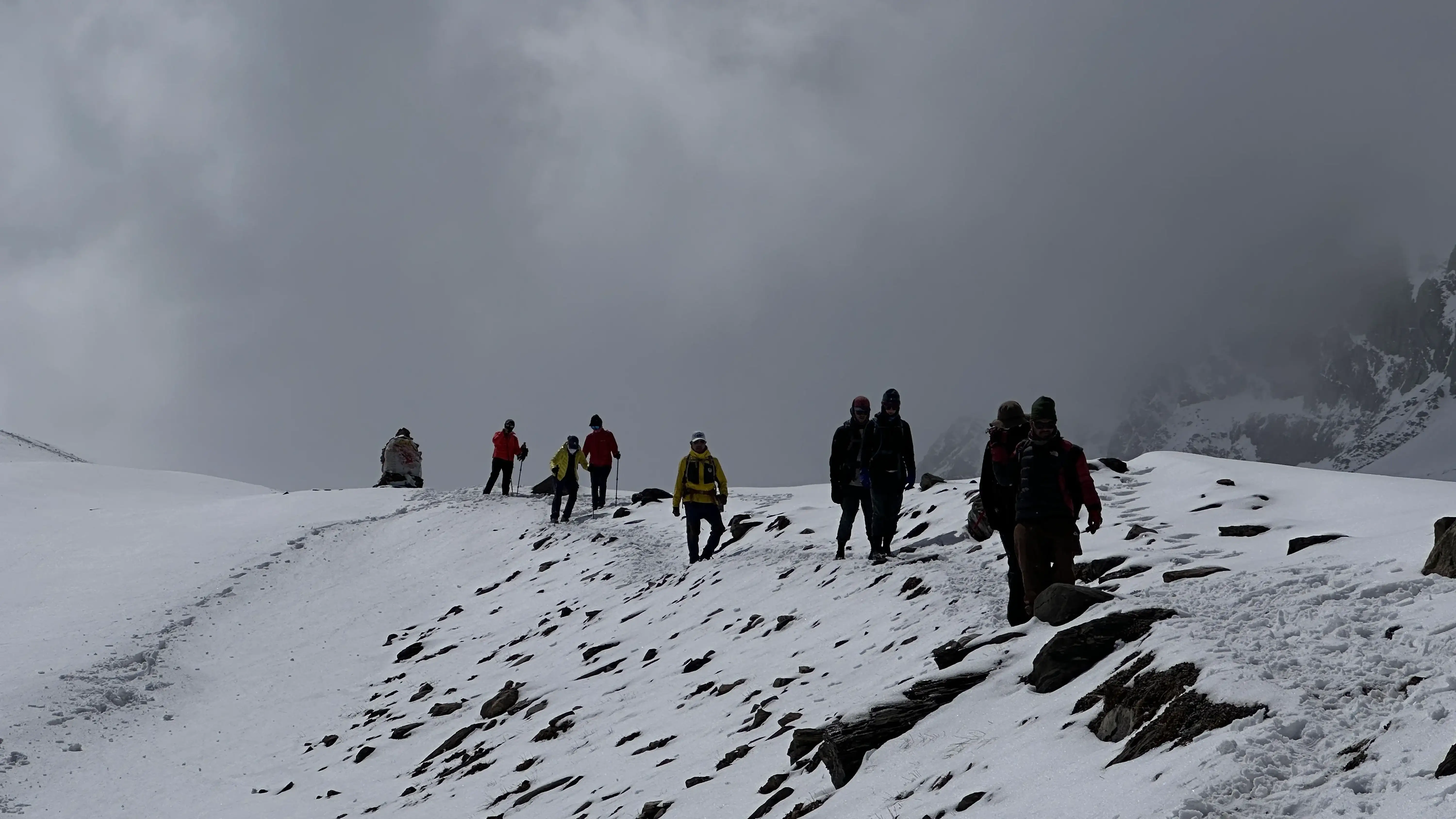
We'll pack our breakfast early, around 3 AM, and begin our ascent towards the Larkya La Pass (5,106 m | 16,752 ft). The trail winding up to the pass is moderately challenging, with a rocky and uneven path.
After a short, tricky section, we'll climb the snow-filled route and over the mountain pass. Crossing the Larkya La can be challenging in harsh weather and snow, but our experienced guide will lead us safely.
Way to Larkya La Pass
As we reach the top of the pass, we'll be rewarded with stunning views of snow-capped peaks like Ratna Chuli, Cheo Himal, and the mighty Manaslu (8,163m). We'll take some time to enjoy the scenery at the pass before beginning the descent.
The trail down from the pass leads us past some icy lakes before reaching the valley of Bimthang. The descent can be steep and slippery in parts, so we must be extra cautious.
After 10–11 hours on the trail, we will reach Bimthang. Once in Bimthang, we can look forward to a more relaxed afternoon after the strenuous climb over the pass. The village is situated in a grassy, flower-filled valley, providing a scenic resting spot.

Larkya La Pass
This crossing of the Larkya La is considered the most challenging part of the Manaslu Circuit trek. But the dramatic mountain vistas and sense of accomplishment make it all worthwhile. We'll spend the night in Bimthang.

Photo: On the way to Bimthang Village.
We'll begin our trek early in the morning, enjoying the stunning views of Mt. Manaslu, Lamjung Himal, and Himlung Himal.
The trail descends along the fig trees and rhododendron forests, taking us through rocky riverbeds and sliding hillsides. As we descend, we'll pass through several small, green villages.

Photo: Forest trail from Bimthang to Tilije
Eventually, after a long but scenic day of trekking, we'll reach the large village of Tilije. Tilije is home to a unique mix of inhabitants - Manangis of Tibetan descent and Chettris, Hindus. This cultural blend is reflected in the village's architecture and cuisine.
In Tilije, we can expect to find a variety of local dishes, including dal bhat, buckwheat dhido, tsampa, and Tibetan salt tea. We'll spend the night at a teahouse in the village, enjoying the diverse culture and resting up for the next day's journey.
The trek from Bimthang to Tilije allows us to witness the transition from the high mountain landscapes to the more verdant, forested terrain. Overnight at Tilije (2,300 m / 7,546 ft).
The distance from Tilije to Dharapani is 8 km and it takes an easy 3-hour walk. Dharapani is also a part of the Annapurna Circuit Trek. On this trail, you can enjoy the Buddhist Mani Wall and small villages along the way.
Once you reach Dharapani, we will catch a sharing Jeep and drive to Besisahar, which takes 3 - 4 hours. From Besisahar it's 2–3 hours by jeep to Pokhara or 5–7 hours to Kathmandu. The Tsum Valley Manaslu Trek ends here.
This route crosses two restricted areas and two conservation areas, so you need four permits. All four are included in your package price. We apply for them in Kathmandu with a copy of your passport and passport-size photos, so the paperwork is ready before you leave for Jagat. Restricted area permits are only issued through a registered trekking agency, with a licensed guide.
| Permit | September–November | December–August |
|---|---|---|
| Manaslu Restricted Area Permit | USD 100 for the first 7 days, then USD 15 per day | USD 75 for the first 7 days, then USD 10 per day |
| Tsum Valley Restricted Area Permit | USD 40 for the first 7 days, then USD 7 per day | USD 30 for the first 7 days, then USD 7 per day |
| Manaslu Conservation Area Permit (MCAP) | NPR 3,000 | |
| Annapurna Conservation Area Permit (ACAP) | NPR 3,000 — for the descent from Bimthang to Dharapani | |
| TIMS card | Not required on this route | |
Fees are set by the Government of Nepal and can change; the ones above are the 2026 rates. For the full breakdown, see our Manaslu Circuit permit guide.
Autumn Trail Alert: Trails are dry and stable with clear, cold-morning days over Larkya La; lodges are open throughout, though wifi and network stay patchy above Samagaun.
We had a great time trekking with Raj, doing the Manaslu circuit and Tsum Valley. He is an amazing guide who made trekking very fun and enjoyable. This was my girlfriend first trek in Nepal and first trek longer than 8h. Raj is a great guide for beginners, setting up a very reasonable pace through the mountains, while providing great information about the surroundings. I 100% recommend trekking with him if this is your first time trekking in Nepal.
100% recommend North Nepal Trek for Manaslu Circuit and Tsum Valley
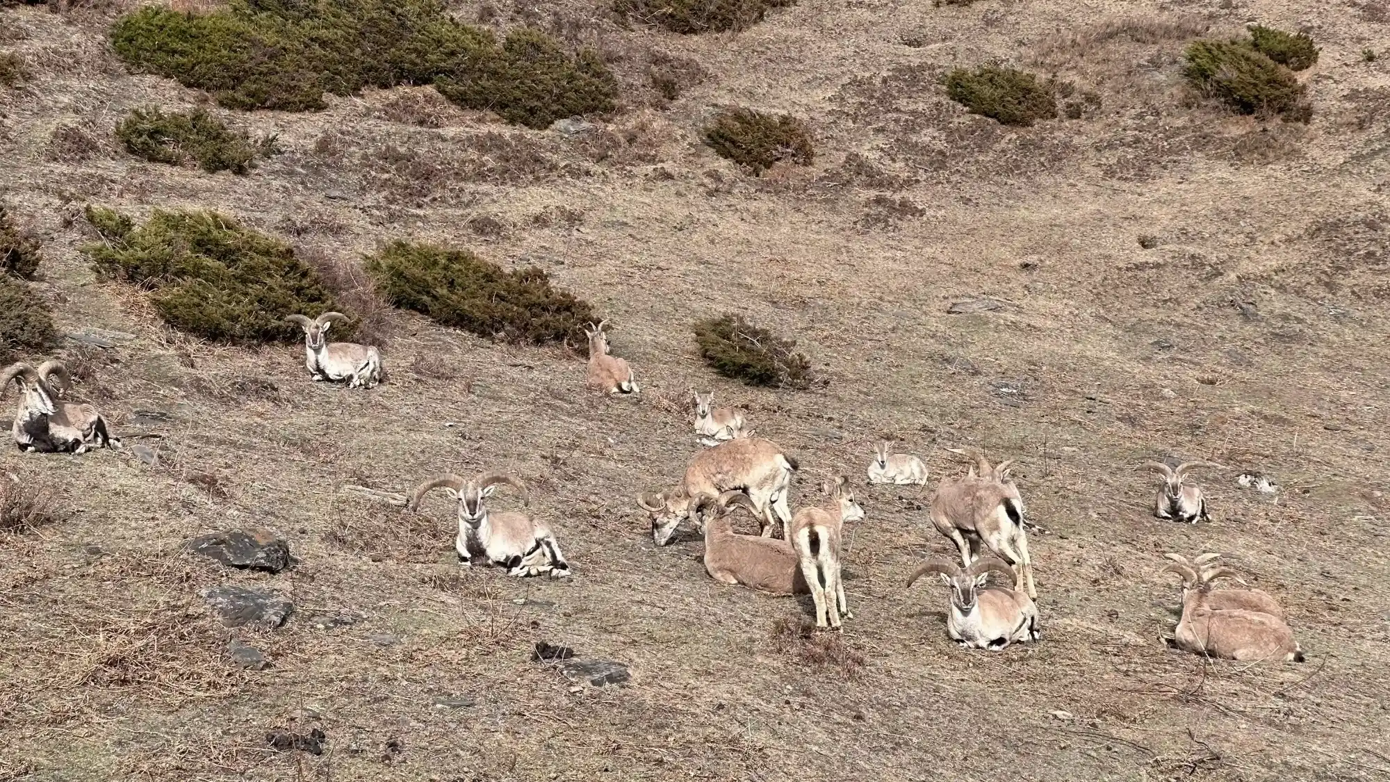
We recently had an incredibly wonderful and memorable experience with our guide Zeewan and our porter Dayaram on our Manaslu Circuit and Tsum Valley trek. Zeewan came highly recommended from friends. He and Dayaram were exceptional, we always felt we were in safe hands over the 19 days we were completing the trek. Zeewan has so much passion for Nepali wildlife and it shined through and really enriched our experience; while we were trekking, he spotted wild deer, Tahr, Blue Sheep and Himalayan Marmots for us to see. We would absolutely recommend heading out with Zeewan to anyone, we are incredibly grateful for the professionalism and kindness of our guide and porter.
Best Manaslu and Tsum Valley Trekking
We came as strangers and left as friends. That sums up our experience with North Nepal Travel & Trek (especially Mohan, the manager, and Zeewan, our guide) perfectly. It is definitely the best agency we can imagine. Mohan takes time for his guests, listens to them and then customizes a trekking tour. Everything is highly professional and perfect in terms of safety. When things didn't go fast enough in the kitchen at the guesthouse, Zeewan always stepped in and helped to get the best result for us. As soon as we weren't feeling well with the altitude, he supported us with any problem and helped us to feel better quickly. We even experienced a winter storm during our hike in February and still felt very safe and in best hands, Zeewan knows exactly what he is doing. After the hike, we were welcomed as friends by Mohan and we met again and again for tea, coffee and food many times. Thank you so much for this wonderful experience Mohan and Zeewan, we look forward to seeing you again!!!
We design our itineraries with gradual ascents so you can safely acclimatize for high points like Larkya La Pass (5,106 m). We monitor for AMS daily, and if severe symptoms ever appear, we descend immediately. Your health always comes first.
While rarely needed, it's crucial to be prepared. In the event of a severe emergency, our Kathmandu team will instantly coordinate a rapid helicopter evacuation to get you the help you need.
To keep you fully protected, comprehensive insurance covering high-altitude trekking (up to 6,000 m) and emergency helicopter rescue is strictly required for this off-the-beaten-path adventure.
Secure the Manaslu Circuit with Tsum Valley Trek for 2026/2027 before the seat gets fully booked.
18 days (17 nights). Day 1 is the drive to Jagat, Days 2–17 are walking days, including a Manaslu Base Camp hike and a rest day at Samagaun, and Day 18 is a short walk to Dharapani followed by the drive back. Our 11-day Manaslu Circuit covers the circuit alone; Tsum Valley adds seven days.
Yes. Our 8-day Tsum Valley Trek goes in and out of the valley from Jagat without crossing Larkya La. It tops out at Mu Gompa (3,700 m) and suits trekkers who want the monasteries without the high pass.
Moderate to challenging. No climbing skills are needed, but it is 16 walking days, most of them 5–7 hours. The hardest day is the Larkya La crossing (5,106 m / 16,752 ft): 10–11 hours from a 3–4 am start. The Tsum section adds days rather than difficulty.
Much quieter. You will meet other groups on the main circuit between Deng and Samagaun, but once you turn off at Lokpa into Tsum Valley, whole days can pass with only local traffic on the trail.
In Tsum Valley: Rachen Gompa, Milarepa's Cave (Piren Phu) and Mu Gompa. On the Manaslu side: the gompas of Namrung, Lho and Samagaun, and Pungyen Gompa on Day 11. Gumba Lungdang is an optional side trip from Chhekampar.
Local tradition holds that the Tibetan yogi Milarepa meditated in this cave, and a footprint on the rock is attributed to him. It is one of the most important pilgrimage sites in Tsum Valley. We pass it between Chhekampar and Nile on Day 5.
Mu Gompa is the largest monastery in Tsum Valley, at 3,700 m (12,139 ft) near the head of the valley. According to Kopan Monastery, which now looks after it, Mu Gompa and Rachen Nunnery were both established in 1936 by Dukpa Rinpoche. We visit it on Day 6.
Four: the Manaslu Restricted Area Permit, the Tsum Valley Restricted Area Permit, the Manaslu Conservation Area Permit (MCAP) and the Annapurna Conservation Area Permit (ACAP). A TIMS card is not required. All four are included in the package price, and we arrange them in Kathmandu with your passport copy and photos. See the permit table above for current fees.
Not without a guide. Independent solo trekking is not permitted in the Manaslu and Tsum Valley restricted areas. What has changed is the two-person rule: you used to need at least one other trekker to get the permit, but now a single trekker can do this trek with a licensed guide booked through a registered agency. Read more in our guide to trekking Nepal's restricted areas without a partner.
Yes. Our guides, including Rajendra Rai and Zeewan, lead this combined route every season and know the Tsum monasteries, the Nubri villages and the Larkya La crossing first-hand. Several of the reviews on this page name them.
Start two to three months out with regular uphill walking, stairs and long hikes on back-to-back days. Get a medical check-up if you take regular medication, and talk to a travel doctor about altitude medication. Buy insurance that covers helicopter rescue up to 6,000 m.
It isn't a good choice for young children. The length, long walking days, altitude and remote terrain are hard on them. If you're considering it with teenagers, message us with their age and trekking experience first.
Autumn (September–November) is best: dry trails, clear views and the most reliable Larkya La crossings. Spring (March–May) is second, warmer, with rhododendrons on the lower slopes. December is possible but cold. Larkya La is often snowbound in January and February, and the June–August monsoon brings landslide risk in the lower valley.
Family-run teahouses every night, with twin-share rooms, foam mattresses and mostly shared bathrooms. Rooms are unheated, and the dining room is usually the only warm room. Lodges are simplest inside Tsum Valley and at Dharamsala (4,460 m), the night before Larkya La.
Dal bhat, noodle soups, momos, thukpa, Tibetan bread, porridge and potatoes. Menus are shorter inside Tsum Valley. Tsum's Shyagya tradition forbids killing animals, and the upper Manaslu villages keep a similar custom, so expect vegetarian meals in the high villages.
Himalayan tahr, blue sheep and Himalayan marmots are the most common sightings, especially above Samagaun and in upper Tsum. Musk deer, golden eagles and Himalayan griffons are seen occasionally. Snow leopards live here but are rarely seen, so treat any sighting as luck.
Chumling for Ganesh Himal, Lho and Shyala for the full Manaslu face, Manaslu Base Camp for close glacier views, and the top of Larkya La for Himlung, Cheo Himal and Annapurna II on the far side.
Only in places. Wifi and signal are patchy above Samagaun, and there is none at Dharamsala. Most lodges charge a small fee for wifi, battery charging and hot showers; these are not included in the package. Carry a power bank and tell family before the pass days.