The North Face of Mount Everest: The Wall, the Route and the Legend
Published Oct 20, 2026 Updated Oct 20, 2026 13 min read
Quick answer
The north face of Mount Everest is the wall above the Rongbuk valley in Tibet. Climbers summit this side by the North Col and Northeast Ridge, first climbed in 1960. China kept it closed to foreign teams in 2026.
Our guests on the Kailash Mansarovar and Everest Base Camp tour stand at Rongbuk and look straight up at this wall. It is where Everest climbing began in the 1920s, where George Mallory and Andrew Irvine disappeared in 1924, and where the north route still runs today. This post covers its geography, its history, the climbing route camp by camp, how it compares with the Nepal side, and how you can see it without climbing.
Key facts
LocationTibet Autonomous Region, China, above the Rongbuk Glacier
Summit8,848.86 m (29,032 ft)
North base campAbout 5,200 m (17,060 ft), reached by road
Standard routeNorth Col and Northeast Ridge, over the Three Steps
First ascent from the north25 May 1960, Wang Fuzhou, Gonpo and Qu Yinhua
First full ascent of the face10 May 1980, Takashi Ozaki and Tsuneo Shigehiro
Tibet-side record, 1922 to 20253,850 summits, 110 deaths
2026 statusClosed to foreign climbing teams
Where is the north face of Mount Everest?
The north face of Mount Everest faces north into Tibet, at the head of the Rongbuk valley. The summit stands around 3,650 m (11,975 ft) above the north base camp at about 5,200 m (17,060 ft). The face sits between the Northeast Ridge on the left and the West Ridge on the right.
Two big gullies cut the upper wall and shape its climbing history. The Norton Couloir, also called the Great Couloir, runs down the centre below the summit. The Hornbein Couloir cuts the upper face further west. Below the wall, the Rongbuk Glacier fills the valley floor, and the climbers' route branches off up its eastern arm, the East Rongbuk Glacier.
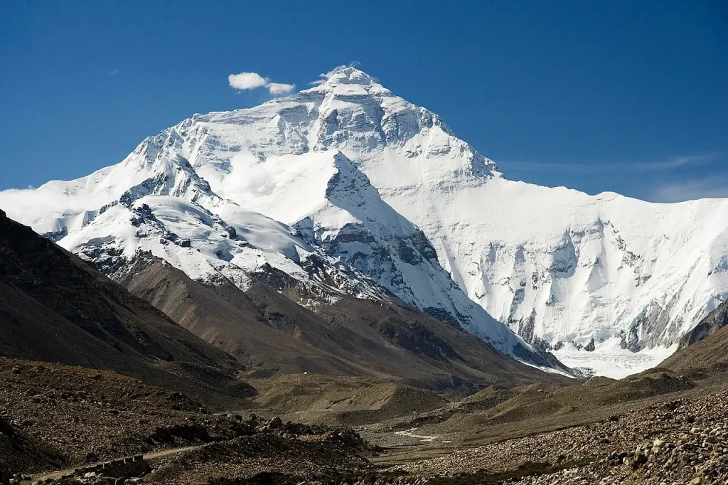
The north face of Everest seen from the Tibet side, with the Northeast Ridge on the left. Photo: Luca Galuzzi, Wikimedia Commons, CC BY-SA 2.5.
Wind shapes this side of the mountain. For most of the year the jet stream blows across the summit, and on a clear day you can see the plume of snow streaming off the top from the valley. Climbers on the north route spend much of summit day on an exposed ridge, so the cold and wind matter even more here.
What happened on the north side before 1960?
The first Everest expeditions all came from the north, because Nepal was closed to foreigners. British teams in 1921, 1922 and 1924 worked out the route through the Rongbuk valley to the North Col, and their attempts gave the mountain its first records and its first deaths.
In 1922, seven porters died in an avalanche below the North Col, the first reported climbing deaths on Everest. The same expedition set a world height record of 8,321 m (27,300 ft) using bottled oxygen. On 4 June 1924, Edward Norton climbed to about 8,573 m (28,127 ft) in the gully now named after him, without bottled oxygen.
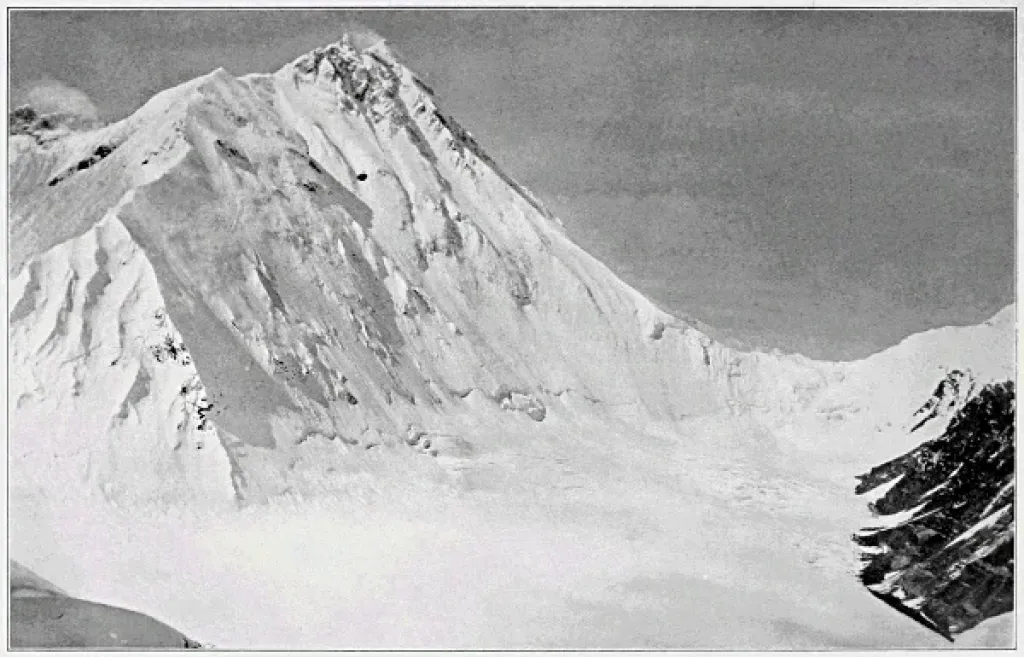
The North Col of Everest photographed from Lhakpa La during the 1921 British reconnaissance. Photo: Charles Howard-Bury, Wikimedia Commons, public domain in the US.
Four days later, George Mallory and Andrew Irvine set off for the summit and never came back. Mallory's body was found on 1 May 1999 at about 8,156 m (26,759 ft). In 2024 a National Geographic team found a boot below the north face, on the Central Rongbuk Glacier, with a sock labelled "A.C. IRVINE". Their camera has never been found, so whether they reached the top is still unknown.
Who first climbed Everest from the north?
A Chinese expedition made the first ascent from the north. Wang Fuzhou, Gonpo, a Tibetan climber, and Qu Yinhua reached the summit at 4:20 am on 25 May 1960, by the North Col and Northeast Ridge. Because the night-time summit was not photographed, some Western climbers doubted the claim, and a few still do.
A second Chinese expedition in 1975 put a ladder on the Second Step, the hardest rock band on the ridge, and almost every north-side climber since has used a ladder there. The same year, the Tibetan climber Phanthog became the first woman to reach the summit from the north.
Then the face itself was climbed:
Year
Climb
10 May 1980
Takashi Ozaki and Tsuneo Shigehiro make the first full ascent of the north face, by the Japanese and Hornbein couloirs
1980
Reinhold Messner makes the first solo ascent of Everest, from the north, without bottled oxygen, finishing through the Norton Couloir
October 1984
Tim Macartney-Snape and Greg Mortimer climb a new route on the face to the Norton Couloir, without bottled oxygen
These face routes see few repeats. Almost everyone who climbs from the north today follows the ridge route that the 1920s teams pioneered and the 1960 team completed.
What is the standard route on the north side?
The standard north route drives to base camp at about 5,200 m (17,060 ft), walks about 22 km up the East Rongbuk Glacier to Advanced Base Camp, then climbs to the North Col, up the North Ridge and along the Northeast Ridge to the summit.
Camp
Height
What it is
Base camp
About 5,200 m (17,060 ft)
Gravel plain reached by road, near Rongbuk Monastery
Interim camp
About 6,187 m (20,299 ft)
Overnight stop on the East Rongbuk Glacier
Advanced Base Camp
About 6,400 m (20,997 ft)
The working base for the climb
Camp 1, North Col
About 7,000 m (22,966 ft)
Reached by fixed ropes up a steep snow and ice slope
Camp 2
About 7,500 m (24,606 ft)
Tents on rock and scree on the North Ridge
Camp 3
About 8,300 m (27,231 ft)
The top camp, already inside the death zone
Summit
8,848.86 m (29,032 ft)
Along the Northeast Ridge and over the Three Steps
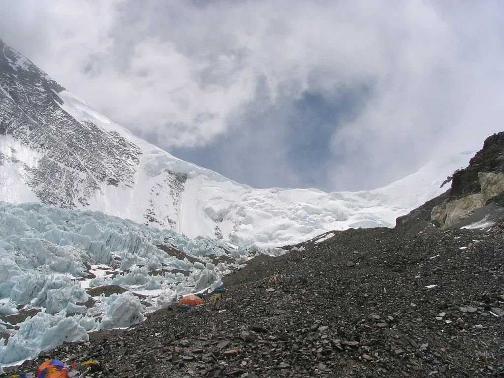
Ice slopes below the North Col, the first big climb on the north route. Photo: Csearl, Wikimedia Commons, CC BY-SA 3.0.
Advanced Base Camp is where most of the acclimatisation happens. At about 6,400 m (20,997 ft) it is about the same height as Camp 2 on the Nepal side, and teams climb from there to the North Col and back before the summit push. Yaks carry the loads from base camp to Advanced Base Camp; the Chinese permit includes five yaks in and four yaks out for each climber.
The North Col slope is the most technical climbing below the ridge, with one section of about 60 degrees on fixed ropes. Above it the route follows the North Ridge, rock and snow mixed, to Camp 2 and Camp 3.
What are the First, Second and Third Steps?
The Three Steps are rock bands on the Northeast Ridge that every north-side climber crosses on summit day. The First Step is at about 8,500 m (27,887 ft), the Second Step at about 8,577 m (28,140 ft) and the Third Step at about 8,690 m (28,510 ft).
The Second Step is the crux. After a short rock slab, climbers use a near-vertical ladder about 9 m (30 ft) high, the "Chinese ladder", first put in place in 1975. Without it, the step is hard rock climbing at over 8,500 m, which is why many climbers and historians doubt that Mallory and Irvine got past it in 1924.
Summit day is long. Teams usually leave Camp 3 at about 10 pm, take 8 to 10 hours to reach the summit, and need another 4 to 6 hours to get back to Camp 3. Almost all of that time is spent above 8,300 m (27,231 ft).
That is the main difference from the Nepal side. A climber in trouble on the north ridge has a long, exposed way down over the same steps, and the north side has no Khumbu Icefall but much less room for a slow retreat. For a wider look at what makes Everest hard on either side, read how hard it is to climb Mount Everest.
How does the north side compare with the Nepal side?
Neither side is easy. The north side avoids the Khumbu Icefall and has fewer climbers, but it is often colder and windier, its top camp is higher and helicopter rescue is usually not allowed. Its death rate per summit is a little higher than Nepal's.
North side (Tibet)
South side (Nepal)
Base camp
About 5,200 m (17,060 ft), by road
5,364 m (17,598 ft), after a trek of about a week
Main hazard
Wind, cold and a long summit ridge
The Khumbu Icefall
Top camp
Camp 3, about 8,300 m (27,231 ft)
South Col, 7,920 m (25,984 ft)
Summits, 1922 to 2025
3,850
About 9,890
Deaths, 1922 to 2025
110
229
Deaths per 100 summits, 1922 to 2025
About 2.9
About 2.3
Climbing permit
USD 15,800 to 18,000 per person, teams of four or more; a cap of 300 permits a year, including hired staff
USD 15,000 in spring; no fixed cap on numbers
Helicopter rescue
Usually not permitted, though this may change by 2027
Helicopters can land at Camp 2, about 6,400 m (20,997 ft)
The death totals follow the traffic. The Nepal side has had more than twice as many summits, so it has more deaths, but the rate per summit is a little higher on the north side: about 2.9 deaths per 100 summits against 2.3. The risk sits in different places: low in the icefall on the Nepal side, high on the summit ridge on the north side.
Prices depend on the operator more than the side. Alan Arnette's 2026 price survey put the median with Nepalese operators at about USD 47,000 for the north side and USD 45,250 for the Nepal side, and with international operators at about USD 90,800 for the north side. In 2025 the north side recorded 120 summits and no deaths.
Can you climb the north side of Everest in 2026?
No foreign teams could climb from the north in 2026. China kept the north side closed to foreign teams in spring 2026, and only Chinese climbers were on that side. Alan Arnette reported 28 Chinese climbers supported by 60 Chinese and Tibetan climbers, and 25 of the 28 reached the summit. As of late August, no expedition was known to have an autumn permit.
When the north side is open, the rules are stricter than in Nepal. Every climber joins an organised expedition through the Chinese mountaineering authorities, and in 2010 China set an age range of 18 to 60 for Everest from Tibet. For 2026, Alan Arnette reported that China also required members to have climbed a 7,000 m (22,966 ft) peak, though it was unclear how strictly that was enforced.
If you are planning an Everest climb, check the north side's status with your operator before you commit. Our post on the Everest expedition timeline shows how a standard climb is planned, and who climbs Everest looks at the people on both sides.
How can you see the north face without climbing?
You can see the whole north face from Rongbuk, at the end of the public road. Our 15-day Kailash Mansarovar and Everest Base Camp tour flies from Pokhara to Lhasa, then drives through Shigatse and Tingri to Rongbuk before going on to Mount Kailash.
The drive does the acclimatisation for you, a day at a time. Guests spend their first days in Lhasa, 3,650 m (11,975 ft), then sleep in Shigatse, about 3,830 m (12,566 ft), and Tingri, 4,300 m (14,108 ft), before reaching Rongbuk, just below the north base camp. The next morning, weather permitting, they watch sunrise on the face before driving on to Saga.
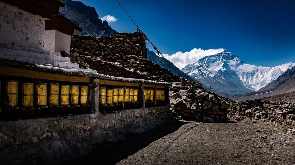
Rongbuk Monastery with the north face of Everest behind. Photo: Mondo79, Wikimedia Commons, CC BY 2.0.
Rongbuk Monastery sits just below base camp. It was founded in 1902, was destroyed during the Cultural Revolution and has been partly rebuilt. Since 2019, visitors without a climbing permit can't go up into the climbers' base camp itself, so the monastery and the area around it are where most people see the face.
Tibet doesn't allow independent travel for most foreign visitors. You need a Chinese visa and a Tibet Travel Permit, plus an Alien's Travel Permit and border permits for areas outside Lhasa, and they are issued for your exact dates. We arrange them as part of the tour.
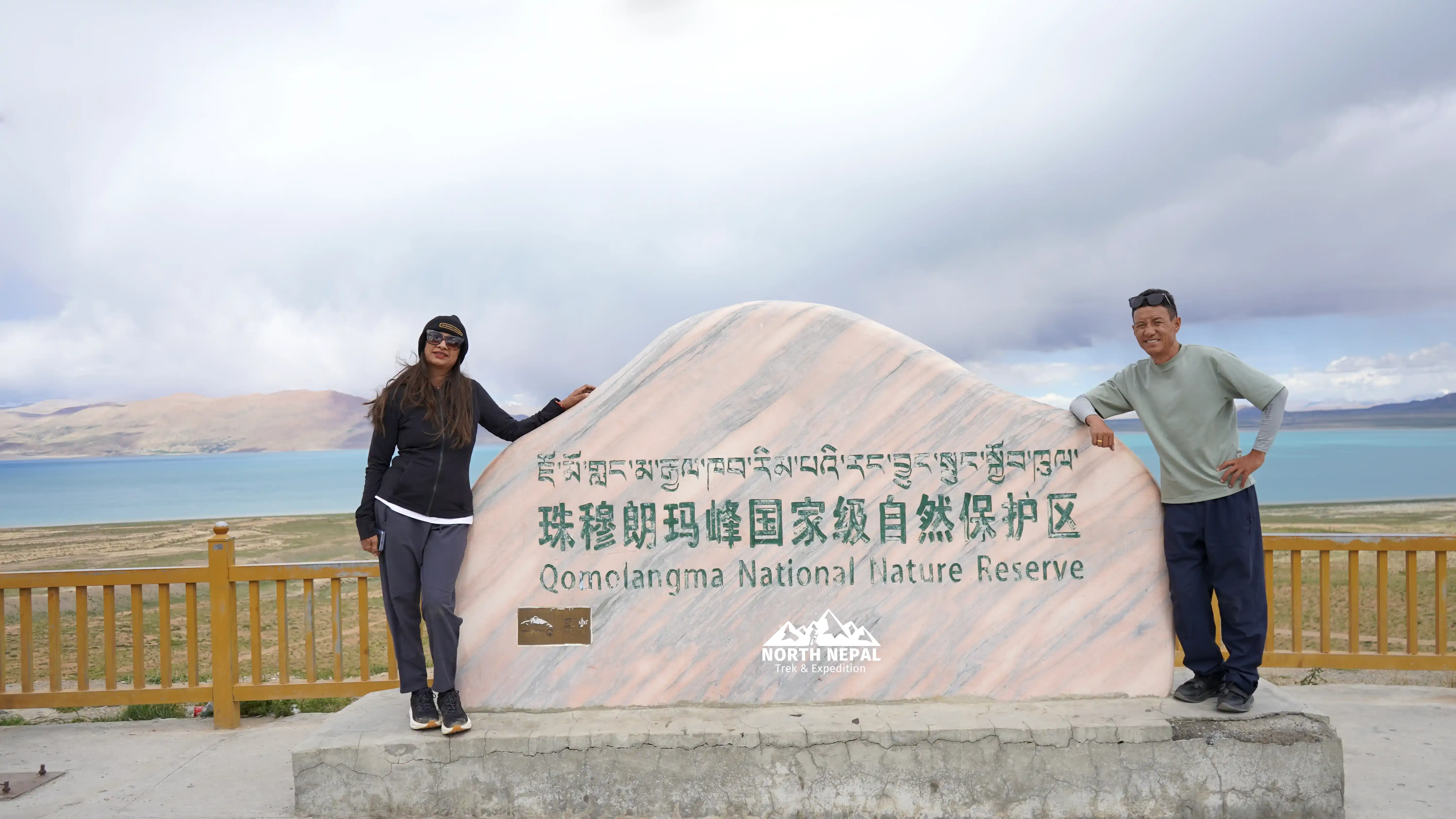
Our guests at a Qomolangma National Nature Preserve sign in Tibet. The preserve is the protected area that includes the north side of Everest. Photo: North Nepal Travel & Trek.
On the Tibet side you arrive at Rongbuk, close to 5,000 m (16,404 ft), by vehicle, not on foot, and that catches people out. Driving up is easy; your body still has to adjust. Take the acclimatisation days in Lhasa seriously, drink plenty, and tell your guide straight away if a headache doesn't go away. The night at Rongbuk is cold in every season.
Frequently asked questions
The north face of Mount Everest is in the Tibet Autonomous Region of China, at the head of the Rongbuk valley. Its summit stands about 3,650 m (11,975 ft) above the north base camp. The face sits between the Northeast Ridge and the West Ridge and is cut by the Norton and Hornbein couloirs.
Wang Fuzhou, Gonpo and Qu Yinhua of a Chinese expedition reached the summit on 25 May 1960, by the North Col and Northeast Ridge. The first full ascent of the north face itself was by Takashi Ozaki and Tsuneo Shigehiro of Japan on 10 May 1980.
Nobody knows. They were last seen high on the Northeast Ridge in June 1924. Mallory's body was found in 1999 and what is believed to be Irvine's boot in 2024, but their camera has never been found, and many climbers and historians doubt they could have climbed the Second Step.
In different ways. The north side has no Khumbu Icefall, but it is often colder and windier, its top camp is higher at about 8,300 m (27,231 ft), summit day crosses the Three Steps, and helicopter rescue is usually not allowed. The death rate per summit is a little higher on the north side.
The Second Step is a rock band on the Northeast Ridge at about 8,577 m (28,140 ft), the hardest part of the north route. Since 1975 climbers have used a near-vertical ladder of about 9 m (30 ft) fixed by a Chinese expedition.
Alan Arnette's 2026 price survey put the median at about USD 47,000 with Nepalese operators and USD 90,800 with international operators. The Chinese climbing permit alone costs USD 15,800 to 18,000 per person for teams of four or more. China kept the north side closed to foreign teams in spring 2026.
Tourists can visit Rongbuk, below the climbers' base camp, with the right permits. Since 2019, visitors without a climbing permit can't enter the climbers' camp. You need a Chinese visa and Tibet permits arranged through a registered agency, because independent travel isn't allowed for most foreign visitors.
Wikipedia, "1922 British Mount Everest expedition", "1924 British Mount Everest expedition", "1960 Chinese Mount Everest expedition", "Norton Couloir", "Hornbein Couloir", "Takashi Ozaki", "Tim Macartney-Snape", "Phanthog", "Mallory and Irvine Research Expedition" and "Rongbuk Monastery" (historical dates only; accessed 20 October 2026): https://en.wikipedia.org/wiki/1924_British_Mount_Everest_expedition
A native of the Annapurna region, he brings over 17 years of firsthand experience leading treks across the mountains of Nepal. His deep local roots and proven guiding expertise make him a trusted authority on authentic Himalayan adventures.