The Faces of Everest: Southwest, North and Kangshung Explained
Published Oct 26, 2026 Updated Oct 26, 2026 10 min read
Quick answer
Mount Everest has three faces: the Southwest Face above Nepal, the North Face above Tibet and the Kangshung (East) Face in Tibet. Three ridges divide them, and almost every climber follows two of those ridges, not the faces.
I have stood under two of these walls with our guests, one from Kala Patthar in the Khumbu and one from Rongbuk in Tibet, and the question I hear most is simple: which side are we looking at? This guide takes the mountain wall by wall: what each face is, who climbed it first, why commercial climbers now stay off the faces, and where you can see them without a climbing permit.
Key facts
FacesSouthwest (Nepal), North (Tibet), Kangshung or East (Tibet)
RidgesSoutheast, Northeast and West
Standard routesSoutheast Ridge from Nepal; North Col and Northeast Ridge from Tibet
Kangshung Face heightAbout 3,350 m (10,991 ft) from glacier to summit
First face ascentsSouthwest 1975 · North 1980 · Kangshung 1983
Summit8,848.86 m (29,032 ft)
Best trekker viewpoint (Nepal)Kala Patthar, 5,644 m (18,517 ft)
Best viewpoint (Tibet)Rongbuk, below the north base camp
What are the three faces of Mount Everest?
Mount Everest is a three-sided pyramid. The Southwest Face looks down on Nepal's Western Cwm, the North Face looks over Tibet's Rongbuk valley, and the Kangshung, or East, Face drops onto the Kangshung Glacier in Tibet.
Three ridges run down from the summit between the faces: the Southeast Ridge towards Nepal's South Col, the Northeast Ridge into Tibet, and the West Ridge between the other two. The 1953 first ascent took the Southeast Ridge and the 1960 Chinese ascent took the Northeast Ridge. Those two ridges still carry almost every Everest climber.
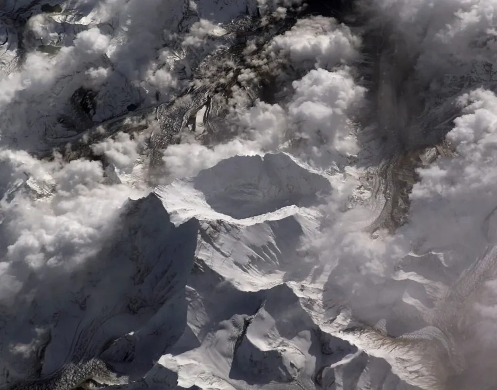
Everest seen from the International Space Station, with local features labelled. Photo: Dan Bursch, NASA, Wikimedia Commons, public domain.
What is the Southwest Face?
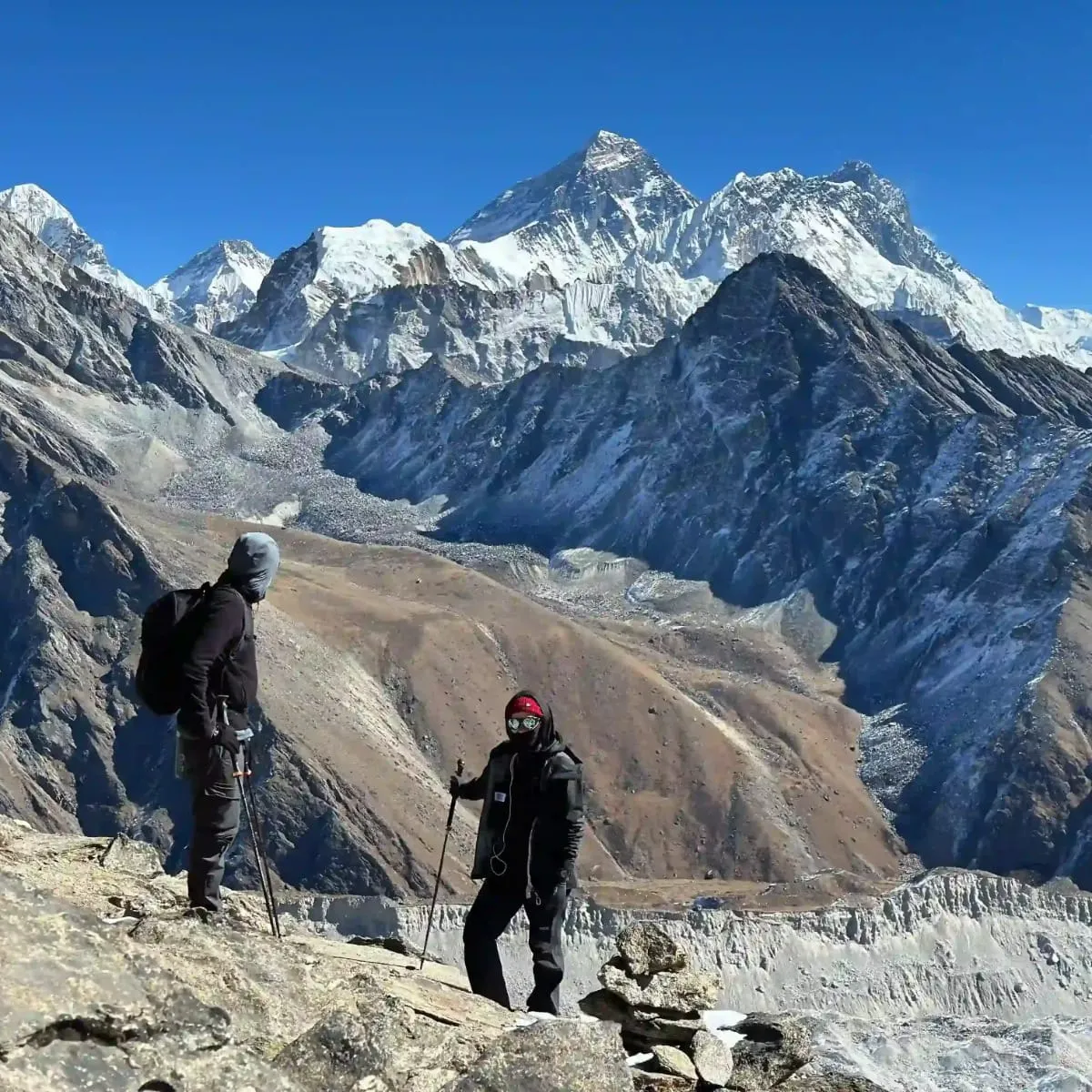
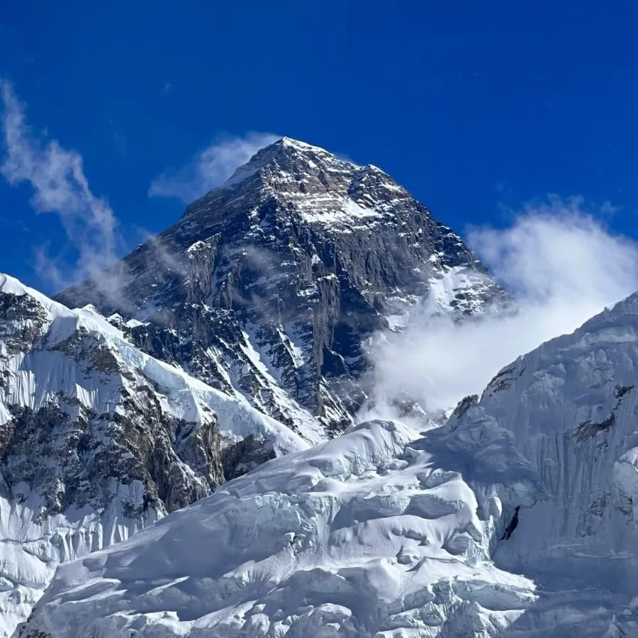
The Southwest Face is the dark rock wall above the Western Cwm on the Nepal side, between the West Ridge and the Southeast Ridge. It is the face you look at from Kala Patthar, the summit pyramid with the broad wall below it.
Teams tried it in 1969, 1971, 1972 and 1973, and none got higher than about 8,350 m (27,395 ft). The key obstacle was a band of cliffs, the Rock Band, at about 8,200 m (26,903 ft). Chris Bonington's British expedition solved it in 1975. Nick Estcourt and Tut Braithwaite climbed the Rock Band, and on 24 September 1975 Dougal Haston and Doug Scott reached the summit at about 6 pm. They spent the night near the South Summit with no tent and no oxygen, then the highest bivouac anyone had made.
The standard route from Nepal goes round this face, not up it. Climbers go through the Khumbu Icefall, walk the Western Cwm under the face, climb the Lhotse Face to the South Col and finish up the Southeast Ridge, the line of Hillary and Tenzing in 1953. Our post on how hard it is to climb Mount Everest covers that route camp by camp.
Everest's summit pyramid from the Khumbu side, with the jet stream blowing snow off the top. Photo: North Nepal Travel & Trek.
What is the North Face?
The North Face is the wall you see from Rongbuk in Tibet, between the Northeast Ridge and the West Ridge. Two long gullies cut its upper part, the Norton (Great) Couloir in the middle and the Hornbein Couloir further west. It is the face George Mallory photographed in 1921 and the setting of the British attempts of the 1920s.
Takashi Ozaki and Tsuneo Shigehiro of Japan made the first full ascent of the face on 10 May 1980, and later that year Reinhold Messner climbed alone from the north without bottled oxygen, finishing through the Norton Couloir. The standard route from Tibet keeps to the ridges instead: the North Col, the North Ridge and the Northeast Ridge over the Three Steps.
The North Face has its own full post, with the history, the route and how to see it from the road: the north face of Mount Everest.
What is the Kangshung Face?
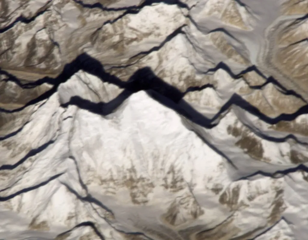
The Kangshung Face is Everest's east face, about 3,350 m (10,991 ft) from the Kangshung Glacier to the summit. It is in Tibet, at the head of the Kama Valley, six or seven days' walk from the nearest road near Kharta. Very few people ever see it.
The face is covered in hanging glaciers, and the avalanches from them sweep the ground below. In 1921 George Mallory looked at it and wrote: "Other men, less wise, might attempt this way if they would, but, emphatically, it was not for us." An American attempt in 1981, with Edmund Hillary on the team, turned back at about 7,000 m (22,966 ft) because of avalanche danger.
An American expedition led by James Morrissey made the first ascent in 1983. Kim Momb, Carlos Buhler and Lou Reichardt reached the summit on 8 October, and George Lowe, Dan Reid and Jay Cassell followed the next day. In 1988 a team of four, Robert Anderson, Stephen Venables, Ed Webster and Paul Teare, climbed a new line to the South Col with no bottled oxygen and no Sherpa support. Venables went on alone and reached the summit on 12 May 1988, the first Briton to climb Everest without bottled oxygen.
Everest's east side from the International Space Station, the Kangshung Face in shadow below the summit. Photo: NASA Johnson Space Center, Wikimedia Commons, public domain.
What is the West Ridge?
The West Ridge is the long, exposed edge between the Southwest Face and the North Face. It has seen very few ascents since it was first climbed in 1963.
On 22 May 1963 Tom Hornbein and Willi Unsoeld of the American expedition climbed the West Ridge, finishing through the couloir on the North Face now named after Hornbein, and reached the summit at 6:15 pm. They could not go back down their route, so they descended the Southeast Ridge, making the first traverse of Everest.
In the dark they met Barry Bishop and Lute Jerstad, who had summited by the Southeast Ridge that day, and the four sat out the night above 8,500 m (27,887 ft) with no shelter. All four came down. Unsoeld lost all but one of his toes to frostbite.
Why do almost all climbers avoid the faces?
Commercial climbing sells a fixed-rope route with the best chance of the summit, and that means the two ridge routes. Everest had 13,737 ascents by 7,563 people to the end of 2025, and nearly all of them followed the Southeast Ridge or the Northeast Ridge. A face route means hard technical climbing at over 8,000 m (26,247 ft), months of work and poor odds.
Face or ridge
Side
First climbed
Who climbs it now
Where you can see it
Southwest Face
Nepal
1975, Haston and Scott
Almost no one
Kala Patthar and Gokyo Ri
North Face
Tibet
1980, Ozaki and Shigehiro
Almost no one
Rongbuk
Kangshung Face
Tibet
1983, Momb, Buhler and Reichardt
Almost no one
The upper Kama Valley
Southeast Ridge
Nepal
1953, Hillary and Tenzing
Most climbers
Kala Patthar
Northeast Ridge
Tibet
1960, Wang Fuzhou, Gonpo and Qu Yinhua
Most north-side climbers
Rongbuk
The ridges have their own risks, and the death totals follow the traffic: 229 deaths on the Nepal side and 110 on the Tibet side to the end of 2025. For the full count of summits and deaths, see our post on how many people have climbed Mount Everest.
Where can a trekker see Everest's danger up close?
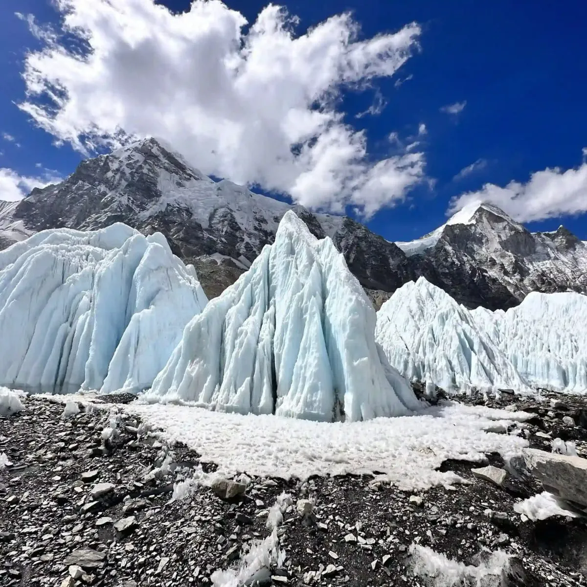
At the Khumbu Icefall, which you reach on the Everest Base Camp trek. The icefall is where the Khumbu Glacier drops about 600 m (1,969 ft) just above base camp, moving an estimated 0.9 to 1.2 m (3 to 4 ft) a day, and it is the most dangerous part of the standard Nepal route.
Climbers cross it many times in a season, and the Nepali workers who fix the ladders cross it most. On 18 April 2014 an avalanche there killed 16 Nepali climbers preparing the route. Trekkers stay at its foot: Everest Base Camp, 5,364 m (17,598 ft), sits beside the bottom of the icefall, and in spring you can watch the head torches of climbers moving through it before dawn.
Ice towers at the foot of the Khumbu Icefall, beside Everest Base Camp. Photo: North Nepal Travel & Trek.
How can you see Everest's faces without climbing?
On the Nepal side, climb Kala Patthar, 5,644 m (18,517 ft), on our 12-day Everest Base Camp Trek. From the top you look straight at the summit pyramid, the Southwest Face and the upper Southeast Ridge. From Gokyo Ri, 5,357 m (17,575 ft), on the Gokyo Lake Trek, you see Everest from further west above the Ngozumpa Glacier.
For the North Face, our Kailash Mansarovar with Everest Base Camp Tour drives to Rongbuk, where the whole face fills the head of the valley. The Kangshung Face is a different matter: it needs a camping trek of about a week through the Kama Valley from the Kharta side in Tibet. We don't run that trip, and I would rather say so than sell you a trip we don't know well.
If you want to see more of the Khumbu, the Everest Three Passes Trek takes in both Kala Patthar and Gokyo Ri. For a short look at Everest from a distance, the Pikey Peak Trek takes 5 days.
Our trekkers in front of Everest and its neighbours on the Kala Patthar side. Photo: North Nepal Travel & Trek.
Heads up
You can't see Everest's summit from Everest Base Camp itself; Nuptse hides it. The view is from Kala Patthar, and the best light is at sunrise, so you leave Gorak Shep in the dark and the cold, at the highest night of the trek. Your guide will set a slow pace. If you are short of breath or have a headache that won't go away that morning, the view is not worth it: go down instead.
Frequently asked questions
Three: the Southwest Face above Nepal's Western Cwm, the North Face above Tibet's Rongbuk valley, and the Kangshung, or East, Face above the Kangshung Glacier in Tibet. The Southeast, Northeast and West ridges separate them.
None. Edmund Hillary and Tenzing Norgay climbed the Southeast Ridge from Nepal in 1953, going through the Khumbu Icefall, the Western Cwm and the Lhotse Face to the South Col. Most climbers from Nepal still follow that route.
Yes, but rarely. An American expedition made the first ascent in 1983, and in 1988 a four-person team climbed a new line to the South Col without bottled oxygen, from which Stephen Venables reached the summit alone on 12 May.
Both have serious risks. The Nepal side had 229 deaths to the end of 2025, against 110 on the Tibet side, but it also had far more climbers. Per summit, the north side's rate is a little higher: 110 deaths in 3,850 summits, about 2.9 per 100, against 229 in about 9,890, about 2.3.
Not the summit. From Everest Base Camp, 5,364 m (17,598 ft), Nuptse hides the top of Everest. Most trekkers climb Kala Patthar, 5,644 m (18,517 ft), the next morning for the full view of the summit pyramid and the Southwest Face.
Yes. With a Chinese visa and Tibet permits arranged through an agency, you can travel by road to Rongbuk, below the north base camp, where the whole North Face is in view. Visitors without a climbing permit can't enter the climbers' base camp.
Tom Hornbein and Willi Unsoeld, on 22 May 1963. They came down the Southeast Ridge, making the first traverse of Everest, and spent the night above 8,500 m (27,887 ft) with Barry Bishop and Lute Jerstad.
Wikipedia, "Kangshung Face", "1975 British Mount Everest Southwest Face expedition", "1963 American Mount Everest expedition" and "Khumbu Icefall" (historical dates and figures; accessed 26 October 2026): https://en.wikipedia.org/wiki/Kangshung_Face
North Nepal Travel & Trek, Everest Base Camp Trek and Gokyo Lake Trek package pages (elevations), accessed 26 October 2026
A native of the Annapurna region, he brings over 17 years of firsthand experience leading treks across the mountains of Nepal. His deep local roots and proven guiding expertise make him a trusted authority on authentic Himalayan adventures.