Manaslu Circuit: The Complete Guide to Permits, Cost, Difficulty and Larkya La
Published Apr 16, 2025 Updated Oct 27, 2026 11 min read
Quick answer
The Manaslu Circuit loops around Manaslu, 8,163 m (26,781 ft), up the Budhi Gandaki valley and over the Larkya La, 5,106 m (16,752 ft). It is a strenuous restricted-area teahouse trek: you need three permits and a licensed guide, and our itinerary takes 11 days. After the October 2026 flood the route reopened on 21 October with a detour; check access before you book.
The Manaslu Circuit is the trek I recommend to people who want the Annapurna Circuit as it was before the roads: Gurung villages low down, Tibetan Buddhist villages high up, and one big pass. The restricted-area permit keeps numbers lower than on the Everest and Annapurna trails. This guide covers how the route works, what it costs and how hard it is, and, first, what this year's floods mean for access.
Key facts
Highest pointLarkya La, 5,106 m (16,752 ft)
Our itinerary11 days; Larkya La on day 8 (10 to 11 hours)
GradeStrenuous
PermitsManaslu RAP + MCAP + ACAP
GuideRequired; restricted area
Our price, 2026From USD 980 per person (two or more); USD 800 each for 13 to 25
Access, late October 2026Partly reopened on 21 October; drive to Machhakhola, then walk
Access in 2026: read this first
Date
What happened
Effect
6 September 2026
A flash flood on the Therang Khola at Namrung took out two bridges
The district halted trekking; it reopened within days (8 to 9 September) after locals built a temporary bridge over the Suksam Khola
Late September
Snow on the Larkya La
A group broke the trail on 1 October
11 October 2026
A flash flood on the Budhi Gandaki destroyed the Soti Khola road bridge, a 22-metre section of the Arughat bridge and several trail footbridges between Machhakhola and Philim
The circuit and Tsum Valley could not be entered from the south
21 October 2026
TAAN declared the Manaslu and Larkya La route partly open
Vehicles reach Machhakhola; you walk through Jagat, with a short signed detour at Yaru Bagar. Tsum Valley stayed closed while a bridge was rebuilt
When this guide was updated in late October 2026, the route was open again but held together in places by detours and temporary repairs, and TAAN asked trekkers to take care where flood damage remains. We confirm departures one at a time. For the latest, read our Budhi Gandaki flood update and our Manaslu conditions update.
Heads up
If you are booking Manaslu, ask your operator in writing which access road and bridges they expect to use, and what happens to your money if another flood closes the valley. A good operator will offer an alternative trek rather than a cancellation.
What is the Manaslu Circuit?
The circuit follows the Budhi Gandaki river north from Jagat through Gurung farming villages, climbs into the Tibetan Buddhist villages of Lho, Samagaun and Samdo below Manaslu, crosses the Larkya La, and drops to Bimthang and the Marsyangdi valley, where it meets the Annapurna Circuit at Dharapani. Manaslu, 8,163 m (26,781 ft), is the eighth-highest mountain in the world.
The landscape changes fast. The first days are hot, with terraced fields and long suspension bridges over a loud river in a deep gorge. By Samagaun you are in open yak pasture under 7,000-metre peaks, and above Samdo the trail climbs over moraine to the pass. You can add the Tsum Valley, a side valley close to the Tibet border, on our 18-day Manaslu with Tsum Valley trek.
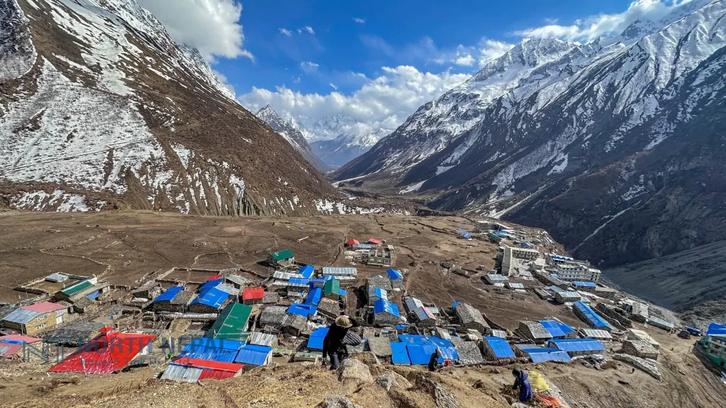
Samdo, 3,875 m (12,713 ft), the last village before the pass. Photo: North Nepal Travel & Trek.
Our 11-day itinerary
Day
Route
Sleep at
Walking
1
Drive from Kathmandu to Jagat (see note below)
Jagat, 1,340 m (4,396 ft)
8 to 10 hours by road
2
Jagat to Deng
Deng, 1,860 m (6,102 ft)
18 km, 6 to 7 hours
3
Deng to Namrung
Namrung, 2,630 m (8,629 ft)
17 km, 6 to 7 hours
4
Namrung to Shyala
Shyala, 3,520 m (11,549 ft)
17 km, 5 to 6 hours
5
Shyala to Samagaun via the Pungyen valley (acclimatisation)
Samagaun, 3,530 m (11,581 ft)
14 km, 4 to 5 hours
6
Samagaun to Samdo via Birendra Lake
Samdo, 3,875 m (12,713 ft)
8 km, 4 to 5 hours
7
Samdo to Dharamsala (Larkya Phedi)
Dharamsala, 4,460 m (14,633 ft)
12 km, 6 to 7 hours
8
Over the Larkya La, 5,106 m (16,752 ft), to Bimthang
Bimthang
24 km, 10 to 11 hours
9
Bimthang to Gho
Gho, 2,515 m (8,251 ft)
13 km, 5 to 6 hours
10
Gho to Dharapani, then drive via Besisahar to Kathmandu
Kathmandu
Short walk and a long drive
11
Departure
Until the road is repaired, vehicles stop at Machhakhola and you walk on to Jagat; ask us how this changes Day 1. This is a tight itinerary for fit trekkers with some altitude experience. If you have not been above 4,000 m before, ask us for an extra night at Samagaun or Samdo; it is the single best change you can make. Full details are on our Manaslu Circuit Trek page.
How hard is the Manaslu Circuit?
We grade it strenuous. The daily walking is longer and rougher than on Annapurna Base Camp, the trail in the lower gorge is narrow and landslide-prone after rain, and the pass day is the longest day of almost any classic teahouse trek in Nepal. It is not the right first trek for most people.
You need to be able to walk six to seven hours a day, several days in a row, with a light pack. Train for eight to twelve weeks with long hill walks, stairs and back-to-back days, and include long descents: the drop from the Larkya La to Bimthang is hard on knees. Our Manaslu difficulty guide goes day by day with GPS data.
Pass day starts at around 4 in the morning at Dharamsala, by headlamp, in serious cold. The early start gets you over the top before the afternoon wind and cloud, and leaves daylight for the long descent. Expect 10 to 11 hours on your feet.
Near the top the trail often carries ice and old snow. Your guide decides on the morning whether to cross; microspikes are often needed. From the pass the trail swings down into a huge glacial basin under Himlung Himal, Cheo Himal, Kang Guru and Annapurna II, one of the finest mountain views in Nepal, then down the moraine to Bimthang.
How the pass goes depends on the days before. The Pungyen valley and Birendra Lake detours on days 5 and 6 help you acclimatise; an extra night at Samagaun is better still. If a storm closes the pass, you wait at Dharamsala or drop back to Samdo; flexible dates matter here.
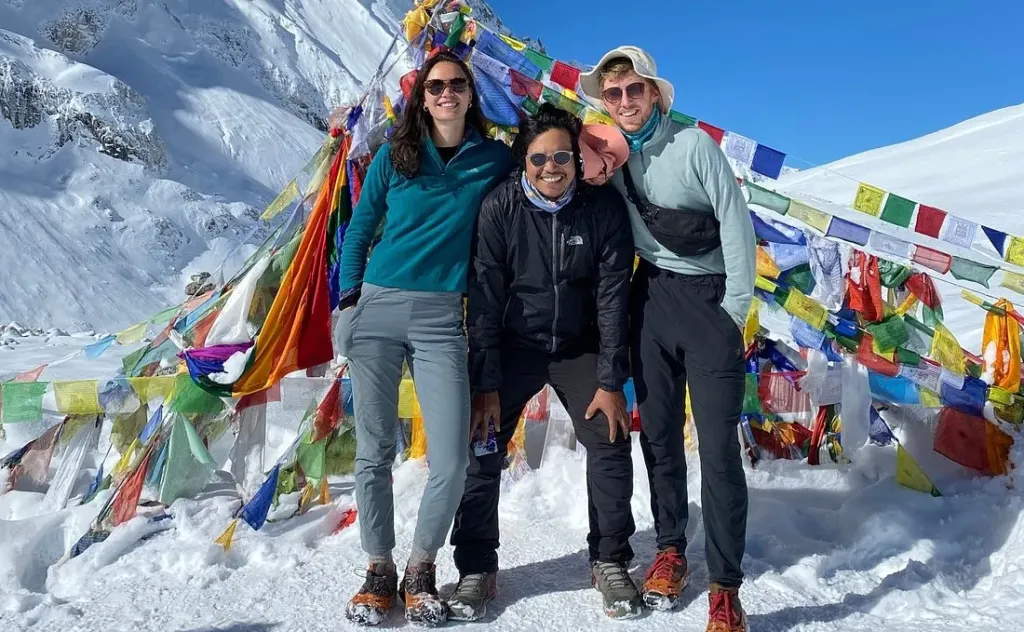
Our trekkers on the Larkya La, 5,106 m (16,752 ft). Photo: North Nepal Travel & Trek.
Permits and the guide rule
Permit
Fee (2026)
Notes
Manaslu Restricted Area Permit, September to November
USD 100 for the first 7 days, then USD 15 a day
Covers the restricted zone in northern Gorkha, up to the Larkya La; our 11-day trek needs about 8 days
Manaslu Restricted Area Permit, December to August
USD 75 for the first 7 days, then USD 10 a day
Manaslu Conservation Area permit (MCAP)
NPR 3,000
Annapurna Conservation Area permit (ACAP)
NPR 3,000
For the Dharapani side
TIMS card
Not needed
The TIMS system is not active
All three permits are arranged through a registered agency, and a licensed guide must walk with you for the whole trek. Since 22 March 2026 a single trekker can get the restricted-area permit; before that you needed at least two. The guide and agency rules did not change. Our Nepal trekking permits guide has the details.
What the Manaslu Circuit costs
Group size
Our 11-day price per person
2 people
USD 980
3 to 6
USD 920
7 to 12
USD 875
13 to 25
USD 800
Our price covers the permits, a licensed guide, teahouse rooms, meals on the trek and the road transport. On top, budget for your flights, visa, insurance that covers trekking to at least 5,106 m (16,752 ft) with helicopter evacuation, tips, and drinks, showers, charging and Wi-Fi on the trail. If you hire people directly, a guide costs USD 40 a day and a porter USD 20 to 25 a day.
Manaslu costs more than the Annapurna Circuit because of the restricted-area permit and the long drive, and less than Everest Base Camp because there are no Lukla flights.
Best time to go
Season
Conditions
Our view
Late September to November
Clear skies, cold nights; early snow and floods have hit in recent autumns
Best overall, with spare days
March to May
Warmer, rhododendrons low down, possible late snow on the pass
Very good
December to February
Very cold; the pass and the Dharamsala lodges can close after snow
It is a teahouse trek from start to finish. Rooms are simple twins, bathrooms are mostly shared, and lodges in Namrung and Samagaun are the most comfortable. Dharamsala, the night before the pass, is the most basic of all. Hot showers, charging and Wi-Fi cost extra and get scarce above Samagaun; bring a power bank.
Dal bhat is the staple at every stop, cooked fresh and with free refills, alongside noodles, potatoes, soups and Tibetan bread. Menus shrink and prices rise as you climb. Phone signal is patchy in the upper valley, so tell people at home not to worry if you go quiet for a few days.
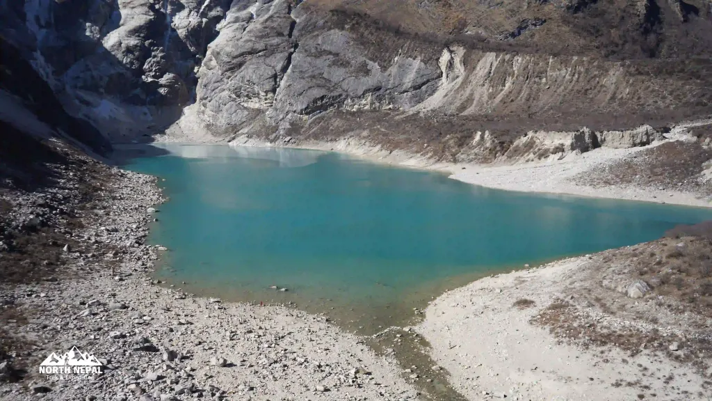
Birendra Lake, a short walk from Samagaun and a good acclimatisation hike. Photo: North Nepal Travel & Trek.
Gear
Pack for heat in the gorge and deep cold at Dharamsala. Bring a sleeping bag rated to about −10°C, a warm down jacket, insulated gloves, a hat, a waterproof shell, broken-in boots, a headlamp with spare batteries and microspikes for the pass. Down jackets and sleeping bags can be rented in Kathmandu or Pokhara.
On 21 October 2026 TAAN declared the Manaslu and Larkya La route partly open: vehicles reach Machhakhola, you walk from there through Jagat, and a short signed detour avoids flood damage at Yaru Bagar. Tsum Valley was still closed. Check current conditions with your operator before you book.
Our itinerary is 11 days from Kathmandu, with the Larkya La on day 8. Add a night at Samagaun or Samdo if you have little altitude experience, and keep a spare day for the pass.
Strenuous. Days are long, the lower trail is rough, and the pass day takes 10 to 11 hours. It is not the right first trek for most people.
No. It is a restricted area: the permit is issued through a registered agency and a licensed guide must walk with you.
Yes, since 22 March 2026. You still need an agency and a guide.
USD 100 for the first 7 days from September to November, then USD 15 a day; USD 75 and USD 10 a day from December to August. MCAP and ACAP add NPR 3,000 each.
Our 11-day trek costs USD 980 per person for two, falling to USD 800 each for 13 to 25, including permits, guide, teahouses and meals.
A native of the Annapurna region, he brings over 17 years of firsthand experience leading treks across the mountains of Nepal. His deep local roots and proven guiding expertise make him a trusted authority on authentic Himalayan adventures.