Why Colorado Hikers Should Do the Annapurna Circuit with Tilicho Lake
Published Oct 27, 2026 Updated Oct 27, 2026 11 min read
Quick answer
If you hike Colorado fourteeners, you have the legs for the Annapurna Circuit with Tilicho Lake. What is new is the duration and the height: Tilicho Lake is 4,919 m (16,138 ft) and the Thorong La pass is 5,416 m (17,769 ft), about 3,300 ft above Mount Elbert. Our version takes 11 days and needs a licensed guide.
Colorado hikers arrive in Pokhara with good legs and real altitude experience, and they often assume a fourteener has prepared them for the Himalaya. It has, partly. This post is about the part it has not: day after day above 13,000 ft, a landslide traverse with nothing like it on a Colorado trail, and a pass higher than anything in the lower 48. It also explains why the Tilicho side trip is worth the extra effort.
Key facts
Highest pointThorong La, 5,416 m (17,769 ft)
Tilicho Lake4,919 m (16,138 ft)
For comparisonMount Elbert, 4,401 m (14,440 ft)
Our itinerary11 days, about 125 km of walking
GradeModerate to challenging
PermitACAP, NPR 3,000; a licensed guide is required
Our priceFrom USD 1,000 per person; USD 700 each for 13 or more
The short version
The Annapurna Circuit follows the Marsyangdi valley up to Manang, crosses the Thorong La and drops to Muktinath on the Kali Gandaki side. The Tilicho detour leaves the main trail above Manang for a glacial lake at 4,919 m (16,138 ft), then rejoins it at Yak Kharka, two days before the pass.
I recommend the detour for two reasons. The lake is one of the most striking places in Nepal, a long sheet of turquoise water under the glaciers of Tilicho Peak. And the day at the lake works as acclimatisation: you have already slept at 4,150 m (13,615 ft) and climbed to 4,919 m before you face the pass. Fitness does not prevent altitude sickness, but a body that has been high once already usually copes better with the pass.
Colorado fourteener
Annapurna Circuit with Tilicho
Highest point
4,401 m (14,440 ft) on Mount Elbert
5,416 m (17,769 ft) at Thorong La
Time high
One hard day
Seven nights in a row near or above Manang's 3,519 m (11,545 ft)
Sleeping altitude
Usually your home altitude
Up to 4,450 m (14,600 ft) at Thorong Phedi
Terrain
Class 1 or 2 trail and talus
Village trails, a scree traverse, switchbacks on moraine, a long pass day
Support
Usually self-supported
Teahouses every night, a licensed guide and porters
Days 1 to 5: up the Marsyangdi to Manang
We drive from Kathmandu or Pokhara via Besisahar to Dharapani, 1,860 m (6,102 ft), and start walking the next morning. The lower valley looks nothing like Colorado: terraced fields, waterfalls off the cliffs and subtropical forest. By Chame, 2,670 m (8,760 ft), and Pisang the valley turns to pine, the houses turn to flat-roofed stone, and the prayer flags start.
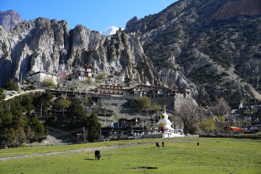
Manang, 3,519 m (11,545 ft), is where the landscape starts to look like the tundra above treeline on a fourteener, except that the peaks above the village are 7,000 m (22,966 ft) and more. We spend a full acclimatisation day nearby at Braka, with a hike up towards Ice Lake. The Himalayan Rescue Association runs a seasonal aid post in Manang; if there is an altitude talk on while you are there, go to it.
In late September 2026 floods and landslides closed the Besisahar to Chame road for six days. It reopened on 3 October, but the road above Chame stayed broken, so trekkers started walking from Chame. Our Nepal trekking conditions update has the latest.
Braka, near Manang, where we spend the acclimatisation day. Photo: North Nepal Travel & Trek.
The Tilicho detour, honestly
From Manang the Tilicho trail goes west through the old village of Khangsar and Shree Kharka, 4,045 m, to Tilicho Base Camp at 4,150 m (13,615 ft). Between Shree Kharka and base camp it crosses an active landslide slope: a narrow path on loose scree with a long drop below, about a kilometre long.
Our guides cross it early, keep people spaced out and moving, and do not stop for photos. After heavy rain or fresh snow they will turn a group around rather than commit to it. Large numbers of trekkers cross it every season, but I would rather you know about it at home than meet it on the day.
Heads up
The landslide traverse is the one part of this trek with no equivalent on a Colorado trail, and it is the main reason you should not do the Tilicho detour without a guide who knows the slope. If the guide says the traverse is not safe that day, the plan changes.
Tilicho Base Camp is basic: simple rooms, a warm dining room, a short menu and nights well below freezing.
The 22 switchbacks to Tilicho Lake
The lake day starts before dawn so you reach the shore before the wind gets up. The climb is the Bais Ghumti, the 22 turns: a zig-zag trail up a steep moraine face, gaining about 770 m (2,500 ft) from base camp. At this height each step costs more than you expect, and the rests get longer.
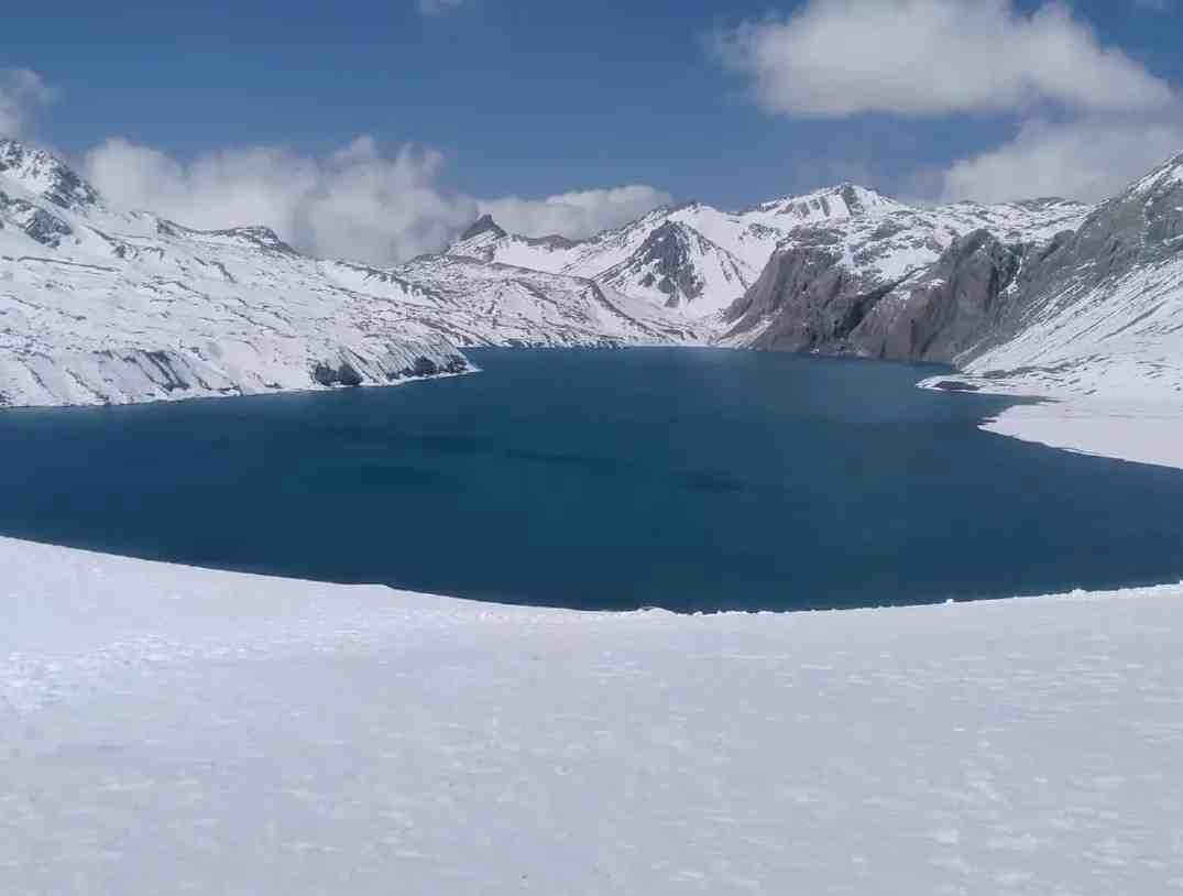
Then the trail levels, you come over a moraine ridge, and the lake is there: about 4 km long, turquoise and usually still in the morning, with the ice of Tilicho Peak falling straight into it. There are no trees and almost no sound. You eat your packed lunch, take your photos and go back down to base camp.
Tilicho Lake, 4,919 m (16,138 ft), about 1,700 ft higher than any summit in Colorado. Photo: North Nepal Travel & Trek.
For the geology, the legends and the Mesokanto La route beyond the lake, see our Tilicho Lake guide.
Back to the Circuit and over Thorong La
You do not need to go back to Manang. A connecting trail from the Tilicho side runs to Yak Kharka, 4,050 m (13,287 ft), on the main Circuit. It is a long, rough day, but it keeps you high, which is what you want before the pass.
From Yak Kharka you walk to Thorong Phedi, 4,540 m (14,895 ft). Pass day starts in the dark, by headlamp, in serious cold. The climb to Thorong La, 5,416 m (17,769 ft), gains nearly 1,000 m (about 3,150 ft), and the descent to Muktinath, 3,762 m (12,343 ft), is long and hard on the knees. Plan on most of a day on your feet.
Over the pass the landscape changes completely: the dry, wind-cut country of Mustang, closer to the San Luis Valley than to anything green. Muktinath is sacred to both Hindus and Buddhists, and a small natural gas flame burns beside a spring inside one of the temples.
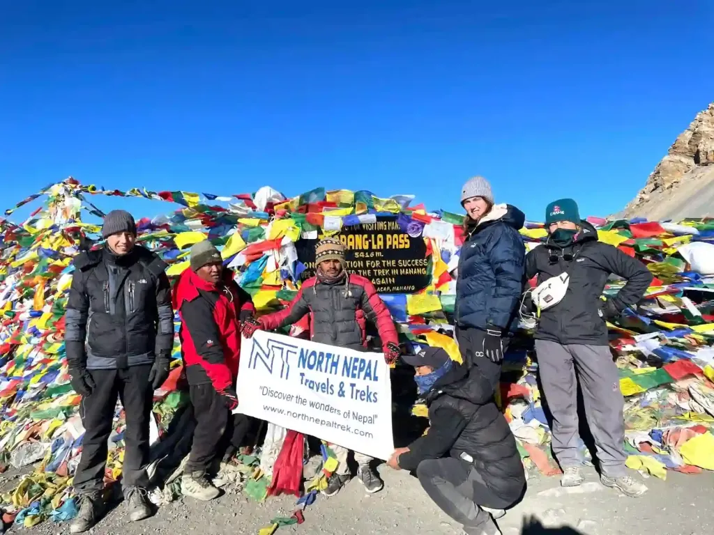
Our group on the Thorong La, 5,416 m (17,769 ft). Photo: North Nepal Travel & Trek.
Our 11-day itinerary
Day
Route
Sleep at
1
Drive from Kathmandu or Pokhara via Besisahar
Dharapani, 1,860 m (6,102 ft)
2
Dharapani to Chame
Chame, 2,670 m (8,760 ft)
3
Chame to Upper Pisang
Upper Pisang
4
Upper Pisang to Braka
Braka
5
Acclimatisation day, hike towards Ice Lake
Braka
6
Via Manang and Khangsar to Tilicho Base Camp
Tilicho Base Camp, 4,150 m (13,615 ft)
7
Tilicho Lake, 4,919 m (16,138 ft), and back
Tilicho Base Camp
8
Tilicho Base Camp to Yak Kharka
Yak Kharka, 4,050 m (13,287 ft)
9
Yak Kharka to Thorong Phedi
Thorong Phedi, 4,540 m (14,895 ft)
10
Thorong La, 5,416 m (17,769 ft), to Muktinath
Muktinath, 3,762 m (12,343 ft)
11
Drive from Muktinath to Pokhara
Pokhara
We also run a 9-day version for fit trekkers who have been to altitude before, and a 13-day version with a full rest day and a Poon Hill finish. Details are on the Annapurna Circuit with Tilicho Lake page. If you would rather skip Tilicho, the standard Annapurna Circuit Trek is 12 days.
What it costs
Item
2026 figure
Our 11-day trek, one trekker
USD 1,000
Two trekkers
USD 880 each
Groups of 3 to 6 / 7 to 12 / 13 or more
USD 800 / 750 / 700 each
ACAP permit (included in our price)
NPR 3,000, about USD 20
TIMS card
Not needed; the TIMS system is not active
Nepal visa, 30 days
USD 50
Our price includes the permit, a licensed guide, teahouse rooms, three meals a day on the trek and the ground transport. On top, budget for your flights, insurance with helicopter evacuation, tips, and drinks, hot showers, charging and Wi-Fi on the trail, which get more expensive the higher you go. Since April 2023 foreign trekkers in the Annapurna Conservation Area must walk with a licensed guide.
How fit do you need to be?
If you can do Grays and Torreys, or any Class 1 or 2 fourteener, as a comfortable day hike, you have the base fitness. The difference is duration: about ten walking days in a row of five to eight hours, several nights above 4,000 m, and one very long pass day.
Altitude is the thing that catches strong hikers out, and fitness does not predict it. I have seen runners with headaches at Manang while their less-fit friends felt fine. Use what you know from Colorado, but take it more seriously:
Rule
Why
Above 3,000 m, go up no more than about 500 m (1,640 ft) of sleeping height a day where the route allows, and take the rest days
The standard Wilderness Medical Society guidance. Day 6 to Tilicho Base Camp is the one bigger jump, which is why it follows the rest day
Tell your guide about any headache, nausea or unusual tiredness early
Mild symptoms are treated by stopping, not pushing on
Descend if symptoms get worse
Descent is the treatment
Talk to your doctor about acetazolamide before you go
It helps prevent altitude sickness but is not for everyone
Train for eight to twelve weeks with long days carrying a pack, and do some back-to-back hiking days at altitude in Colorado if you can. Our 16-week Himalayan training plan goes into detail.
Best time to go
Season
Conditions
Our view
October and November
Clearest skies, cold nights, busiest
Best overall; book early
March to May
Warmer, rhododendrons lower down, more cloud higher up
Very good
December to February
Very cold; snow can close the pass and the Tilicho traverse
Only with flexibility
June to September
Monsoon on the Marsyangdi side; the upper valley is drier
Possible, with road and landslide risk
Snow can close the Thorong La at any time of year, and our guides decide on the day. In late September 2026 heavy snow made the pass unsafe and more than 150 trekkers turned back to Manang, and in late October the Department of Hydrology and Meteorology forecast a Bay of Bengal system to bring rain and snow, heaviest from 29 to 31 October. Plan a spare day. Month-by-month detail is in our guide to the best time to trek in Nepal.
Frequently asked questions
The fitness needed is similar to a Class 1 or 2 fourteener done as a day hike, but you walk for about ten days in a row and sleep up to 4,450 m (14,600 ft). The pass at 5,416 m (17,769 ft) is about 3,300 ft higher than Mount Elbert.
Tilicho Lake is at 4,919 m (16,138 ft), above Manang in the Annapurna region. It is about 1,700 ft higher than the summit of Mount Elbert.
Most of it is not, but the trail between Shree Kharka and Tilicho Base Camp crosses an active landslide slope. Cross it early in the day with a guide, and turn back if the guide says conditions are unsafe.
Our standard itinerary is 11 days from Kathmandu or Pokhara, with a 9-day version for experienced trekkers and a 13-day version with an extra rest day.
Yes. Since April 2023 foreign trekkers in Nepal's conservation areas, including the Annapurna Conservation Area, must walk with a licensed guide.
Our 11-day trek costs USD 1,000 for one trekker and less per person for groups, down to USD 700 each for 13 or more, including the ACAP permit, guide, teahouses and meals.
October and November for the clearest skies, or March to May. Snow can close the Thorong La and the Tilicho traverse in winter.
Luks AM et al., Wilderness Medical Society Clinical Practice Guidelines for the Prevention, Diagnosis and Treatment of Acute Altitude Illness: 2024 Update, Wilderness & Environmental Medicine 35(1 suppl): https://doi.org/10.1016/j.wem.2023.05.013
A native of the Annapurna region, he brings over 17 years of firsthand experience leading treks across the mountains of Nepal. His deep local roots and proven guiding expertise make him a trusted authority on authentic Himalayan adventures.