Tilicho Lake Trek via Annapurna Circuit & Thorong La - 11 Days

Tilicho Lake Trek via Annapurna Circuit & Thorong La - 11 Days
DESTINATION Nepal
MAX. ELEVATION 5416 m
WALKING DISTANCE ~125 km
GRADE Moderate to Challenging
BEST SEASON March-May / September-November
DURATION 11 Days
MEALS INCLUDED Breakfast, Lunch & Dinner
ACCOMMODATION Hotel, Lodge & Teahouse

OVERVIEW & HIGHLIGHTS

Tilicho Lake Trek: Overview of the 11-Day Route

The Tilicho Lake Trek is an 11-day guided route on the Annapurna Circuit in Manang District, Gandaki Province, Nepal. It reaches Tilicho Lake at 4,919 m (16,138 ft), then crosses Thorong La Pass at 5,416 m (17,769 ft) to Muktinath. A licensed guide is required under Nepal Tourism Board rules.

You start walking at Dharapani (1,860 m) in the Marsyangdi valley and climb through Chame and Upper Pisang into the dry, Tibetan-Buddhist upper Manang valley. At Manang you leave the standard Circuit for two days to reach Tilicho Base Camp and the lake, then rejoin it at Yak Kharka, cross Thorong La and drop to the Muktinath temple. The whole route is inside the Annapurna Conservation Area (ACAP).

Tilicho Lake Trek at a Glance

Location Manang District, Gandaki Province, Nepal (Annapurna Conservation Area)
Tilicho Lake elevation 4,919 m / 16,138 ft
Highest point Thorong La Pass, 5,416 m / 17,769 ft
Duration 11 days, 9 of them walking (9-day and 13-day versions available)
Walking distance About 125 km
Start / finish Dharapani (by road via Besisahar) / Muktinath, then drive to Pokhara
Grade Moderate to challenging
Accommodation Teahouse lodges every night, including Tilicho Base Camp
Meals Breakfast, lunch and dinner on the trek
Permits ACAP permit (NPR 3,000 for foreign nationals), arranged by us
Guide Licensed guide required (Nepal Tourism Board rule since 1 April 2023)
Best season March to May and September to November
Price per person USD 1,000 solo · 880 for 2 · 800 for 3–6 · 750 for 7–12 · 700 for 13+

Download the all-season packing checklist before you pack for the Tilicho Lake Trek.

Why Trek to Tilicho Lake?

  • Reach Tilicho Lake at 4,919 m (16,138 ft), one of the highest large lakes in the world
  • Hike to Ice Lake (Kicho Tal) at 4,620 m (15,157 ft) as your acclimatisation day
  • See Annapurna II, Gangapurna and Tilicho Peak up close, with Manaslu and Dhaulagiri from higher points
  • Cross Thorong La Pass at 5,416 m (17,769 ft)
  • Visit Braka Monastery, the chortens of upper Manang and the Muktinath temple
  • Walk through the Gurung and Tibetan-Buddhist villages of Manang, then into Mustang
  • Walk through pine and rhododendron forest below Chame before the valley turns dry above Pisang
  • Walk the classic Annapurna Circuit, plus the detour most Circuit trekkers skip
Mohan Raj Bhandari
Itinerary review by

Mohan Raj Bhandari, Founder/Managing director

When I founded North Nepal Trek in 2015, I wanted to guide people on routes that still feel wild and personal, and the Annapurna Circuit with Tilicho Lake is exactly that kind of trek. The early climb from Tilicho Base Camp to the lake and the long day over Thorong La at 5,416 m are the hardest days of the trek, and getting the acclimatisation right before them is why we have kept refining this itinerary for over a decade.

Tilicho Lake Trek Itinerary: 11 Days on the Annapurna Circuit

Toggle all
Day 1

Drive from Kathmandu or Pokhara to Dharapani (1,860 m / 6,102 ft)

HIGHEST ALT. (1,860 m / 6,102 ft)
Distance
DISTANCE ~230 km from Kathmandu | ~160 km from Pokhara

From Pokhara (820 m | 2,690 ft):
After breakfast, we start our 1st day of the Annapurna Circuit Trek with Tilicho Lake early and drive to Prithvi Chowk bus park from Lakeside at 6:45. There are only 1 or 2 buses for Besisahar and they are available in the morning. After 15 min of driving, we reach Prithvi Chowk Bus Park. We take our bus toward Besisahar, a scenic bus ride from Prithvi Chowk to Besisahar takes about 4 hours, covering a total distance of 105 km.

Tourist praying, by rotating mani bells during Annapurna circuit trek clicked by north nepal trek.Photo: Way to Dharapani

From Kathmandu (1,400 m | 4,594 ft): 
We take an early bus to Besisahar from Balaju bus park at 7: 00 am. The drive is filled with scenic mountain views and the Trishuli River. The scenic drive takes about 5 hr 30 min covering a total distance of 180 km via Prithvi Highway.

From Besisahar (760 m | 2,494 ft), it is the same route throughout the trek whether you start from Kathmandu or Pokhara:
After reaching Besisahar, we have lunch and take a Jeep toward Dharapani (1,860 m|6,102 ft) Village. The scenic view of the Marsyangdi River, the cliffs with waterfalls, a drive-through tunnel, and the hydropower of the Marsyandi River make this drive more memorable. The drive from Besisahar to Dharapani takes about 5:30 - 6 hours, as the drive is off-road and bumpy. Overnight stay at Dharapani.

Day 2

Dharapani to Chame (2,670 m / 8,760 ft)

HIGHEST ALT. 2,670 m / 8,760 ft
DURATION 5 - 6 hours
Distance
DISTANCE 15.5 km

After breakfast we start our trek from Dharapani (1,860m) to Chame (2,670m), covering 15.5km in approximately 4 hrs 30 mins. We start by checking in at the ACAP office and choose the scenic trail via Thonche. Ascend through mist-covered landscapes, pine forests, and quaint villages. Enjoy a relaxing stop in Timang (2,750m), have our lunch amidst alpine scenery, then continue along the road to Koto (2,600m) and experience the beauty of the journey. After we reach Chame, savor a delicious meal, unwind with a thermos of tea, and overnight stay at Chame.
Teahouse in Chame, with the backdrop of hills and prayer flags handing around the teahouse.
Photo: Teahouse in Chame

Day 3

Chame to Upper Pisang (3,310 m / 10,860 ft)

HIGHEST ALT. 3,310 m / 10,860 ft
DURATION 5 - 6 hours
Distance
DISTANCE 16 km

After breakfast at the hotel, we start our 3rd day of the Annapurna Circuit Trek. We follow a narrow path through a dense forest of pine trees and then along a steep rocky trail. We pass through a semi-tunnel made by carving the hill, and the Marsyangdi River is within our sight during the hike.

Breakfast (omelette, bread, roasted potatoes, tea) in the circuit trek. Photo: Breakfast (omelette, bread, roasted potatoes, tea) in the circuit.

We pass through Telekhu and Bhrathang and cross a bridge to reach the south bank of the Marsyangdi River. Bharthang is famous for its Apple Garden. After having lunch at Dhikur Pokhari, we walk along a gentle climb northward with the view of Annapurna II (7,937 m | 26,040 ft) at our backs. 

After the total journey of 16 kilometers of hiking over 6 hours, we finally reach the town of Upper Pisang, filled with Tibetan Gurung, where we spend the night.

Day 4

Upper Pisang to Braka via Ghyaru and Ngawal (3,500 m / 11,483 ft)

HIGHEST ALT. 3,660 m / 12,008 ft (Ngawal); overnight 3,500 m / 11,483 ft
DURATION 7 - 8 hours
Distance
DISTANCE 18 km

After a hearty breakfast, we ascend toward the typical Tibetan-styled Ghyaru village. From the top of the Ghyaru, the panoramic view of the Annapurna range looks astounding. We can have our lunch here at Ghyaru, but if you want to have lunch at Ngawal, then it is also possible.

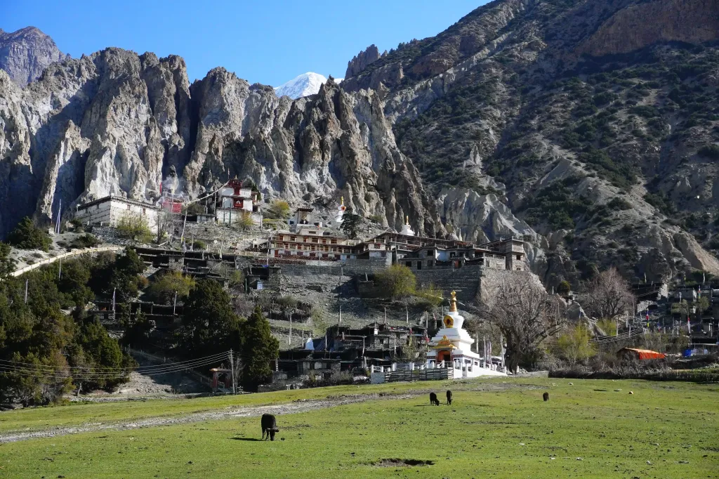
View of Temple and village of Braka, in the laps of mountains terrain, clicked by North Nepal Trek.

Photo: The view of Braka Village.

The journey from Upper Pisang to Ngawal is short, but due to ascending route, the total distance of 10 kilometers of hiking takes 4 -5 hours of trekking at average speed. We have our lunch at Ngawal and rest before trekking to Braka. At first, we descend from Ngawal, and then the way is straight/flat to Braka. During the second half of the day, we mostly trek on the motor roads. After about 3 hours covering 8 km of accessible roads, we reach Braka. 

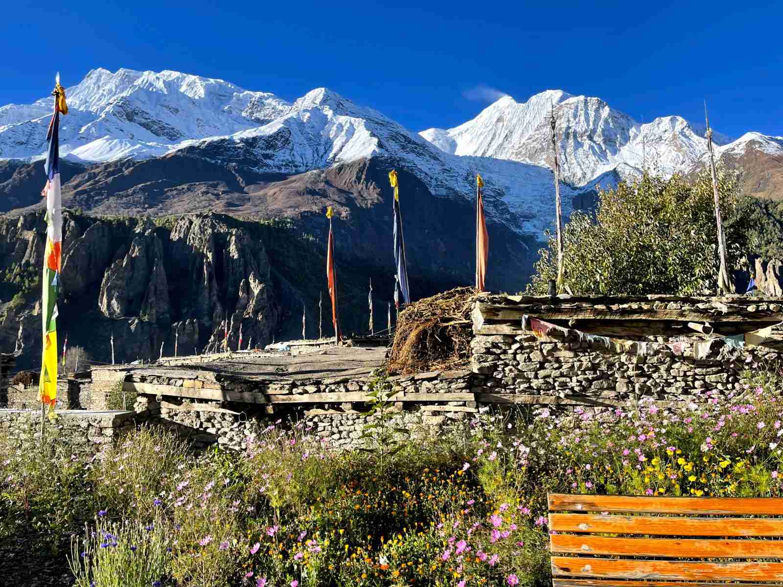
Braka is a less crowded town and is home to many monasteries. While there are certainly, a significant number of hotels in Braka, there are more Monasteries than hotels here in Braka. Moreover, the oldest monastery in the Manang district, Braka Gompa, lies in Braka. Not only that, but Braka also harbors the Milarepa Cave, which is famous among Tibetans, so you can witness many cultures during your stay here. Not only the cultural aspect, but Braka also hosts a collection of natural pointy hills made of rocks, attractive as natural wonders and a must-visit destination. 

After a total hike of 7- 8 hrs and covering a total distance of 18 km, we reach Braka. Braka welcomes us with mesmerizing views of Pisang Peak, Heaven's Gate, Annapurna II, IV, III, Gangapurna, Khangsar Kang, and Tilicho Peak making a stage from left to right. After enjoying the mountain views, we prepare for our trek to Ice Lake tomorrow, have dinner, and stay overnight at Braka.

Day 5

Braka to Ice Lake (4,620 m / 15,157 ft), back to Braka and on to Manang (3,540 m / 11,614 ft)

HIGHEST ALT. 4,620 m / 15,157 ft
DURATION 8 - 9 hours
Distance
DISTANCE ~11.5 km

We start our 5th day of the Annapurna Circuit Trek early after breakfast, as we have to cover Ice Lake and then trek to Manang. The total distance from Braka to Manang is approximately 5 kilometers, which makes a both-way distance of approximately 10 kilometers. The total trekking time from Braka to Ice Lake, back to Braka, and then to Manang is nearly 8 - 9 hours.

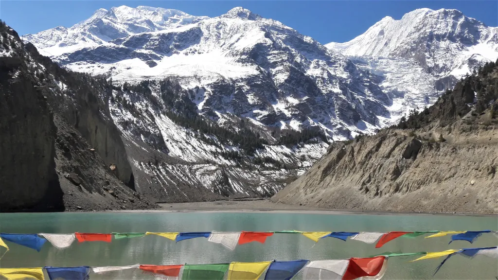
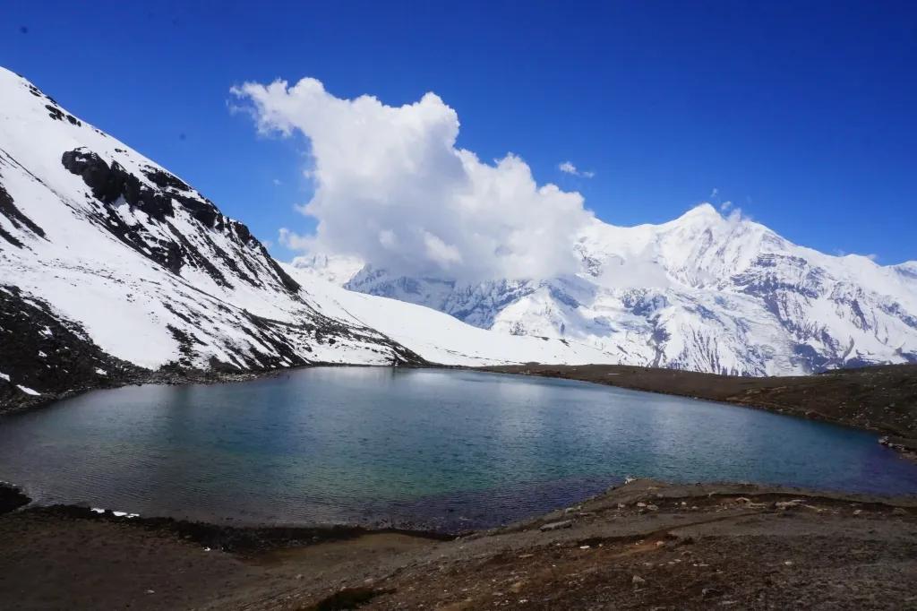
Gangapurna lake with himalayas in the background, filled with crystal waters clicked by north nepal trek
Photo: Gangapurna Lake in Manang

The trek from Braka to Ice Lake takes nearly 4 hours, and returning takes 3 hours, making it 7 - 8 hours of trek.  

We gain an elevation of approximately 1,080 meters (3,600 feet) while trekking from Braka to Ice Lake. The path is filled with stairs going straight upward, and altitude surpasses the treeline, making the path discernible and recognizable even from a distance, even in adverse weather conditions. In such cases, descending southward will inevitably intersect with the Circuit.

A splendid panorama of the Annapurna Range unfolds to the south, while Ice Lake, also known as Kicho Tal (4,620 m), lies to the north, beneath the towering Chulu East and Chulu Central. 

A grand stupa adorned with prayer flags marks the Ice Lake. After our expedition to Ice Lake, we trek back to Braka and have lunch here, and with some rest, we trek to Manang. The distance from Braka to Manang is about 1.5 kilometers, taking 30 - 40 minutes of slow-paced trek. Overnight stay at Manang. 

Day 6

Manang to Tilicho Base Camp (4,150 m / 13,615 ft) via Khangsar and Shree Kharka

HIGHEST ALT. 4,150 m / 13,615 ft
DURATION 7 hours
Distance
DISTANCE ~15 km

After breakfast at Manang, we start our trek to Tilicho Lake Base Camp early in the morning. The 6th day of the Annapurna Circuit Trek first takes you to the Khangsar Village, high above the Marsyangdi River through Khangsar Khola Valley.

Way to Tilicho Lake, with rocky mountain terrains and adventurous terrains, clicked by North Nepal
Photo: Way to Tilicho Base Camp

To reach the Khangsar Village, sitting at an altitude of 3756 m, we have to cross a suspension bridge and climb gradually upward with views of the Himalayas along the way. After some rest, we have lunch and continue our trek toward the Tilicho Base Camp. 

After some time, we pass by another settlement called Shri Kharka (4,045 m), and after passing through Shri Kharka the path splits between three. 

While the middle part is the shortest, it is also the most dangerous one in some sections as it intersects steep rubble slopes. However, the lower path isn’t even marked, and the upper trail is way too long and challenging. Furthermore, we use the middle path as it is used by trekkers and locals alike. 

One of the most significant peaks along the trail from Manang to Tilicho Base Camp is the Khangsar Khang, also known as Rock Noir, a black rock. The wall of this rock is so steep that neither snow nor ice can stick on it, creating a black field on its top. You can see the Annapurna I, Tilicho Peak, and many more during this section. After about 2- 3 hours in this slippery section after Shri Kharka, we reach Tilicho Base Camp after trekking a total of 7 hours. Overnight stay at Tilicho Base Camp.

Day 7

Tilicho Base Camp to Tilicho Lake (4,919 m / 16,138 ft) and back to Tilicho Base Camp

HIGHEST ALT. 4,919 m / 16,138 ft
DURATION 6 - 7 hours
Distance
DISTANCE ~ 11 km

After breakfast, we trek toward Tilicho Lake a little bit early. The trail to Tilicho Lake is well-marked, as it is a popular trekking route and destination. It leads to the western edge of Tilicho Lake Base Camp, so we start our trek from here. The massif Manaslu and the Ngada Chulli can also be seen from the east side at the start of the trek.

Tilicho lake at Manang during Annapurna Circuit Trek with North Nepal Trek.

The climb of the zig-zags area during this trek makes it more challenging, and after trekking for about 3 - 4 hours, we reach one of the highest lakes in the world, Tilicho Lake. Before reaching Tilicho, we can see a plateau from where Tilicho Lake is around 20 - 30 min away.

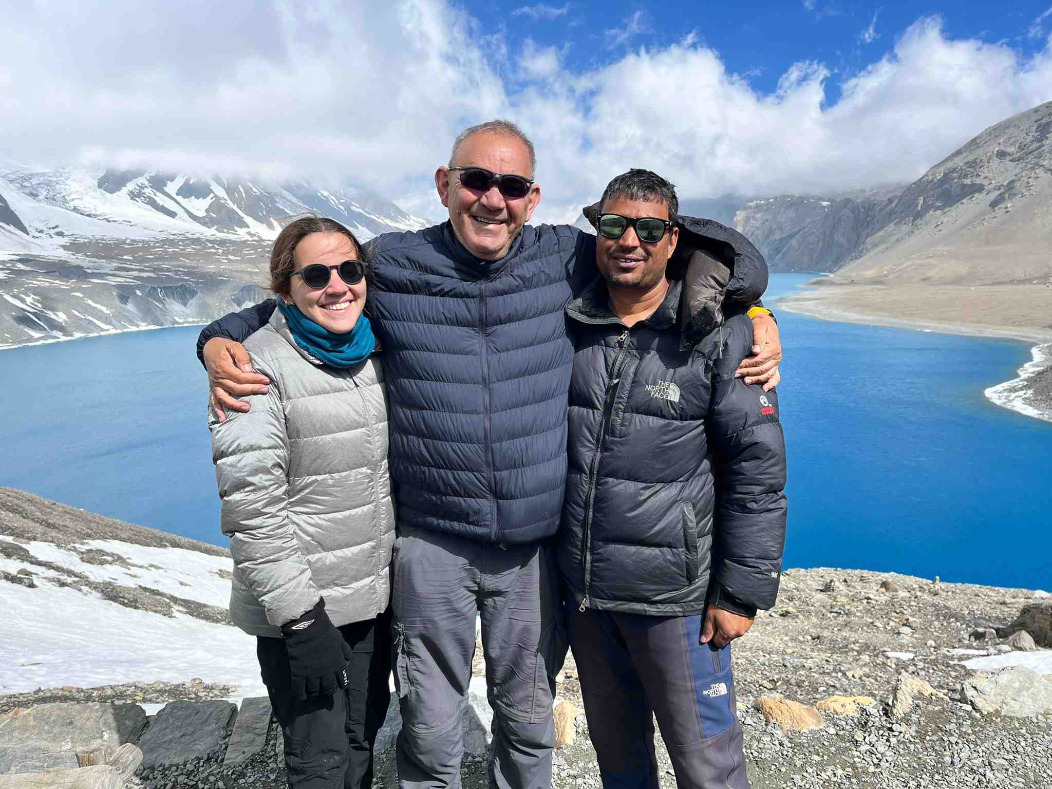
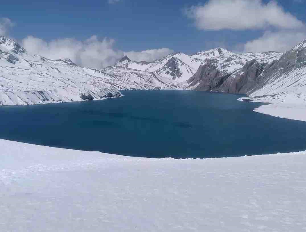
Tilicho Lake is one of the world's highest lakes, around 4,919 meters above sea level. The turquoise waters of Tilicho Lake, often partially frozen, create a stunning contrast with the rugged mountain terrain, providing a visual spectacle that rewards the physically demanding high-altitude experience. Not only limited to the lake itself but also witness the mesmerizing views of towering peaks such as Tilicho Peak, Gangapurna, Tare Kang, KhangSar Kang, and Muktinath Himal.

After we explore the Tilicho Lake, we return to the Tilicho Base Camp. The way down is comparatively easy, but still, we need to be aware of the slippery paths. After hiking downwards for 2 hours, we reach our Lodge. Overnight stay at Tilicho Base Camp.

Day 8

Tilicho Base Camp to Yak Kharka (4,050 m / 13,287 ft) via Shree Kharka and Upper Khangsar

HIGHEST ALT. 4,050 m / 13,287 ft
DURATION 6 - 7 hours
Distance
DISTANCE ~ 15 km

After breakfast, we trek toward Yak Kharka, a small mountain village mostly famous as an acclimatization stop. Yak Kharka is situated at an elevation of about 4,050 meters (about 13,287 feet), so the weather condition here is also unpredictable.

Trekkers along the suspension bridge near Yak Kharka, during Annapurna Circuit Trek, clicked by North Nepal Trek.
Photo: Suspension bridge near Yak Kharka

The term “Kharka” in Yak Kharka means it is a pasture land that local herders utilize for grazing Yaks. There are no tree lines in Yak Kharka, so all you can see is pasture grassland. Moreover, during your trek in this section, you can also witness the Himalayan Blue Sheep if you are lucky enough. The surrounding landscape offers stunning alpine views, rugged terrain, and sweeping vistas of neighboring peaks. After trekking for about 6 - 7 hrs, covering about 15 km with a mostly straight uphill path, we reach Yak Kharka. From Yak Kharka, we can see Thorung La Phedi and Thorung Peak. Overnight stay at Yak Kharka.

Day 9

Yak Kharka to Thorong Phedi (4,450 m / 14,600 ft)

HIGHEST ALT. 4,450 m / 14,600 ft
DURATION 3 - 4 hours
Distance
DISTANCE ~6.5 km

After breakfast, Day 9 of the trek takes us to the Thorung Phedi. This is the shortest trekking day during the overall Annapurna Circuit Trek, as the height changes significantly from Yak Kharka to Thorung Phedi. For most trekkers, this is usually the last day before attempting to cross the Thorang-La Pass at an altitude of 5,416 m | 17,769 ft, and we will be doing the same.

Horses trekkers and porters in Thorung Phedi, preparing for Thorung La Pass trek with background of teahouses in throung phedi and hill afar, clicked by north nepal trek.
Photo: Thorung Phedi

This route takes us from Yak Kharka to Ledar and from Ledar to Deurali Tea House. We will have our lunch at Deurali Tea House and then finally trek to Thorung Phedi. Starting at 4,100m, we would ascend to 4,450m by the end of the day. It’s around 6.5 km and about 3 hrs walk from Yak Kharka to Thorong Phedi, including all stops. Moreover, this easygoing session today prepares us for the arduous crossing of Thorung la Pass tomorrow. Overnight stay at Thorung Phedi.

Day 10

Thorong Phedi to Muktinath (3,762 m / 12,343 ft) via Thorong La Pass (5,416 m / 17,769 ft)

HIGHEST ALT. 5,416 m / 17,769 ft
DURATION 7 - 8 hrs
Distance
DISTANCE ~16 km

We start our day at around 3 am, as we have to be at Thorung La Pass before the sun rises to its peak. We need to pack our breakfast and take breakfast during our tea and coffee breaks in shelters during this section. The trek from Thorung Phedi to Thorung High Camp takes nearly 40 - 50 mins, and then we start our trek to Thorung La Pass. 

Trekkers from North Nepal Trek clicking photo at Thorung La Pass with banners, backdrop of many chortens and prayer flags.Photo: Thorung La Pass at 5,416 m (17,769 ft), the highest point of the trek.

Today is the most anticipated and challenging section of the Annapurna Circuit Trek, so be prepared for steep climbs, challenging treks, awe-inspiring sceneries from here, and a real sense of accomplishment at the highest point of the trek. 

The route from Thorung La Pass is all the way slightly ascending from Thorung Phedi. We cross a bridge and come across two shelters made for emergencies. We take a tea/coffee break and breakfast here in the shelter. On our way to the Thorong La Pass, we can get outstanding views of Thorung La Peak, Sangang Peak, Yakwankang, and Dajong Paldip Peak. We can see a giant board covered with many Tibetan multi-color flags when we reach the Thorung La Pass after 5 - 6 hrs of trekking. 

After clicking pictures and enjoying our time in Thorung la Pass, we trek to Muktinath. The trail is all the way downwards, so we will reach Muktinath in about 3 hours. After visiting the Muktinath temple, we make our way to the hotel for tonight’s stay. We will provide you with rooms with attached bathrooms if they are still available. Overnight stay at Muktinath.

Day 11

Drive from Muktinath to Pokhara (about 175 km)

HIGHEST ALT. 3,762 m / 12,343 ft
Distance
DISTANCE 175 km

After visiting the temple of Lord Vishnu at Muktinath and the monasteries in the area, we'll have breakfast and get ready to drive back to Pokhara by sharing transport. The road from Muktinath to Pokhara is beautiful with the most stunning views of the Annapurna and Dhaulagiri mountains.

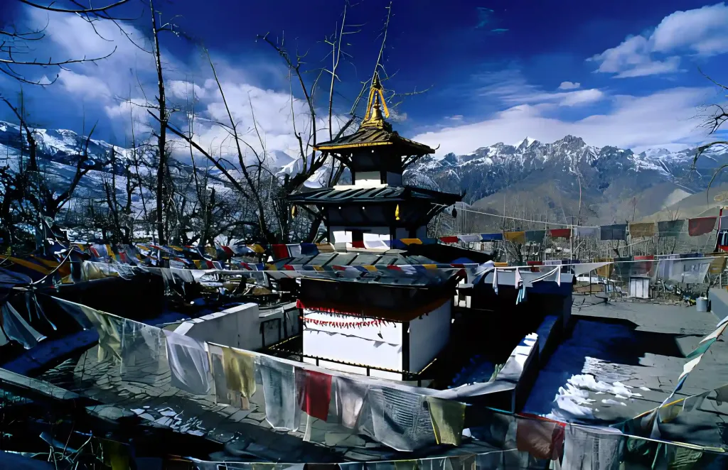
Muktinath Temple with mesmerizing himalayas in the background clicked by North Nepal Trek during Annapurna circuit trek
Photo: Muktinath Temple 

After a few hours of driving, we stop in the Tatopani for lunch. After having our Lunch, we drive towards Pokhara along with the Kaligandaki River. On the route, we will pass through traditional villages and stunning mountain views. The total distance from Muktinath to Pokhara is 175 km / 108.7 miles. Overnight stay at Lakeside, Pokhara.

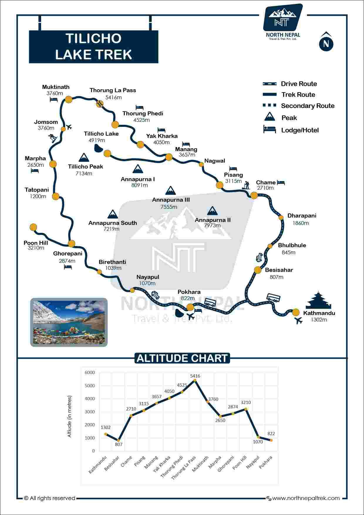
Annapurna Circuit Trek with Tilicho Lake map

Annapurna Circuit Trek with Tilicho Lake map

What's Included & Excluded

  • Tea house/Lodge accommodation during the trek.
  • We provide 3 meals per day (Breakfast, Lunch, and Dinner) and tea twice daily. Please note that each meal is served as a single serving.
  • Kathmandu/Pokhara to Besisahar by public bus on the first day
  • Besisahar - Dharapani (At the start of the trip ) and Muktinath - Pokhara ( At the end of the trip ) in a shared Jeep 
  • Professional English-speaking, Eco Trained trekking guide, his food, accommodation, salary, insurance, equipment, medicine, transportation, etc.
  • The company helps rescue services in an emergency; you should provide insurance papers covering high-altitude rescue up to 5,500 m.
  • All paperwork and the Annapurna Conservation Area Permit (ACAP).
  • Sleeping Bag and Trekking poles, if necessary  (to be returned after trip completion).
  • Additional assistant guide if the group is above 7 pax.
  • First Aid Medical Kit Box with an oximeter.
  • Water bottle to store hot water overnight.
  • Government taxes, TDS, VAT & other legal documents.

For any additional information or questions, please get in touch with us on WhatsApp/9856016904

  • Private transport during the trip with an additional cost.
  • Porter service, which carries up to 22 kg at its own expense.
  • Travel and rescue insurance
  • Personal expenses (phone calls, laundry, bar bills, battery recharge, extra porters, bottle or boiled water, shower, etc.)
  • Tips and gratuities for the staff
  • Additional costs incurred due to causes beyond our control, like landslides, bad weather conditions, cases of itinerary modification with a view to a safety concern, illness, change of government policy, etc
  • Any other expenses that are not mentioned in the included section

Note:

You can include a porter ( carries up to 22 kg ), with an extra cost of $ 25 per day.

Complete Guide to the Annapurna Circuit Trek with Tilicho Lake

Toggle all

Route Overview & How Difficult Is the Tilicho Lake Trek?

The Tilicho Lake Trek follows the standard Annapurna Circuit as far as Manang, then leaves it for two days. From Manang we walk south-west to Khangsar (3,756 m) and Shree Kharka (4,045 m), cross the scree slopes to Tilicho Base Camp (4,150 m), and climb to the lake the next morning. Instead of returning to Manang, we rejoin the Circuit at Yak Kharka via Upper Khangsar, then cross Thorong La (5,416 m) to Muktinath. The detour adds two walking days and one 4,919 m high point to the standard route.

Tilicho lake at Manang during Annapurna Circuit TrekPhoto: Tilicho Lake from the trail above base camp

Above Shree Kharka the trail is stones and sand with almost nothing growing, but you have Annapurna I, Khangsar Kang and Tilicho Peak in view most of the way.

How Difficult Is the Tilicho Lake Trek?

It is moderately challenging, and the difficulty comes from altitude rather than technical terrain. You walk nine days, anywhere from 3 hours (Yak Kharka to Thorong Phedi) to 8 (the Thorong La day). From Day 4 every night is above 3,300 m, and the two highest nights are at Tilicho Base Camp (4,150 m) and Thorong Phedi (4,450 m). The 11-day plan has no full rest day: the Ice Lake hike on Day 5 does the acclimatisation work.

Three stretches deserve respect:

  • The traverse to Tilicho Base Camp (Day 6). After Shree Kharka the middle trail crosses steep rubble slopes where loose rock comes down from above. We cross in single file, early in the day, and don't stop in the middle.
  • The climb to the lake (Day 7). About 770 m of zig-zags from base camp to 4,919 m, often on snow in spring and late autumn. Carry crampons.
  • Thorong La (Day 10). A 3 am start, 5–6 hours up to 5,416 m, then about 3 hours and roughly 1,650 m down to Muktinath.

Every night is spent in a teahouse lodge, including both nights at Tilicho Base Camp, so there is no camping on this trek.

Who This Trek Suits, and Who Should Pick Another Route

It suits fit walkers who have done multi-day hikes and can manage 6–8 hours on consecutive days. First time at high altitude is fine on the 11-day plan if you are fit and follow your guide's pacing. If you want more margin, book the 13-day version with its full rest day at Braka.

If you want a shorter, lower first trek in the Himalaya, look at our Annapurna Base Camp Trek instead. Anyone with a heart or lung condition should talk to their doctor before booking any trek above 4,000 m. Start training at least 3 weeks before the trek, and longer if you don't already exercise. For more on preparation, read 16 things to know before Annapurna Circuit trekking.

Trek Length Options: 9, 11 or 13 Days

Which Version Should You Book: 9, 11 or 13 Days?

 9 days11 days (standard)13 days
Walking starts atChameDharapaniDharapani
AcclimatisationIce Lake hike (Day 3)Ice Lake hike (Day 5)Full rest day at Braka (Day 5)
Tilicho Lake dayDay 5Day 7Day 7
Thorong La dayDay 8Day 10Day 10
FinishDrive Muktinath to PokharaDrive Muktinath to PokharaTatopani, Ghorepani and Poon Hill, drive from Hile to Pokhara
Best forFit trekkers who have been to altitude beforeMost trekkersA full rest day and a Poon Hill finish

13 Days Annapurna Circuit Trek with Tilicho Lake Itinerary

Day
Itinerary
Day 1
Drive from Kathmandu/Pokhara to Besisahar to Dharapani
Day 2
Dharapani to Chame
Day 3
Chame to Upper Pisang
Day 4
Upper Pisang to Braka
Day 5
Acclimatization at Braka
Day 6
Manang to Tilicho Base Camp
Day 7
Visit Tilicho Lake (4,919 m)
Day 8
Tilicho Base Camp to Yak Kharka
Day 9
Yak Kharka to Thorong Phedi
Day 10
Thorong La Pass (5,416 m) Day
Day 11
Drive Muktinath to Tatopani & Trek to Sikha village
Day 12
Sikha village to Ghorepani
Day 13
Ghorepani to Poonhill & Drive back to Pokhara from Hile

9 Days Annapurna Circuit with Tilicho Lake Itinerary

Day
Itinerary
Day 1
Drive from Kathmandu/Pokhara to Besisahar to Chame.
Day 2
Chame to Braka.
Day 3
Acclimatization (Ice Lake 4,620 m)
Day 4
Manang to Tilicho Base Camp
Day 5
Explore Tilicho Lake (4,919 m).
Day 6
Tilicho Base Camp to Yak Kharka
Day 7
Yak Kharka to Thorong Phedi
Day 8
Summit Thorong La Pass (5,416 m)
Day 9
Drive from Muktinath to Pokhara.

About Tilicho Lake (4,919 m / 16,138 ft)

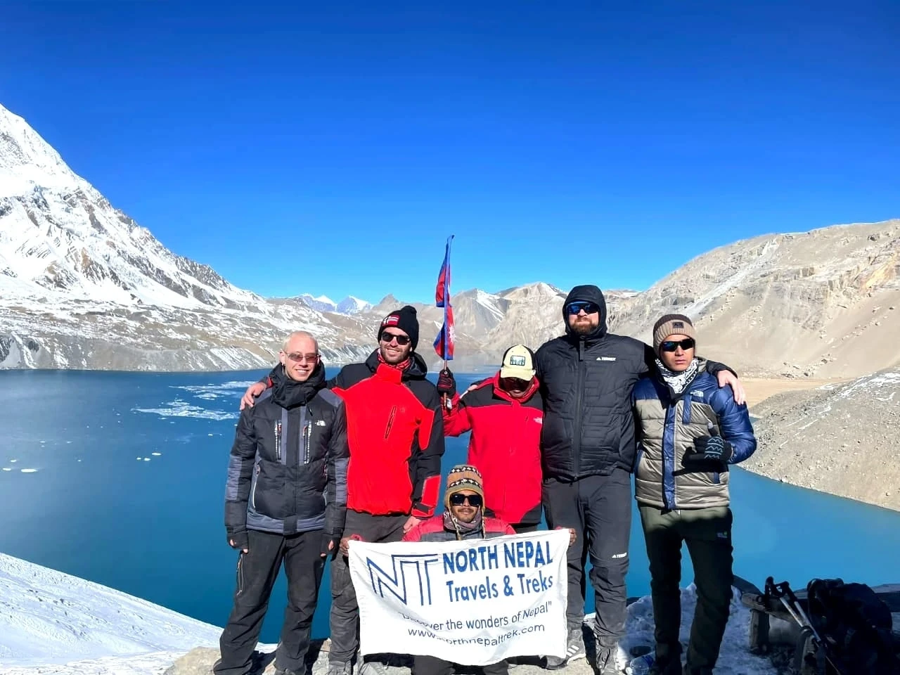
Tilicho Lake sits at 4,919 m (16,138 ft) in Manang District, Gandaki Province, below the north face of Tilicho Peak (7,134 m | 23,405 ft). It is roughly 4 km long and 1.2 km wide, fed by snowmelt and glaciers from the Annapurna massif. On a clear morning the water is a flat turquoise, often partly frozen at the edges, with Annapurna II (7,937 m | 26,040 ft), Gangapurna (7,455 m | 24,457 ft) and Tilicho Peak standing behind it.

Trekkers from North Nepal Trek clicking photo in Tilicho lake during Annapurna circuit trek with Tilicho lake.
Photo: Tilicho Lake

Expect temperatures around freezing at the lake even in the trekking seasons, and wind once the morning sun has warmed the valley. The lake is sacred to both Hindus and Buddhists, and alongside trekkers you will meet pilgrims who have walked up from Manang.

Is Tilicho the Highest Lake in the World?

Not quite. Tilicho is one of the highest large lakes in the world, which is why it is often called the highest. Kajin Sara Lake, also in Manang District, is most often cited at about 5,020 m, although its elevation has not yet been formally surveyed. Tilicho is still far larger than Kajin Sara.

How to Reach Tilicho Lake

From Manang it takes two days. Day one is about 15 km via Khangsar and Shree Kharka to Tilicho Base Camp (4,150 m), around 7 hours. Day two is a 6–7 hour round trip of about 11 km from base camp to the lake and back. We sleep at the base camp lodges both nights; we don't camp at the lake, because sleeping at 4,900 m adds altitude risk for no gain.

Ice Lake (Kicho Tal) at 4,620 m: The Acclimatisation Hike

Ice Lake, or Kicho Tal, sits at 4,620 m (15,157 ft) in a bowl above Braka, below Chulu East and Chulu Central. On our 11-day trek it is the Day 5 acclimatisation hike: you climb about 1,080 m from Braka, then sleep lower in Manang (3,540 m). The climb takes about 4 hours up and 3 down, mostly on steep, stepped trail above the treeline, and a stupa hung with prayer flags marks the lake.

Ice lake also known as Kicho tal, with its clear water sitting just below the Himalayas, clicked by north nepal trek
Photo: Ice Lake (Kicho Tal)

Looking south from the lake you get the whole Annapurna wall: Annapurna II (7,937 m), Annapurna III (7,555 m) and Gangapurna (7,455 m). The lake is often iced over at the edges. Go slowly on the way up: this day is about getting your body used to altitude before Tilicho, not about speed.

Best Time to Visit Tilicho Lake

Spring (March to May) and autumn (September to November) are the best seasons for Tilicho Lake. We don't recommend the monsoon months, and winter snow can close the trail to Tilicho Base Camp and Thorong La.

Spring: March to May

Spring is one of the two best seasons for Tilicho Lake. The weather is mild, rhododendrons flower in the forests below Chame, and the skies are usually clear enough for full views of the Annapurna range. Expect snow on the higher trail, especially early in the season.

Autumn: September to November

Himalayan Gentiana a medecinal herb found in Annapurna Circuit TrailPhoto: Himalayan Gentiana a medecinal herb found in Annapurna Circuit Trail.

The monsoon has cleared, the air is crisp and dry, and the mountain views are usually the clearest of the year. Autumn also brings local festivals. It is the busiest season on the trail, so book early. The rare plants like Himalayan Gentiana also grows during this season.

Summer and Monsoon: June to August

Heavy rain makes the lower trails slippery and landslide-prone, and cloud often hides the peaks. We don't recommend it for most trekkers.

Winter: December to February

Cold, with heavy snow above Manang. The lake freezes, and the trail to Tilicho Base Camp and Thorong La can be blocked. Only experienced trekkers with proper gear should consider it, and plans can change at short notice.

For month-by-month detail on the whole Circuit, see best time to visit the Annapurna Circuit.

Things to Do on the Tilicho Lake Trek

  • Visit the cheese and bakery shops in Manang.
  • Visit Braka Monastery and spend time with the monks at the gompas of upper Manang.
  • Walk to the Gangapurna glacier and lake, and to the Milarepa cave near Braka.
  • See the Gurung and Tibetan-Buddhist villages of Manang, and Thakali culture on the Mustang side.
  • Try the dishes local families cook at the teahouses.
  • Time your trek for the Yartung horse festival (August–September) or Metha archery (April–May).
  • Photograph the upper-trail villages of Ghyaru and Ngawal and the Tilicho basin.
  • Go horse riding in Manang and Mustang.

What to Pack for the Tilicho Lake Trek

The Tilicho Lake Trek is one of the longer treks in the Annapurna region that offers a trek to two different glacier lakes and crossing the Thorung La Pass. The option to trek to Tilicho Lake and Ice Lake entirely depends on the client, so we suggest you pack accordingly.
Even in low-snow seasons, bring at least one pair of crampons for the Tilicho Lake and Thorong La days. Check the detailed packing list, and pack accordingly.

For any additional information or booking, WhatsApp: +977 9856016904.

Customizing Your Trek & Combining With Other Routes

The route of the Tilicho Lake Trek is virtually the same as that of the Annapurna Circuit Trek, except for the diversion at Manang. On our route we don't go back to Manang: from Tilicho Base Camp we walk via Shree Kharka and Upper Khangsar to rejoin the Circuit at Yak Kharka, then cross Thorong La to Muktinath.

The Tilicho Lake Trek package can be customized as per your needs, availability, and budget. The Annapurna circuit trek with Tilicho Lake's itinerary is detailed; however, we can fully customize the itinerary of the trek as promised and as expected. The cost of the Annapurna circuit with the Tilicho Lake trek varies according to the agencies, but we will give you the most reasonable price.

Furthermore, this trek can be combined with the Ghorepani Poon Hill Trek and other treks of the Annapurna Sanctuary.

Why Trek With Us

Crossing Thorong La and walking the scree trail to Tilicho Lake needs a team that knows this route well. Here is why trekkers choose North Nepal Travel & Trek:

100% Locally Owned & Pokhara-Based

We are based in Pokhara, the gateway to the Annapurna region, so your investment stays local and supports the mountain communities we cross.

Officially Licensed & TAAN-Registered

A fully government-registered agency and active TAAN member, ensuring legal compliance, financial security, and the highest safety standards.

A Decade on This Exact Route

We have safely run the Annapurna Circuit with Tilicho Lake for over ten years, mastering its high passes, weather, and acclimatization logistics.

Expert Local Leadership

Your expedition is personally led by our expert guide, a government-certified, English-speaking local leader who knows every step of the trail.

Top-Rated Client Satisfaction

Backed by a 4.9/5 review rating across global platforms for safety, hospitality, and personalized service.

Live Trail Update of Tilicho Lake Trek via Annapurna Circuit & Thorong La - 11 Days Live

Last updated: 1 Week Ago

Updated: Mohan Bhandari

Trail Condition Dry, Rocky Alpine Trails
Weather Clear Days, Cold Nights
Wifi/Network Limited Wifi Above Manang
Teahouses Basic, Warm Teahouse Stays

Trekker Alerts

Autumn Trail Alert: Expect dry, rocky alpine trails and clear days with cold nights on the Annapurna Circuit Trek with Tilicho Lake this season. Wifi becomes limited above Manang, and basic but warm teahouse stays await along the route.

Reviews From The Trail

Hear it from those who've walked with us.

★★★★★

Annapurna Circuit Trek

Mohan, Bharat and their team were fantastic. Mohan went above and beyond to make an extremely competitive price and ensured that we enjoyed ourselves on the trek with having the worry of meals taken care of and accommodation. Especially in the busy time of year there were a few times that accommodation was hard to come by but our guide had gone to great length to make sure we had a place to eat, sleep with a lot of other comforts like hot showers available. The circuit exceeded all expectation, with the help of Mohan and his team. Couldn’t recommend them enough.

A
Alexi M
Nepal · Tilicho Lake Trek via Annapurna Circuit & Thorong La - 11 Days · Jan 2023
★★★★★

Annapurna Circuit Trek

We booked our guide and porter with North Nepal for our Annapurna circuit trek. Mohan was super helpful in helping organise our trek and responsive in communication.

Our guide (Bishnu) and porter (Ganesh) took care of us throughout the 14 day trek from Dharapani to Tatopani. They made sure we have an enjoyable, fun and most importantly safe trek during these days. Bishnu also shared a lot of local knowledge, culture and customs that we wouldn’t know of if travelling without a guide. Both are kind, honest and go out of the way to host their guests. I strongly recommend booking with North Nepal.

E
Evan Ng
Nepal · Tilicho Lake Trek via Annapurna Circuit & Thorong La - 11 Days · May 2023

Safety Policy

Professional & Certified Guides

Every trek is accompanied by a licensed, English-speaking local guide trained in eco-tourism, wilderness survival, and first-aid response. Guides carry comprehensive medical kits equipped with essential pharmaceuticals and pulse oximeters to monitor oxygen levels daily during the ascent toward Tilicho Lake and Thorong La Pass.

High-Altitude Acclimatization & AMS Management

Our itineraries gain height gradually. On the 11-day trek the Ice Lake hike on Day 5 is the acclimatisation day, and the 13-day version adds a full rest day at Braka, before you reach Tilicho Base Camp (4,150 m), Tilicho Lake (4,919 m), and Thorong La Pass (5,416 m). Guides conduct rigorous daily health assessments for early symptoms of Acute Mountain Sickness (AMS). If severe symptoms appear, standard protocol mandates immediate descent to lower elevations.

Emergency Rescue Coordination

In cases of severe injury, acute altitude illness, or extreme weather conditions on high-altitude passes, emergency helicopter evacuation is coordinated directly through local rescue services. Evacuations are initiated promptly upon assessment by your guide in communication with our Pokhara and Kathmandu offices.

Mandatory Travel Insurance

All trekkers must hold comprehensive travel insurance covering emergency medical treatment, high-altitude trekking (up to 5,500 m), and emergency helicopter rescue/evacuation. Insurance details must be submitted prior to the departure of the trek to streamline emergency logistics if required.


Annapurna Circuit Trek with Tilicho Lake Departure Date for 2026/2027

Secure the Annapurna Circuit Trek with Tilicho Lake for 2026/2027 before the seat gets fully booked.


Terms, Conditions & Feasibility

  1. All bookings are made with North Nepal Travel & Trek Pvt. Ltd Registered Company Number 162883/073/074 (hereafter referred to as The Company) whose office is in Lakeside, Pokhara-6, Nepal.
  2. The term "trip" used in this website and booking conditions refers to all itineraries described on this website including those which might otherwise be know as walking, tours, trekking trips, sightseeing, climbing, mountaineering, expeditions, or holidays.
  3. We accept your last-minute booking as well, but full payment of the total tour cost should be made in advance if necessary or can be paid fully on arrival day. See More 

Frequently Asked Questions

Cultural Insights

1. What cultural sites are on the Tilicho Lake Trek?

The main ones are Braka Monastery above Braka village and the Muktinath temple. You also pass chortens, gompas and prayer walls through the Manang valley.

2. What is Muktinath, and why is it significant?

Muktinath is a temple at about 3,760 m dedicated to Lord Vishnu and one of the most important pilgrimage sites for Hindus. Buddhists revere it too. You visit it on the morning of Day 11 before driving to Pokhara.

Packing Gear & Rental

1. What should I pack for the Tilicho Lake Trek?

Trekking trousers and shorts, T-shirts and warm layers, broken-in trekking boots, trekking poles, and at least one pair of crampons for the Tilicho and Thorong La days, even in low-snow seasons. We lend a sleeping bag and poles if you need them. Our essential packing list for Nepal trekking has the full list.

Payments & Extra Costs

1. How much does the Tilicho Lake Trek cost?

Our 11-day trek costs USD 1,000 per person for one trekker, USD 880 each for two, USD 800 each for 3–6, USD 750 each for 7–12 and USD 700 each for 13 or more. That covers lodges, three meals a day, permits, a licensed guide, bus and shared-jeep transport, and a sleeping bag and poles if you need them. Budget separately for drinks, hot showers, charging, porters (USD 25 per day), insurance and tips.

Booking & Company Policies

1. Can I do the Tilicho Lake Trek without a guide?

Since 1 April 2023, Nepal Tourism Board rules require foreign trekkers in the Annapurna Conservation Area to trek with a licensed guide booked through a registered agency. Enforcement on the Circuit is inconsistent, and you will meet people walking without one. Every North Nepal departure runs with a licensed guide. On the Tilicho section, with its rockfall-prone traverse and a 5,416 m pass day, we’d recommend one regardless of the rule. Read more on choosing a trekking guide in Nepal.

2. Should I do the trek clockwise or counterclockwise?

Counterclockwise, from Dharapani over Thorong La to Muktinath, is the standard direction and the one we recommend. Going the other way means climbing about 1,650 m to the pass from Muktinath in a single day.

3. Are there alternative routes?

We run a 13-day version that finishes via Tatopani, Ghorepani and Poon Hill, and a 9-day version that starts walking at Chame and ends at Muktinath. If you would rather skip Tilicho, see our standard Annapurna Circuit Trek.

4. What is the Annapurna Circuit itinerary without Tilicho Lake?

The standard Annapurna Circuit goes from Dharapani through Chame, Pisang, Manang, Yak Kharka and Thorong Phedi, over Thorong La to Muktinath and Jomsom, then on to Pokhara. See our 12-day Annapurna Circuit Trek.

Weather & Seasons

1. What is the best time for the Tilicho Lake Trek?

Spring (March to May) and autumn (September to November). In spring the peaks still carry plenty of snow and the rhododendrons are flowering lower down. In autumn the air is dry after the monsoon and the views are usually clearest. We don’t recommend June to August because of rain and cloud, and from December to February snow can block the trail to Tilicho Base Camp and Thorong La.

2. What weather can I expect?

Mountain weather here is hard to predict. Expect some snowfall in spring and mostly clear, dry weather in autumn. Nights above 4,000 m are cold, often below freezing, so pack a warm layer for sleeping.

Health & Safety

1. How difficult is the Tilicho Lake Trek?

It is moderately challenging, and the difficulty comes from altitude rather than technical climbing. You walk 3 to 8 hours a day, sleep two nights at Tilicho Base Camp (4,150 m), climb about 770 m to the lake at 4,919 m, and cross Thorong La at 5,416 m. The difficulty section above covers the three stretches that deserve the most respect.

2. What is Thorong La Pass like to cross?

Thorong La (5,416 m) is the highest point of the trek. We leave Thorong Phedi at around 3 am. The climb to the pass takes about 5–6 hours and the descent to Muktinath about 3 more, so you climb about 970 m and descend about 1,650 m in one day. On a scale of 1 to 10 we rate it a solid 7: not steep all the way, but with steep sections, possible snow and thin air.

3. Is altitude sickness a risk on this trek?

Yes. You sleep at 4,150 m and 4,450 m and cross 5,416 m, so altitude sickness is the main health risk. The itinerary gains height gradually, your guide checks your oxygen saturation with a pulse oximeter every day, and anyone with severe symptoms descends straight away. You spend only a short time at the pass itself.

4. How fit do I need to be?

Start training at least 3 weeks before the trek, and longer if you don’t already exercise. If you are active and can walk 6–8 hours on consecutive days, you should manage it. Uphill walking with a daypack is the best preparation.

5. Are there acclimatisation days on the 11-day trek?

There is no full rest day. Day 5 is the acclimatisation day: you climb to Ice Lake (4,620 m) and sleep lower in Manang (3,540 m). If you want a full rest day, the 13-day version adds one at Braka.

6. What happens in an emergency on the trek?

Tell your guide straight away. Your guide assesses you, contacts our Pokhara and Kathmandu offices, and arranges a helicopter evacuation through local rescue services if needed. This is why insurance covering helicopter rescue up to 5,500 m is mandatory.

General Information

9. How many days do I need for Tilicho Lake?

With us, 9 days is the shortest version. It starts walking at Chame, so it suits fit trekkers who have been to altitude before. The 11-day trek is the one most people should book, because the Ice Lake hike on Day 5 acclimatises you before you sleep above 4,000 m. The 13-day version swaps the Ice Lake hike for a full acclimatisation day at Braka and finishes via Tatopani, Ghorepani and Poon Hill.

1. Where is the Tilicho Lake Trek?

Tilicho Lake is in Manang District, Gandaki Province, inside the Annapurna Conservation Area of north-central Nepal. Our 11-day route starts walking at Dharapani, which you reach by road via Besisahar, and finishes at Muktinath, followed by a shared jeep back to Pokhara. The 13-day version finishes at Hile after Poon Hill instead.

2. How long is the Tilicho Lake Trek, and how far do you walk?

Our standard trek is 11 days, with 9 walking days and about 125 km on foot between Dharapani and Muktinath. We also run 9-day and 13-day versions, compared in the trek length options section above.

3. What are the main highlights of the Tilicho Lake Trek?

Tilicho Lake’s turquoise water at 4,919 m, the Ice Lake (Kicho Tal) hike, Braka Monastery and the villages of upper Manang, crossing Thorong La at 5,416 m, the Muktinath temple, and close views of Annapurna II, Gangapurna and Tilicho Peak.

4. What is Tilicho Lake, and how do I reach it?

Tilicho Lake is a glacial lake at 4,919 m (16,138 ft) below Tilicho Peak in Manang District. From Manang it takes two days: about 15 km via Khangsar and Shree Kharka to Tilicho Base Camp (around 7 hours), then a 6–7 hour round trip of about 11 km to the lake and back to base camp.

5. What is Kicho Tal (Ice Lake)?

Ice Lake, or Kicho Tal, is a glacial lake at 4,620 m (15,157 ft) above Braka. The climb from Braka takes about 4 hours and the round trip about 7–8 hours. We do it on Day 5 as the acclimatisation hike.

6. What is Gangapurna Lake?

Gangapurna Lake is a glacial lake directly below Gangapurna Peak, about an hour’s walk from Braka.

7. Can I visit Tilicho Lake by helicopter?

Yes. A Tilicho Lake helicopter tour flies to Tilicho Base Camp early in the morning and returns to Kathmandu the same day, with a little over an hour of flying time. Ask us for current pricing.

11. Is Tilicho Lake the highest lake in the world?

Not quite. At 4,919 m, Tilicho is one of the highest large lakes in the world, which is why it is often described as the highest. Kajin Sara Lake, also in Manang District, is most often cited at about 5,020 m, although its elevation has not yet been formally surveyed.

8. What mountains can I see from Thorong La?

From Thorong La you can see Khangsar Kang, Annapurna I, II and III, Dhaulagiri and the surrounding peaks.

10. Is Thorong La the highest pass in the Annapurna region?

Yes. Thorong La (5,416 m) is the highest pass in the Annapurna region, followed by Kang La (5,320 m) in the Nar Phu valley.

Trekking Permits & Logistics

1. What permits do I need for the Tilicho Lake Trek?

You need an Annapurna Conservation Area Permit (ACAP). Foreign nationals pay NPR 3,000 per person, and SAARC nationals pay a lower rate. The fee is set in Nepali rupees, so its USD equivalent moves with the Nepal Rastra Bank exchange rate. The TIMS card is not currently active, so you don’t need one for this trek. Your ACAP permit is included in our package price and we arrange it for you.

2. How does Tilicho Lake fit into the Annapurna Circuit?

Tilicho is a detour from Manang. On our route you leave the standard Circuit at Manang, walk via Khangsar and Shree Kharka to Tilicho Base Camp, visit the lake, then rejoin the Circuit at Yak Kharka via Upper Khangsar without going back to Manang. It adds two walking days to the standard Annapurna Circuit.

Transportation

1. Where does the trek start, and how do I get there?

You travel from Kathmandu or Pokhara to Besisahar by public bus (about 5.5 hours from Kathmandu, 4 from Pokhara), then take a shared jeep 53 km up the Marsyangdi valley to Dharapani, where the walking starts. Both legs are included. It is a long road day of 9–10 hours: about 230 km from Kathmandu or 160 km from Pokhara.

Accommodation & Food

1. Is there accommodation at Tilicho Base Camp?

Yes. Tilicho Base Camp (4,150 m) has teahouse lodges, and we stay there on Days 6 and 7. Every night of this trek is spent in a lodge, so no camping is needed. Lower on the route, villages such as Chame and Manang have plenty of lodges; rooms at base camp are simpler.

2. What food is available on the trek?

Higher up, teahouses serve thukpa, momo, vegetable curry, fried vegetables, bread, rice, lentils and flatbread. Lower down the menus are longer, with pasta, pizza and pancakes. Our package includes three meals a day (one serving per meal) and tea twice a day.

3. Is drinking water available?

Yes. Bottled water is sold at almost every stop, but we suggest carrying purification tablets or a filter and refilling instead, which is cheaper and cuts plastic waste in the conservation area. Our package includes a bottle for hot water at night.

Wifi/Network and Communication

1. Is there phone signal on the trek?

Yes, in most villages. Expect no coverage at Thorong La Pass and at Tilicho Lake itself.

2. Can I charge my phone and camera?

Yes. Most villages have electricity, and teahouses usually charge a small fee per device.

Wildlife & Nature

1. What wildlife might I see?

Blue sheep and Himalayan pheasants are the animals you are most likely to see above Manang. Snow leopards live in this area, but sightings are rare.

PRIVATE TRIP

11 Days

Price Start from USD 1100

USD 1000 pp

We Offer Group Discount

No. of PersonsPrice per Person
1 Pax US$ $ 1000
2 Paxes US$ $ 880
3 - 6 Paxes US$ $ 800
7 - 12 Paxes US$ $ 750
13 Above US$ $ 700
RECOGNISED · CERTIFIED · TRUSTED

We are associated with