Mount Everest stands on the border between Nepal and the Tibet Autonomous Region of China, in the Mahalangur Himal section of the Himalayas. Its summit, at 27.9883° N, 86.9253° E, is the highest point on Earth: 8,848.86 m (29,031.7 ft) above sea level. The border runs along the summit ridge, so the mountain belongs to both countries.
| Mount Everest at a glance |
| Continent |
Asia |
| Countries |
Nepal (south side) and China, Tibet Autonomous Region (north side) |
| Mountain range |
Mahalangur Himal, Himalayas |
| Coordinates |
27.9883° N, 86.9253° E |
| Height |
8,848.86 m (29,031.7 ft), Nepal–China survey, 2020 |
| Distance from Kathmandu |
About 160 km east-northeast in a straight line |
| Local names |
Sagarmatha (Nepali), Chomolungma (Tibetan) |
| First ascent |
29 May 1953, Edmund Hillary and Tenzing Norgay |
| Nepal-side base camp |
5,364 m (17,598 ft), reached on foot from Lukla |
| Best trekking seasons |
March to May; late September to November |
Which country is Mount Everest in?
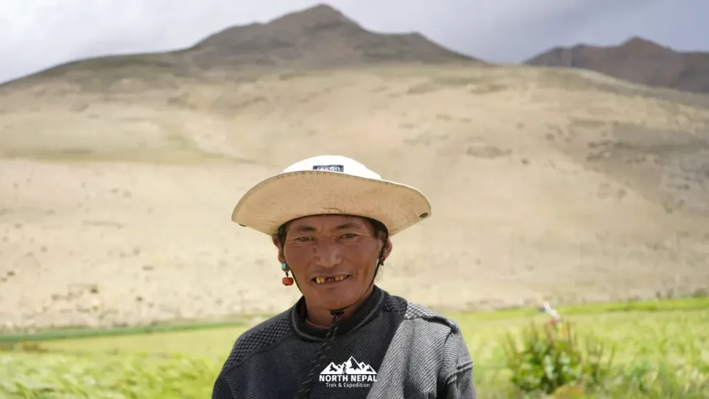 The north side of the range sits on the dry Tibetan plateau, a different world from the Khumbu valleys. Photo: North Nepal Travel & Trek.
Two countries share it. The south side is in Nepal's Solukhumbu district, inside Sagarmatha National Park, a UNESCO World Heritage Site. The north side is in the Tibet Autonomous Region of China. Each side issues its own climbing permits and runs its own base camp, and the two experiences have little in common.
| | Nepal (south side) | Tibet, China (north side) |
|---|
| Base camp | 5,364 m (17,598 ft) | About 5,150–5,200 m (16,900–17,060 ft) |
| How you get there | Flight to Lukla, then about a week on foot | By road |
| Who can visit | Anyone with the two Khumbu permits | Foreigners only on a guided tour, with a Tibet Travel Permit and an Alien's Travel Permit |
| Climbing route | South Col (Southeast Ridge), used in 1953 | North Ridge |
On the Nepal side, the base camp walk is the whole point. Our standard Everest Base Camp trek takes seven days from Lukla to Base Camp, through Namche Bazaar, Tengboche, Dingboche and Lobuche, including a rest day in Namche. The Tibet side is a road trip: you can drive close to the north base camp, which makes it easier to visit but no easier to climb. The North Ridge is colder and windier than the southern route.
Where Everest sits on the map
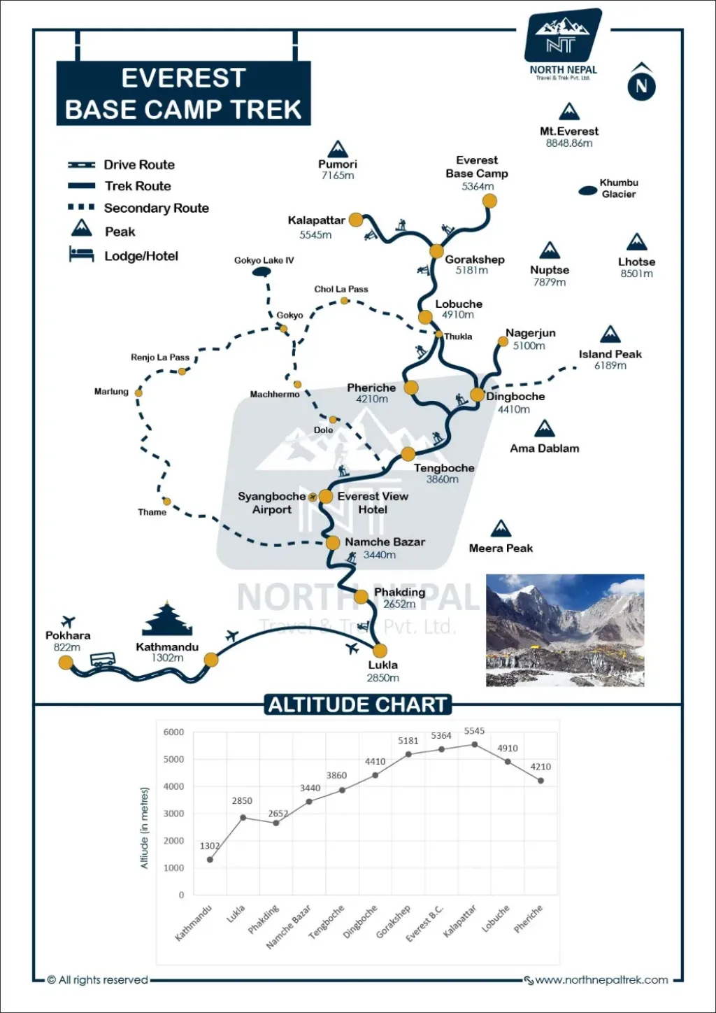 The Khumbu route climbs the Dudh Koshi valley from Lukla to Gorak Shep. Photo: North Nepal Travel & Trek.
On a world map, look for the band of mountains between the Indian subcontinent and the Tibetan Plateau. The Himalayas run about 2,400 km across five countries: Bhutan, India, Nepal, China and Pakistan. Everest stands near the middle of that arc, in north-eastern Nepal.
For scale: the summit is about 160 km east-northeast of Kathmandu and about 620 km almost due north of Kolkata, in a straight line. From Lukla airstrip, where most treks begin, it is under 40 km away, but the walk to Base Camp takes a week because of the altitude, not the distance.
On a Khumbu trekking map, the route climbs the Dudh Koshi valley through Namche Bazaar 3,440 m (11,286 ft), Tengboche 3,867 m (12,687 ft), Dingboche 4,410 m (14,469 ft), Lobuche 4,940 m (16,207 ft) and Gorak Shep 5,164 m (16,942 ft). Above Base Camp the map shows the places climbers talk about: the Khumbu Icefall, the Western Cwm, the Lhotse Face and the South Col at 7,906 m (25,938 ft).
Everest's neighbours
Everest is one of four 8,000 m peaks in the Mahalangur Himal. From the right viewpoint you can see all of them in one sweep.
| Peak | Height | World rank |
|---|
| Everest | 8,848.86 m (29,031.7 ft) | 1 |
| Lhotse | 8,516 m (27,940 ft) | 4 |
| Makalu | 8,485 m (27,838 ft) | 5 |
| Cho Oyu | 8,188 m (26,864 ft) | 6 |
How high is Mount Everest?
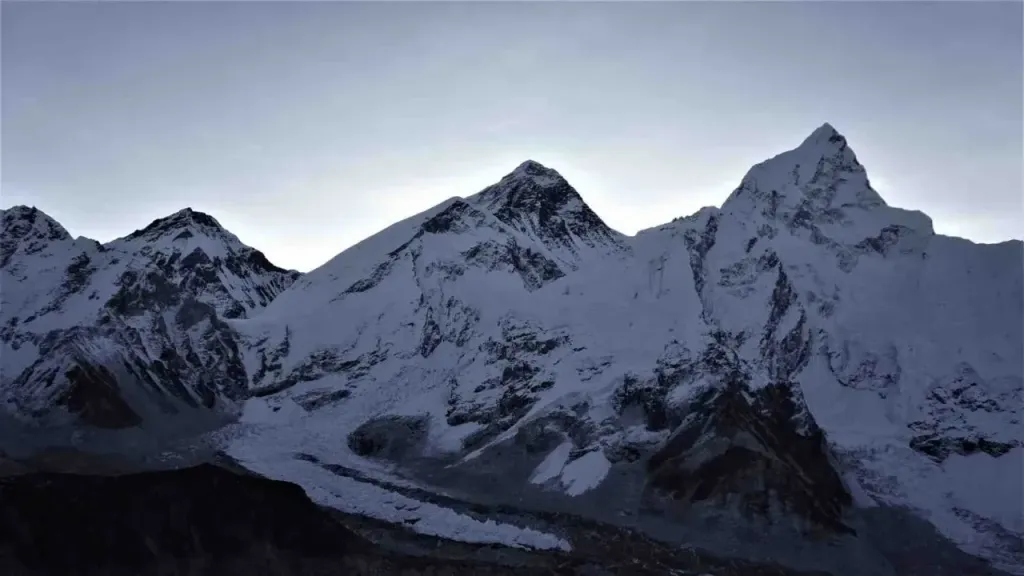 Everest is one of four 8,000 m peaks in this corner of the Khumbu. Photo: North Nepal Travel & Trek.
The official height is 8,848.86 m (29,031.7 ft). Nepal and China announced it jointly on 8 December 2020, after both sent survey teams to the summit. That settled an old disagreement: Nepal had used 8,848 m, while China's 2005 survey gave 8,844.43 m for the rock alone, without the snow cap.
| Year | Height | Survey |
|---|
| 1856 | 8,840 m (29,002 ft) | Great Trigonometric Survey of India, measured from the plains |
| 1955 | 8,848 m (29,029 ft) | Survey of India |
| 2005 | 8,844.43 m (29,017 ft), rock height | China |
| 2020 | 8,848.86 m (29,031.7 ft) | Nepal and China, joint survey |
The 1856 figure was less than 9 m out, worked out with theodolites from well over 100 km away. And the number keeps moving. The Indian plate is still pushing into the Eurasian plate, and most estimates put Everest's uplift at a few millimetres a year. The 2015 Gorkha earthquake was one of the reasons Nepal decided to measure it again.
How Everest compares with other mountains
K2, the second-highest peak, is 8,611 m (28,251 ft), about 238 m lower. Kangchenjunga, on Nepal's eastern border with India, is third at 8,586 m (28,169 ft). Outside Asia nothing comes close: Aconcagua tops South America at 6,961 m (22,838 ft) and Denali tops North America at 6,190 m (20,308 ft).
Everest only wins on height above sea level. Measured from its base on the ocean floor, Hawaii's Mauna Kea is taller, at over 10,000 m. And because Earth bulges at the equator, the summit of Ecuador's Chimborazo is the point farthest from the planet's centre.
Weather and climate on Everest
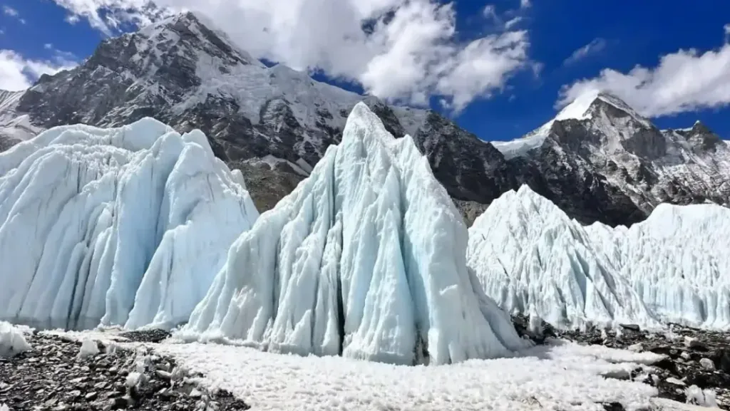 The Khumbu glacier. Nothing here thaws for long, even in the trekking seasons. Photo: North Nepal Travel & Trek.
The summit never warms above freezing. Average lows are around −36°C (−33°F) in January and −18°C (0°F) in July, before wind chill. For much of the year the summit pokes into the jet stream, and winds there can exceed 320 km/h (200 mph). That's the plume of snow you often see streaming off the top in photos.
Air pressure at the summit is about a third of sea level. Above 8,000 m, the "death zone", the body can't acclimatise, which is why most climbers use bottled oxygen for the final push.
Climbers wait for a short window, usually mid-May to early June, when the jet stream moves north before the monsoon arrives. Trekkers have more choice. March to May brings longer, warmer days and rhododendrons in flower below Tengboche. Late September to November brings the clearest views. Winter is possible but very cold above Dingboche, and the monsoon months (June to early September) bring cloud and frequent Lukla flight cancellations.
At Base Camp altitude the main risk to trekkers is altitude sickness, not the weather. Our guide to Everest Base Camp altitude covers how to handle it.
What the local names mean
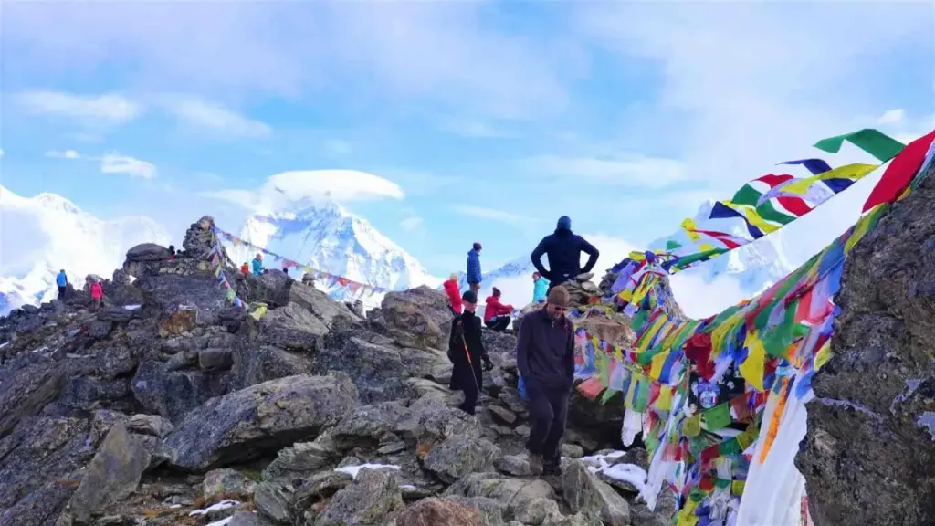 Prayer flags on the climb above Dingboche. The mountain is sacred ground before it is a destination. Photo: North Nepal Travel & Trek.
Nepalis call the mountain Sagarmatha, usually translated as "head in the sky". Tibetans call it Chomolungma, often rendered as "Goddess Mother of the World". Both names are far older than "Everest", which the Royal Geographical Society adopted in 1865 after Sir George Everest, a former Surveyor General of India.
For the Sherpa families of the Khumbu, Everest is a neighbour, a workplace and sacred ground all at once. Before any team enters the Khumbu Icefall, Sherpa crews build a stone altar at Base Camp and hold a puja: juniper smoke, prayer flags strung across the camp and a lama's blessing. Many won't climb until it's done, and clients attend whatever their beliefs. On the north side, Rongbuk Monastery has stood below the mountain since 1902.
The mountain also drives the Khumbu economy. Guiding, portering and teahouses employ much of the valley. Since September 2025 a foreign climber pays a royalty of USD 15,000 for Nepal's standard route, and in spring 2026 Nepal issued 464 Everest permits, with royalty revenue reaching a record Rs 1.01 billion. Sherpa climbers hold most of the mountain's records: Kami Rita Sherpa made his 32nd ascent on 17 May 2026. The losses fall on the same valley. The 2014 icefall avalanche killed 16 Nepali guides.
Where you can see Mount Everest from
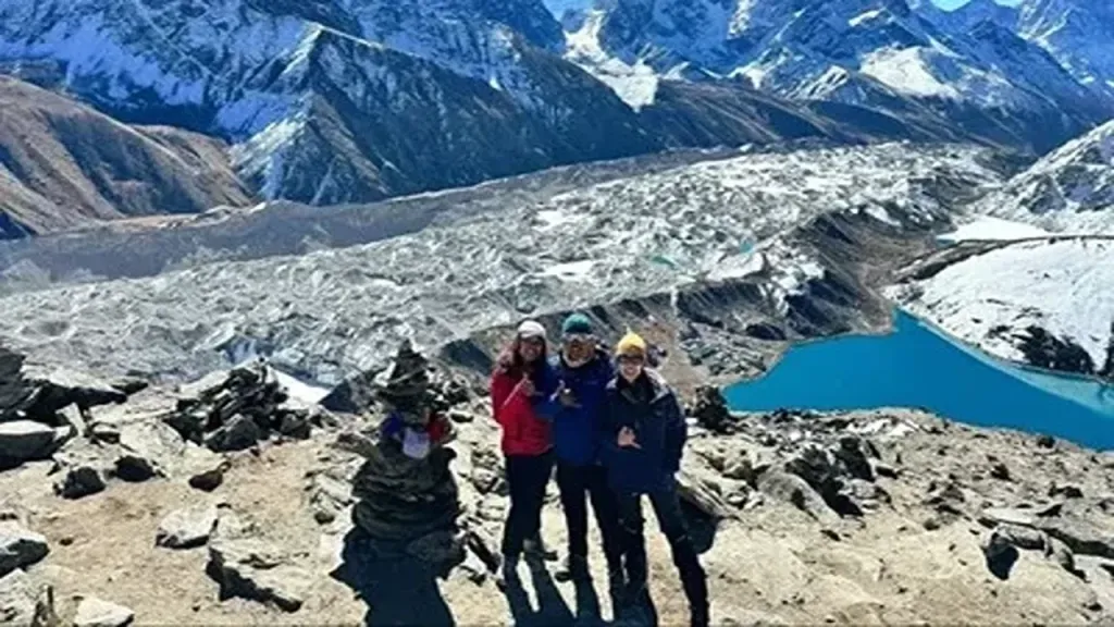 Above the Gokyo lakes. From Gokyo Ri you get Everest, Lhotse, Makalu and Cho Oyu in one sweep. Photo: North Nepal Travel & Trek.
You don't need to climb Everest to see it, but you do need to know where to stand. One thing surprises most first-time trekkers: you can't see the summit from Everest Base Camp itself. The Nuptse wall blocks it.
| Viewpoint | Elevation | How you get there |
|---|
| Kala Patthar | 5,644 m (18,519 ft) | Pre-dawn climb from Gorak Shep on the Everest Base Camp trek; the closest trekking view of the summit |
| Gokyo Ri | 5,357 m (17,575 ft) | Gokyo Lake trek; Everest, Lhotse, Makalu and Cho Oyu in one panorama |
| Everest View Hotel area | 3,962 m (13,000 ft) | Acclimatisation hike above Namche Bazaar |
| Tengboche | 3,867 m (12,687 ft) | Day 5 of the EBC trek; Everest behind the Lhotse–Nuptse ridge, with Ama Dablam to the right |
| Pikey Peak | 4,065 m (13,337 ft) | Pikey Peak trek, reached by road with no Lukla flight |
| From the air | Varies | Everest helicopter tour from Kathmandu |
| North face, Tibet | About 5,150–5,200 m (16,900–17,060 ft) at base camp | Guided Tibet tour via Rongbuk Monastery, such as our Kailash Mansarovar with Everest Base Camp tour |
The first glimpse most trekkers get comes on the long climb up to Namche Bazaar, through a gap in the pines. Everyone stops there, partly for the photo and partly for the breather. If seeing Everest itself is your priority, Kala Patthar at sunrise or Gokyo Ri give the clearest views. All our routes in the Khumbu are on the Everest region treks page.
How to get to Mount Everest
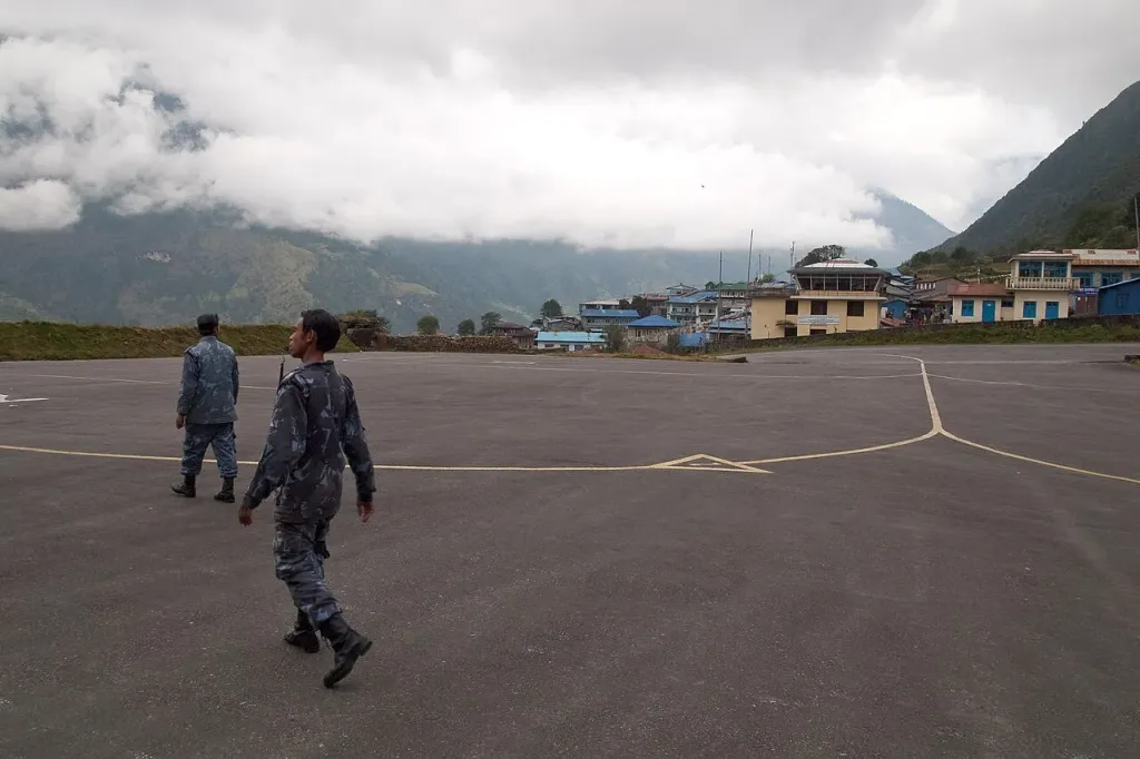 Lukla, 2,860 m. Almost every Nepal-side trek starts and ends on this runway. Photo: Vyacheslav Argenberg, Wikimedia Commons, CC BY 4.0.
From Nepal (south side): fly from Kathmandu, or in peak season from Manthali airport in Ramechhap, to Lukla at 2,860 m (9,383 ft). From there it is about a week on foot to Base Camp, and about 130 km for the round trip. You need two permits: the Sagarmatha National Park entry permit and the Khumbu Pasang Lhamu Rural Municipality permit, each NPR 3,000 for foreign trekkers.
From Tibet (north side): foreigners travel on a guided tour, either overland from Kathmandu or via Lhasa. You need a Tibet Travel Permit and an Alien's Travel Permit, which the tour operator arranges.
If you're weighing whether the trek is for you, our guide to Everest Base Camp altitude explains what the height actually does to your body, and Is the Everest Base Camp trek dangerous? covers the real risks on the trail.
Frequently asked questions
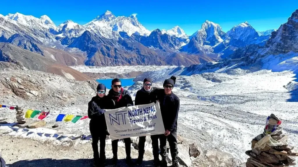 At Base Camp, 5,364 m. The summit itself is hidden behind the Nuptse wall from here. Photo: North Nepal Travel & Trek.
Where exactly is Mount Everest located?
Mount Everest is on the border between Nepal and the Tibet Autonomous Region of China, in the Mahalangur Himal of the Himalayas, at 27.9883° N, 86.9253° E. It lies about 160 km east-northeast of Kathmandu.
Which country owns Mount Everest?
Nepal and China share it. The border runs along the summit ridge: the south side is in Nepal's Sagarmatha National Park and the north side is in the Tibet Autonomous Region of China.
How tall is Mount Everest in 2026?
The official height is still 8,848.86 m (29,031.7 ft), announced jointly by Nepal and China in December 2020. The mountain is rising by a few millimetres a year, but no new official figure has replaced the 2020 survey.
Can you see Mount Everest from Everest Base Camp?
Not the summit. The Nuptse wall hides it. Trekkers climb Kala Patthar, 5,644 m (18,519 ft), above Gorak Shep for the full view, usually at sunrise.
What do Sagarmatha and Chomolungma mean?
Sagarmatha is the Nepali name, usually translated as "head in the sky". Chomolungma is the Tibetan name, often rendered as "Goddess Mother of the World". Both are much older than "Everest", adopted in 1865.
When is the best time to visit Mount Everest?
For trekking to Base Camp, March to May and late September to November. Climbers aim for a short summit window, usually from mid-May to early June.
Author
Mohan Raj Bhandari
Founder/Managing director
A native of the Annapurna region, he brings over 17 years of firsthand experience leading treks across the mountains of Nepal. His deep local roots and proven guiding expertise make him a trusted authority on authentic Himalayan adventures.