Nepalgunj: The Overnight Stop on the Way to Upper Dolpo
Published Oct 30, 2026 Updated Oct 30, 2026 5 min read
Quick answer
Nepalgunj is the hot, flat border town where the Upper Dolpo trek spends its first night out of Kathmandu, because the flight up to Juphal leaves from here the next morning. Give it an easy evening, see the Bageshwori Temple if you have time, and be ready for an early start.
From 150 m on the plains to 2,475 m on a mountain airstrip in 35 minutes. What Nepalgunj is like, how hot it gets, the one sight worth your afternoon, and what to sort out before the Juphal flight.
Nobody books the Upper Dolpo trek for Nepalgunj, and most guests barely notice it. That's a pity, because it's the start of the journey: one night on the plains, close to India, before the small plane takes you into the mountains. Here's what to expect, and how to use the evening well. For what happens if the Juphal flight can't go, see our Upper Dolpo cost guide.
Key facts
WhereBanke district, Lumbini Province, on the border with India
AltitudeAbout 150 m
Flight from KathmanduAbout 50 minutes, early morning, Day 2
Flight to JuphalAbout 35 minutes, after an early breakfast, Day 3
AirportMahendra Airport, often called Ranjha Airport, about 6 km north of the centre
Hottest monthsApril to June, often above 40°C
The sight to seeBageshwori Temple, in the centre of town
Why does the Upper Dolpo trek stop in Nepalgunj?
Because the flights to Juphal go from Nepalgunj, and they don't run often. On our itinerary you fly from Kathmandu to Nepalgunj early on Day 2, about 50 minutes, spend the night in a deluxe hotel, and take the 35-minute flight to Juphal, 2,475 m (8,120 ft), after an early breakfast on Day 3.
The way home is quicker. On Day 24 you fly from Juphal to Nepalgunj and straight on to Kathmandu, where our team meets you and takes you to your hotel. All four flights are included in the trek price.
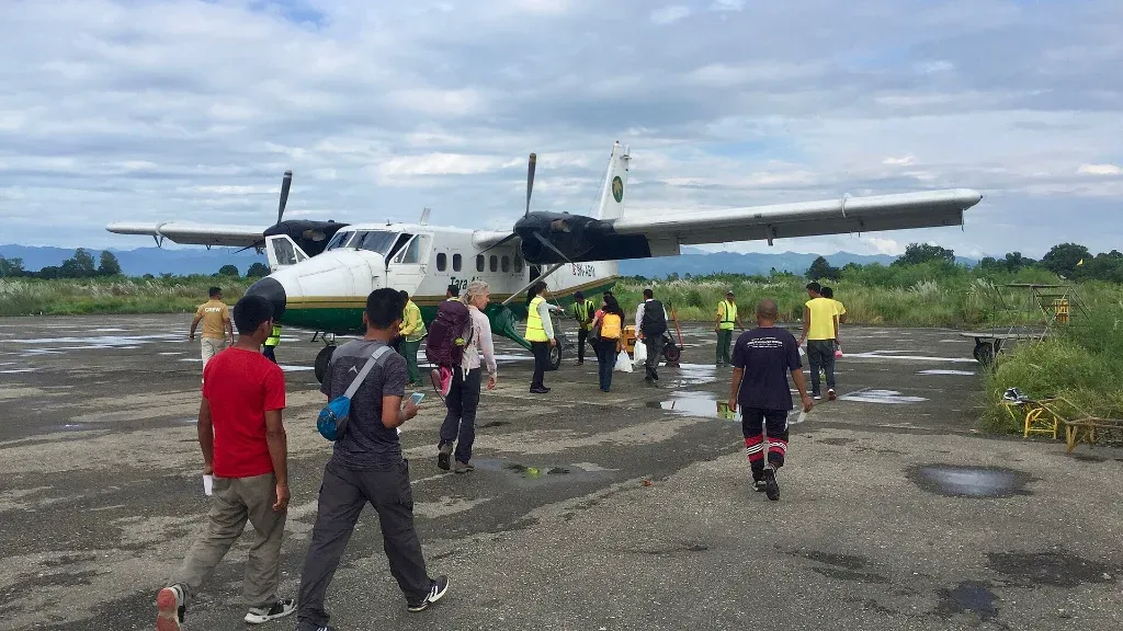
A Tara Air Twin Otter at Nepalgunj Airport. Photo: Bruno Rijsman, CC BY 2.0, via Wikimedia Commons, cropped.
What is Nepalgunj like?
Nepalgunj is a busy sub-metropolitan city on the Terai plains, at about 150 m, in Banke district of Lumbini Province. It sits right by the border with Uttar Pradesh in India, and in feel it is about as far from Dolpo as you can get.
About 166,000 people lived there at the 2021 census. At the 2011 census, roughly a third spoke Nepali as their first language, nearly a third Awadhi and more than a quarter Urdu, so you'll hear all three in the bazaar.
How hot is Nepalgunj?
Very hot from April to June, when the temperature often goes above 40°C. On 30 May 2024 the station at Nepalgunj Airport recorded 44.2°C. A meteorologist at the Department of Hydrology and Meteorology told the national news agency it was the highest temperature ever measured in Nepalgunj.
Winters are milder and can be foggy, with temperatures sometimes below 10°C. Spring departures land in the heat; by autumn the worst of it has passed.
Heads up
You go from about 150 m in Nepalgunj to 2,475 m at Juphal in 35 minutes, and you'll be sleeping in tents within days. Keep a warm layer in your daypack for the airstrip, drink plenty in Nepalgunj's heat, and keep the evening quiet. The flight goes after an early breakfast.
What can you see in Nepalgunj in an afternoon?
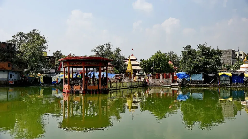
The Bageshwori Temple, in the centre of town, is the one sight I'd make time for. It is the oldest temple in Banke district, and devotees believe it stands where the tongue of the goddess Sati fell.
In the middle of its pond is a Shiva shrine where the god wears a moustache, said to be one of only two in Nepal. The temple is busiest at Dashain, Shivaratri and Teej, and its image is said to appear on Nepal's one-rupee coin. Dress modestly, take your shoes off where others do, and ask before you photograph anyone at prayer.
If you add days either side of the trek, Bardiya National Park is about an hour's drive west, and Banke National Park is close by.
What should you do in Nepalgunj before flying to Juphal?
Use the evening to finish the practical jobs, because Nepalgunj is the last big town before the trek. Here's what I suggest:
Carry all the cash you'll need for tips, drinks and small purchases. There are few ATMs on the trek.
Buy the snacks you like to eat on the trail.
Repack: trek kit in your duffel, valuables, documents and a warm layer in your daypack.
Eat early and go to bed early. The flight leaves after an early breakfast.
If cloud keeps the Juphal plane on the ground, you'll get to know Nepalgunj a little better. It happens, and it's why I suggest leaving spare days before your flight home.
Frequently asked questions
About 35 minutes. On our Upper Dolpo trek it leaves after an early breakfast on Day 3.
About 50 minutes. On our itinerary it is an early-morning flight on Day 2.
Mahendra Airport, often called Ranjha Airport. It is about 6 km north of the city centre.
Not usually. On Day 24 you fly from Juphal to Nepalgunj and on to Kathmandu the same day, unless weather holds the plane.
Visit the Bageshwori Temple and its pond in the centre of town, and walk the bazaar. Bardiya National Park is about an hour's drive west if you add extra days.
Our Upper Dolpo Trek includes the Nepalgunj night and all four flights. Message me on WhatsApp if you want to add a few days at Bardiya.
A native of the Annapurna region, he brings over 17 years of firsthand experience leading treks across the mountains of Nepal. His deep local roots and proven guiding expertise make him a trusted authority on authentic Himalayan adventures.