Nar Phu Trek Weather Warning: Snow Expected 29 Oct to 1 Nov 2026
Published Oct 25, 2026 Updated Nov 16, 2026 7 min read
Short answer
Heavy snow is forecast for the Nar Phu Valley and Kang La Pass, 5,320 m (17,454 ft), from Thursday 29 October afternoon until Saturday 31 October. Friday 30 is the worst day. If you are in Nar Phu this week, plan to be inside a lodge by noon on Thursday. Do not try to cross Kang La until at least 2 to 4 days after the snow stops.
What is happening?
A low-pressure system in the Bay of Bengal is strengthening and is expected to push moisture north into the Himalaya. Nepal's Department of Hydrology and Meteorology (DHM) issued a special post-monsoon bulletin on Friday 23 October, warning that the system may affect Nepal from 28 October to 1 November. Meteorologist Binod Pokharel said the risk would be relatively high on 30 and 31 October and that Manang needs particular attention. On 24 October, climate expert Ujjwal Upadhyay recommended suspending trekking in the high Himalaya for the period.
DHM's bulletin on the morning of Sunday 25 October expects the system to be strongest from Thursday night through Friday and into Saturday afternoon. DHM meteorologist Rojan Lamichhane's advice was plain: trekkers already on the trails should move to safe places.
I spent Sunday afternoon going through the Windy forecast models point by point: Phu village, Nar village and the slopes beside Kang La. The models disagree on how much snow will fall. All of them agree on when.
How much snow will fall in Nar Phu?
The Nar Phu Valley could get roughly 60 to 90 cm of new snow above 4,000 m (13,123 ft) between 29 and 31 October. That is the range from the two models we trust most for this terrain. Here is what each model showed on 25 October for Thursday to Saturday:
Location
ECMWF
meteoblue AI
ICON
GFS
Phu village
58 cm
92 cm
6 cm
303 cm
Nar village
84 cm
91 cm
35 cm
291 cm
Kang La area
71 cm
91 cm
36 cm
276 cm
GFS is almost certainly overdoing it. Its grid is coarse and it tends to pile up snow on big mountains. ICON is the low end. Nobody can promise you a number this far out, and Windy itself rates its confidence at 30 to 40 percent from Thursday onward. The safe way to read it is: a lot of snow, arriving Thursday afternoon, peaking Friday.
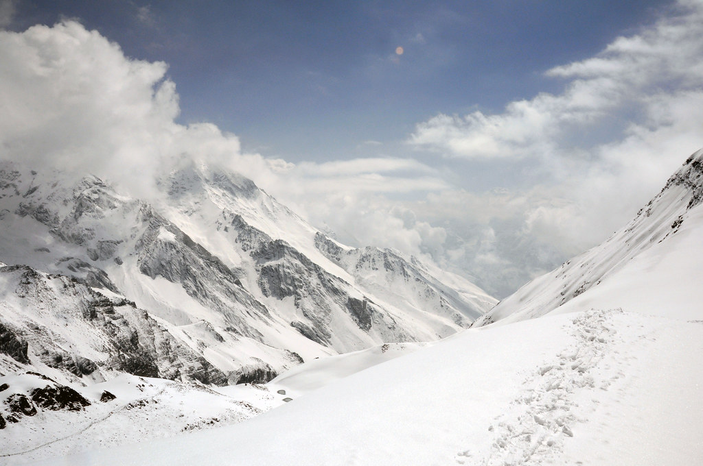
Fresh snow on a high Himalayan trail, from one of our past treks. After a big fall, the path and its cairns disappear under it.
Day by day: what we are telling our own groups
Day
Phu and Nar villages
Kang La Pass
What to do
Wed 28 Oct
Low risk
Moderate
Last clear day. Cross only if you are already in Nar, acclimatised, and moving by 5 am.
Thu 29 Oct
Moderate
High
Morning only, on easy ground. Be under a roof by 12:00.
Fri 30 Oct
High
Extreme
Stay put. Cloud sits 100 to 500 m above the village. No helicopters.
Sat 31 Oct
High
Very high
Stay put. Fresh, wind-blown snow makes avalanche risk highest now.
Sun 1 Nov
Moderate
High
Clearing and very cold. Talk to locals, check the trail, no pass crossing yet.
Why the village forecast is not the pass forecast
The weather in Phu village, 4,080 m (13,386 ft), tells you little about the top of Kang La. The pass is about 1,200 m higher, and air cools by roughly 6 to 7 °C for every 1,000 m you climb, so the top is around 7 to 8 °C colder than the villages. With a 30 km/h wind, the wind chill on Kang La could fall to minus 30 °C or lower at the coldest hours.
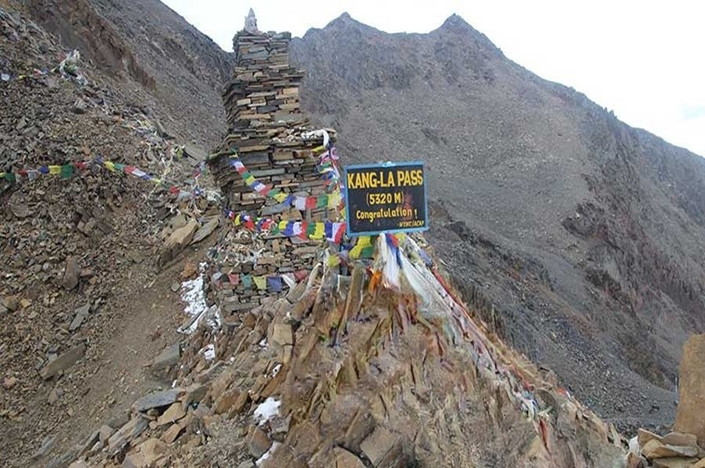
The top of Kang La on a dry autumn day. In fresh snow, everything around this cairn turns white.
The trail itself is the bigger problem. On a normal day the crossing from Nar to Ngawal, 3,650 m (11,975 ft), is about 15 to 17 km and 8 to 10 hours of walking, after a pre-dawn start. In 60 cm of fresh snow, a strong team breaking trail might cover a kilometre an hour. Then it can take 12 hours or more, or not be possible at all. The cairns get buried, and in a whiteout on a wide snow slope you can lose the line within a few metres.
The avalanche and rockfall risk nobody photographs
30 cm or more of new snow in a day or two, followed by wind, is the classic recipe for avalanches. The gullies above the trail between Phu and Nar are steep. So are both approaches to Kang La. Lower down, between Koto, 2,600 m (8,530 ft), and Meta, 3,560 m (11,680 ft), the same storm may fall as rain, which brings rockfall onto the narrow gorge path.
This has happened before. On 14 October 2014, a snowstorm linked to the remnants of Cyclone Hudhud hit Manang and Mustang, around Thorong La. At least 43 people died, at least 21 of them trekkers. Many were caught on the way to or over the pass when the snow came in.
If you are already on the trek
Get to Phu, Nar or Meta and stay there from Thursday midday. Choose a lodge with fuel and food for four or five days.
Bring cash. Lodges in Phu and Nar do not take cards, and an extra three nights adds up.
Charge every power bank and satellite messenger now. Mobile signal in the upper valley drops out often, more so in storms.
Keep your guide and porters inside with you. Porters are usually the least equipped people in the group.
Keep boots and gloves inside your room at night. Nights are forecast around minus 15 °C.
After the storm, walk early, spread out when crossing avalanche run-outs, and exit down to Koto unless locals confirm Kang La is open.
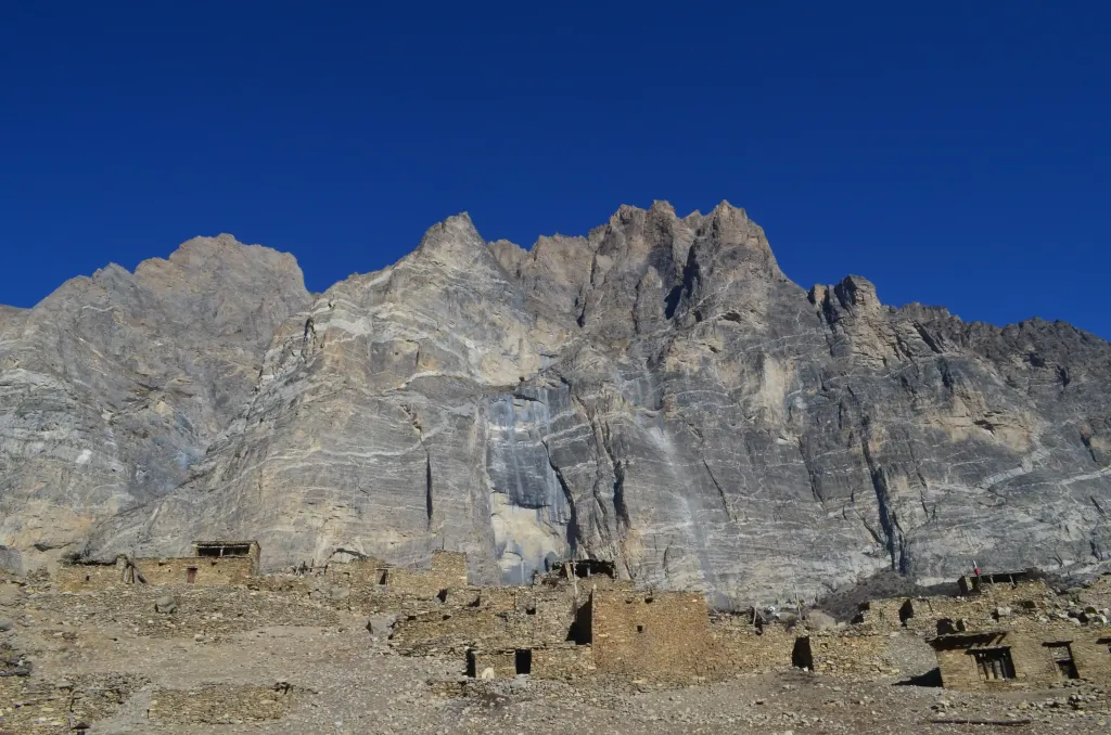
Phu village, where most groups will sit out the storm. Our groups wait in lodges here, not on the trail.
Heads up
Nar Phu is a restricted area, so every trekker here is with a licensed guide. Use that. If your guide says you are staying put, that is not caution for its own sake; it is how groups get home safely after storms like this one.
If your trek starts in the next week
Most groups starting after 3 or 4 November should be fine, with snow on the ground and colder nights than usual. If you start before then, talk to your operator about a later start, or about doing the valley as an out-and-back via Koto. Insist on a plan that does not cross Kang La in the first days after the storm. A good operator will be flexible about this. Ask yours now, before you fly to Kathmandu.
Our view
We would rather have a group lose three days in a warm lodge in Phu than push one day too early. The Nar Phu Valley will still be there next week, and after a storm the views from Phu over Himlung are some of the clearest of the season.
If you are on a North Nepal Travel & Trek trip, your guide already has this plan, and we check in daily from our Pokhara office. If you are trekking with another company and want a second opinion on your plans, message us on WhatsApp (+977 985 601 6904). We are happy to help, booked with us or not. For the full route, days and elevations, see our Nar Phu Valley Trek.
Frequently asked questions
No travel is advised from Thursday 29 October midday until Saturday 31 October, because heavy snow and low cloud are forecast. Wednesday 28 October is the last clear day, and only acclimatised groups already in Nar and leaving by 5 am should think about crossing Kang La. Short village walks may be possible again on Sunday 1 November.
On 25 October the main forecast models showed 36 to 91 cm for the Kang La area, and one outlier, GFS, showed far more. Plan for roughly 60 to 90 cm above 4,000 m, with deeper drifts on the pass.
Kang La Pass usually needs 2 to 4 clear days and a trail broken by locals before it is reasonable to cross. Do not plan a crossing before 3 or 4 November 2026.
Helicopters cannot fly while cloud sits 100 to 500 m above the valley, as forecast for Friday 30 October. The first realistic flying window is an early morning from Sunday 1 November.
You don't need to cancel if your trek starts after about 3 November. If it starts earlier, move the start date or skip the Kang La crossing, and confirm a flexible plan with your operator.
A native of the Annapurna region, he brings over 17 years of firsthand experience leading treks across the mountains of Nepal. His deep local roots and proven guiding expertise make him a trusted authority on authentic Himalayan adventures.