Upper Mustang Trek - 14 Days
The 14-Day Upper Mustang Trek starts from Kathmandu via Pokhara & Jomsom into the trans-Himalaya...
OVERVIEW & HIGHLIGHTS
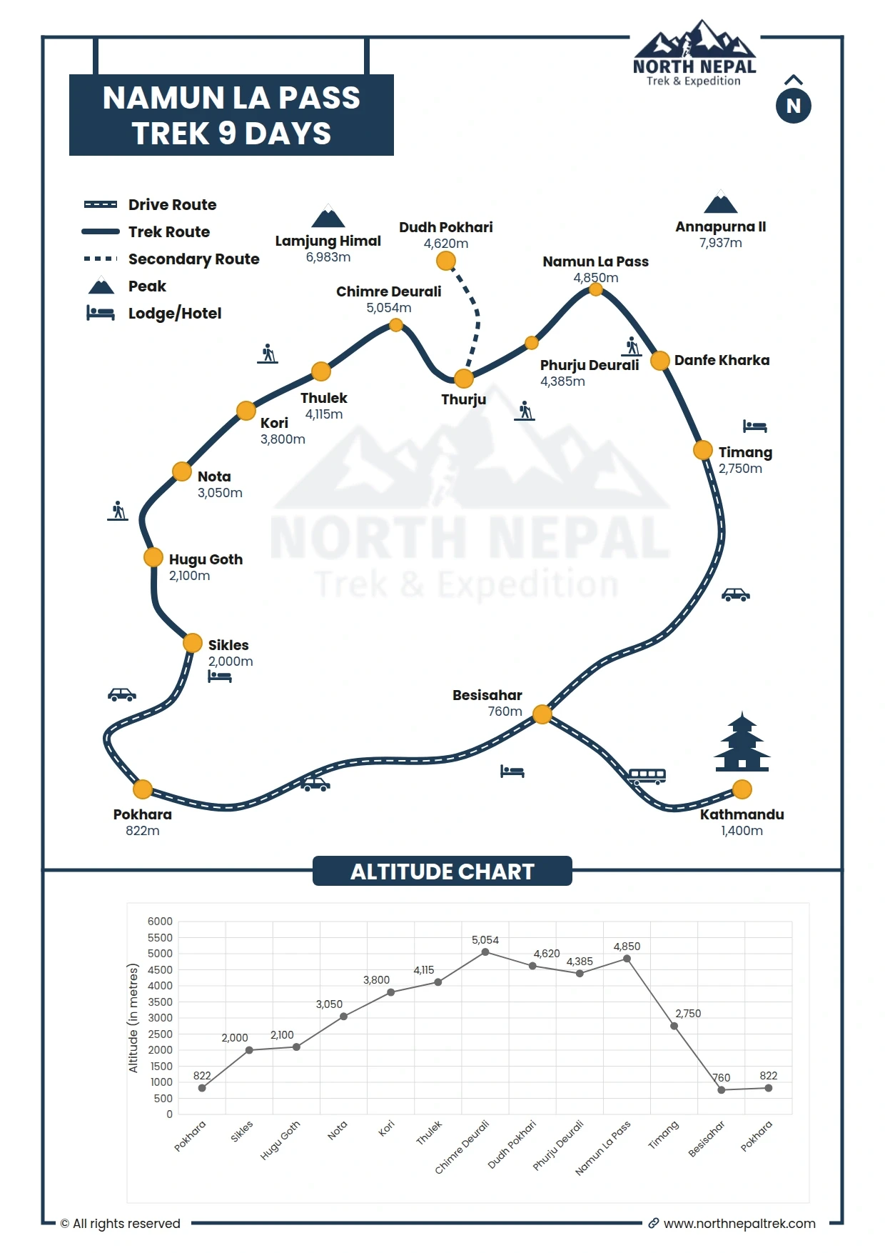
The Namun La Pass trek is a remote and less-traveled route in Nepal’s Annapurna region. At an elevation of 4850 m, this high-altitude pass was once an important trade route between Manang, Lamjung, and Kaski districts. This trek is challenging and unsuitable for beginners, requiring experience and mental preparation. The trek takes about eight days from Pokhara or nine days from Kathmandu.
Opened for trekking in 2008, the Namun La Pass is a relatively unexplored paradise. Rarely visited by foreign travelers, this off-the-beaten-path trek takes you through some of the most remote areas of the Nepalese Himalayas. The Namun La Pass holds a significant place in history, having been a vital route for the Tamu community, now known as Gurung, to journey from Tibet to this beautiful region. One of the most enchanting features is the Dudh Pokhari, a stunning glacial lake believed to possess the mystical ability to cleanse one’s soul. During the Janai Purnima (Sacred Thread Ceremony), pilgrims and devotees from the Gurung community gather here to bathe in its chilly waters.
The Namun La Pass trek via Sikles Village, Kapuche Lake, Kori, Thulek, and Dudhpokhari typically requires camping for 4-5 days, depending on the chosen itinerary. The trek starts from Sikles and is connected to the famous Annapurna Circuit Trek and the Nar Phu Valley Trek, offering a unique and less-traveled way to experience these renowned trekking routes.
The trail to Namun La involves rough and rocky terrain, including hiking along cliffs. Approximately 30% of the trail consists of rocky, landslide-prone, and cliff areas, necessitating proper trekking gear.
This trek is only feasible during specific months, and undertaking it during winter or early spring can be challenging. It requires appropriate gear and experienced sherpas to complete the journey. The trek involves traversing rugged terrain and requires careful planning and preparation to ensure a safe and enjoyable experience.
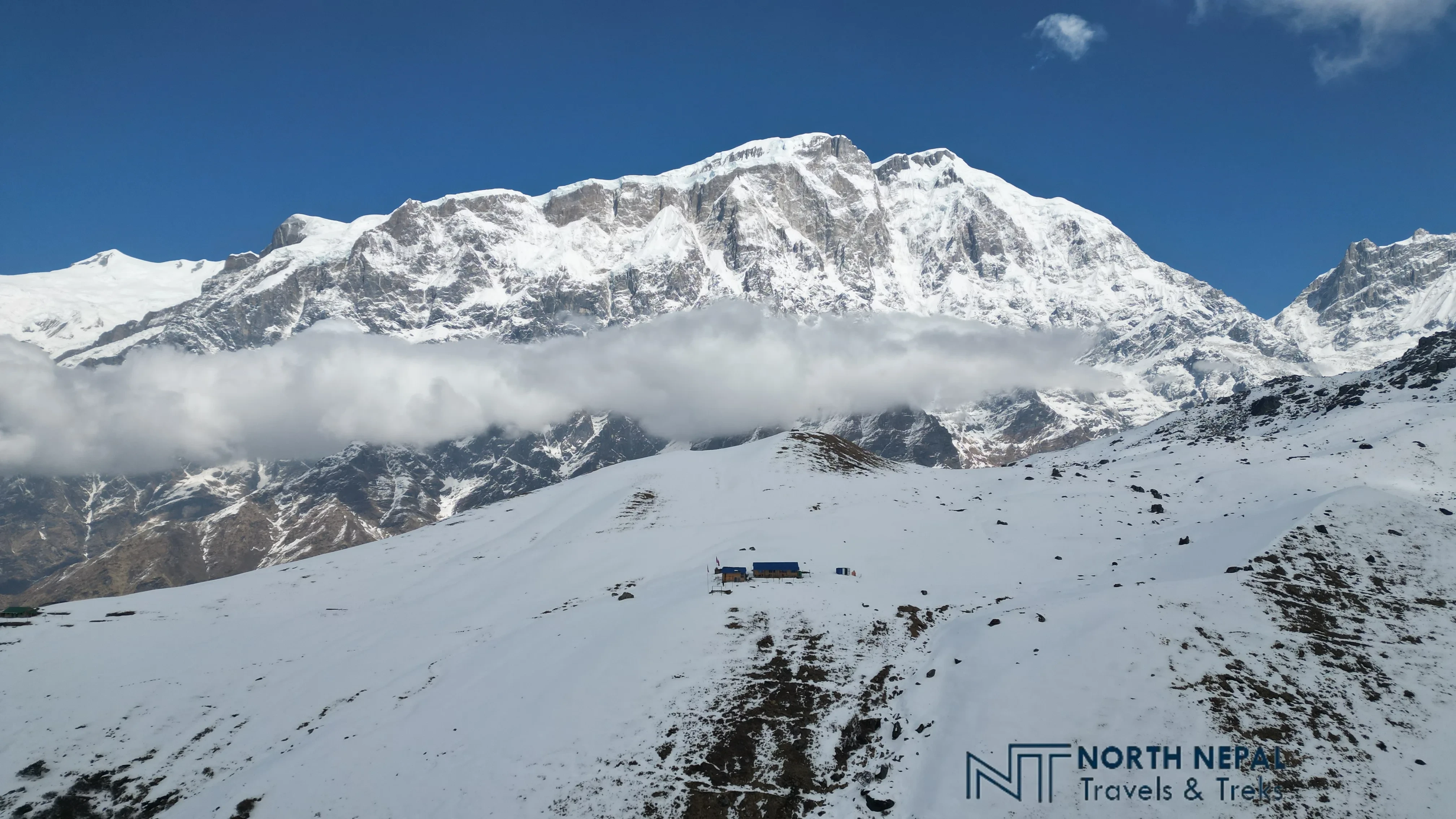
Our second day begins with an exciting morning excursion to Kapuche Lake, the world's lowest glacial lake, situated at just 2546 m. From Hugu Goth, we ascend for a 1.5-hour trek to the lake. This serene spot is known for its crystal-clear waters, and the dramatic ice falls from the surrounding glaciers. Not limited to this, we can also see the direct avalanches from Annapurna II and IV, .ie. Avalanches from 24690 ft fall directly to a cliff visible from Hugu Goth 2564 ft, providing an audible and visually stunning natural spectacle.
Photo: View from Nota
After witnessing the otherworldly Kapuche Lake, another highlight of the Namun La Pass trek, we return to Hugu Goth, and descending takes about an hour. From there, we follow the main trek route of the day, ascending towards Nota, a journey that lasts between 4 to 5 hours. This leg of our trek takes us through dense forest paths. Although there are motorable roads due to Madi hydropower projects, there is almost zero traffic, ensuring our walk remains peaceful and undisturbed.
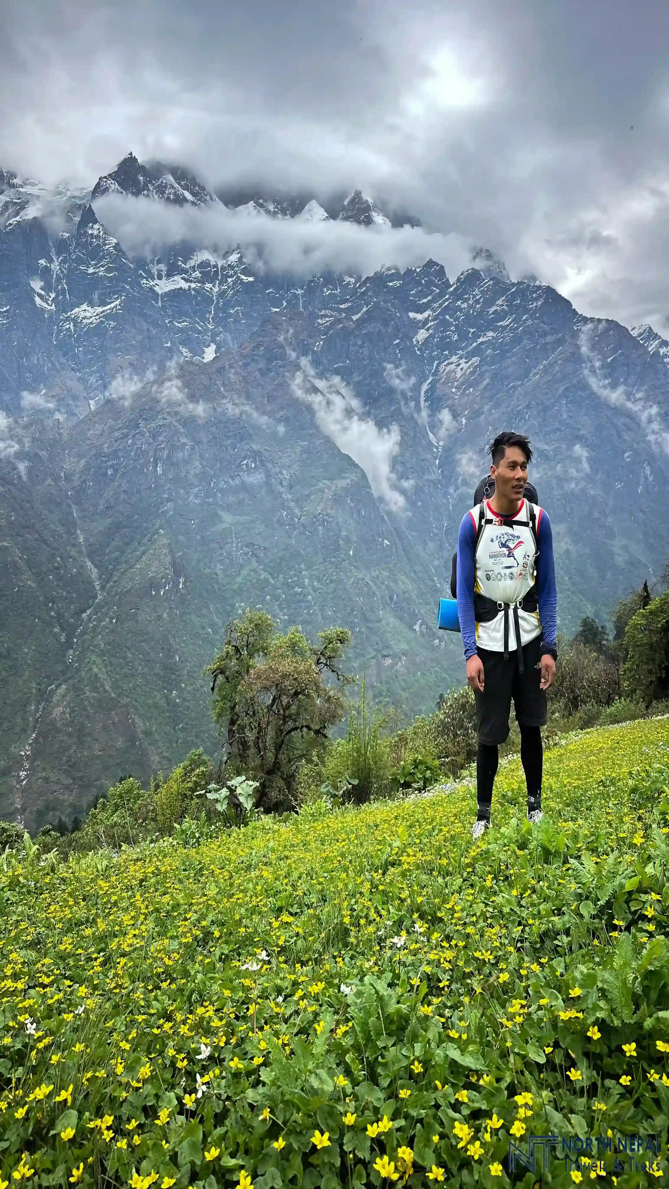
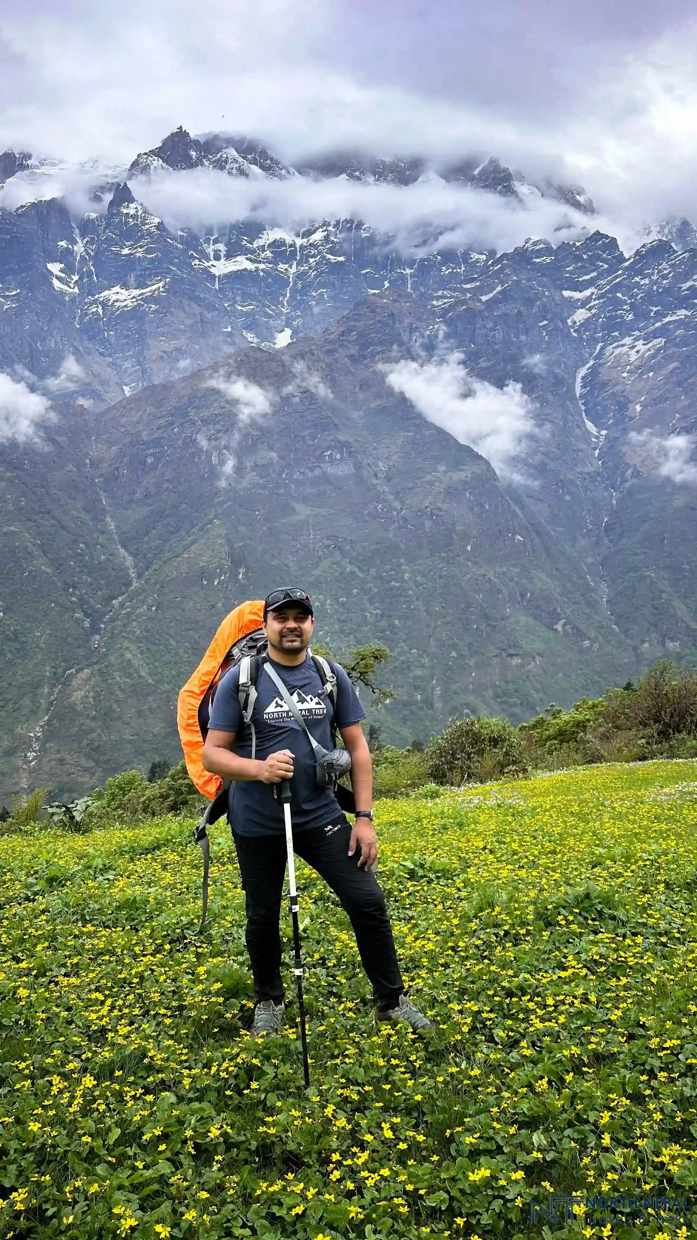
Upon arriving in Nota, often hailed as the "Valley of Flowers," an array of vibrant wildflowers greets us. This unique geographical setting allows us to experience close-up views of towering peaks such as Annapurna II, IV, and Lamjung Himal without any other hills obstructing our views. The clear visibility from a relatively low altitude offers a rare opportunity to observe these majestic mountains in all their glory. The sound of glaciers breaking off in the distance adds to the surreal experience of this beautiful place. Accommodations in Nota are very basic, with only one tea house available. This facility is relatively primitive, lacking electricity and toilets, and serves merely as a place to eat and sleep. Overnight stay at Nota.
The third day of the Namunla Pass trek is one of the most visually rewarding as we journey from Nota to Kori. This stretch is famous for its lush grasslands and expansive natural wildflower gardens. We go through forests filled with Chimal, the white rhododendron, which blooms profusely from late March to early June. The sheer abundance of these blossoms covers the forest in white, transforming our path into an enjoyable picturesque scene.
Photo: On the way from Notaa to Kori.
As we trek through these flowering meadows, we are also treated to breathtaking views of the Annapurna II, IV, the Lamjung Himal, and the entire Lamjung range. These towering peaks serve as a stunning backdrop to the floral spectacle, enhancing the beauty of our journey even further. Combining flora and mountain vistas, this trek from Nota to Kori can be considered one of the most scenic in the Namun La Pass trek.
The elevation gain for the day is moderate, moving from an altitude of 3,000 meters in Nota to 3,800 meters by the time we reach Kori. This gradual ascent allows us to enjoy the surroundings without the strain of a steep climb, making it a pleasant day for trekking.
Moreover, during the monsoon season, trekkers should be prepared for increased insects, including leeches and moths, which are less prevalent in other seasons. Proper preparation and protective clothing can help manage these minor challenges, ensuring the focus remains on the trek's natural beauty and cultural richness.
As we depart Kori on the fourth day, our journey takes us into the camping phase of our trek. Kori is situated on a ridge, providing a strategic vantage point from which to view the encompassing mountains.
Photo: Thullek
The trek from Kori to Thulek takes about 5 hours. We begin by descending slightly from Kori, then following trails carved directly into the cliffs, with the Modi Khola river flowing beneath. This path leads us to a charming small lake, and after a brief 15-20-minute hike from this smaller pond, we arrive at the much larger Thulek Lake.
Thulek sits at an altitude of 4115 m, just at the base of the sister Lamjung Himal range. Throughout our time in Thulek, we are treated to constant views of Lamjung Himal, Annapurna II, and IV, ensuring that the stunning scenery continues to accompany us as we move further into the heart of the Himalayas. The serene setting of Thulek, combined with the reflective waters of its lake, provides a peaceful end to an adventurous day. Overnight stay at a tented camp.
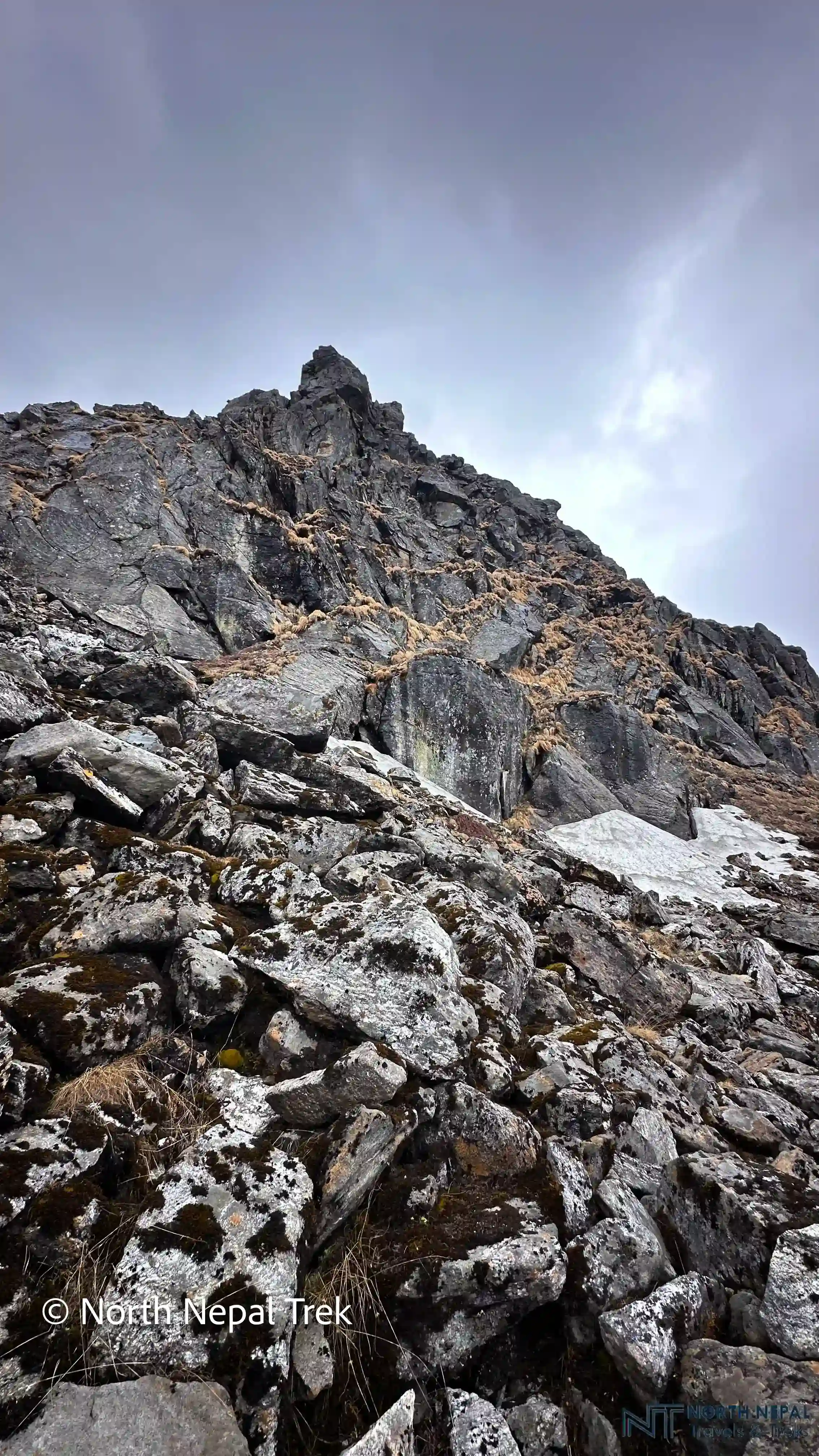
The fifth day of the Namun La Pass trek takes us through avalanche-prone zones and areas where rock falls are common, so we must be cautious and maintain steady footing to avoid loose rocks. We follow a trail carved into the mountain roots until we reach Chimre Deurali, characterized by its rocky landscape. While this section is relatively safe, it is complex enough to be unsuitable for beginners. The trek from Thulek to Thurju takes 6-7 hours and challenges us with its rugged terrain and challenging conditions.
Photo: Route from Chimre Deurali to Thurju
After trekking for 4 hours, we will reach Chimre Deurali, which is a high mountain pass located at an altitude of 5054 m, another highlight of this trek. From Chimre Deurali, the path to Thurju intensifies in difficulty, all the way through cliffs with challenging trails that mostly ascend the hillside. After an approximate 2-3 hour descent, we arrive in Thurju, a location that offers basic shelters for camping. This area also houses Kali Pokhari, a significant local lake and landmark.
Historically, Thurju served as a grazing field and location for buffalo grazing and sheds for the communities of Jagat, Timang, and Chyamche. Previously, the primary sources of income here used to be animal rearing and the harvesting of medicinal herbs. Some of the notable herbs found in this region include Sundried Chiraito, Panch Aaule, Yarsagumba (referred to as Kira in the local dialect), bushes of Sunpati plant, Nagbeli, and Padamchaal. The presence of wildlife such as Danphe, snow leopards, and Thar adds to the region's rich biodiversity, and due to it being at the base of the high Himalayas, Thurju is a kind of base camp of many Himalayas.
The Dudhpokhari is within the proximity of Thurju which makes it possible to visit and return in a single day—a trek that takes about 3 hours and 30 minutes upwards and 2 hours to descend. Dudhpokhari is positioned at the base of Lamjung Himal and is encircled by the Himalayas, at an altitude of 4620 m, and also features three small ponds, known as Dudhpokhari Kunda.
Photo: Thurju
Dudhpokhari is a cultural and spiritual place near Thurju, which holds deep religious significance for the Gurung community. During Janaipurnima, a significant festival, a large crowd of devotees gather at Dudhpokhari to bathe and cleanse their sins, similar to the practices observed at Gosaikunda. It's also a place where locals offer animal sacrifices to the Bharaha, their god thanking them for fulfilling their wishful vows.
Furthermore, Given the strenuous nature of consecutive high-altitude passes, a rest day in Thurju is recommended to prepare for the challenges ahead. So, planning an overnight stay in Thurju with a side trip to Dudhpokhari is ideal for resting and recovering our bodies. As we did the Chimre Deurali pass yesterday, we need to recover before attempting another high pass. This side trip provides us with essential rest and the opportunity to acclimatize properly before attempting the Namun La Pass. This rest day not only helps with acclimatization but also allows trekkers to explore local attractions like DudhPokhari and the culturally rich environment of Thurju.
The trek from Thurju to Daphe Kharka via the formidable Namun La Pass is one of the most challenging yet visually rewarding segments of our journey. Starting from Thurju, we first cross a hanging bridge, which starts our adventurous day. From here, the initial climb is relatively easy, taking us up a series of stairs for about an hour.
Photo: Danfe Kharka
After this easy ascent, the journey continues through areas heavily affected by landslides, often requiring us to zigzag through the remains and debris of the landslide. This part of the trail offers a raw and unfiltered experience of the mountain's dynamic landscape. After crossing this challenging section, we will reach a place called Phurju Deurali after trekking for 2 to 3 hours from Thurju. Phurju Deurali, at an altitude of 4,385 m, is a vantage point, from where we can witness amazing views, and it also serves as a rest point. From here, it's another hour's trek to Namun La Bhanjyang and then an additional 1 to 2 hours to the very top of Namun La Pass.
As we approach Namun La Pass, the trek becomes increasingly demanding, and it takes approximately 4 to 5 hours to reach the pass from Thurju. Namun La Pass itself is one of the most challenging passes in the Annapurna region, at an altitude of 4850 m. The terrain here is filled with steep cliffs and loose rocks. The best times for trekking this pass are during September, October, and November when the weather conditions are most stable. Trekking during the monsoon months of April through July is avoidable due to frequent landslides and poor visibility, which can be less than 100 meters during cloudy weather.
Despite the challenging trek, the panoramic views from the pass are breathtaking, showcasing a 360-degree vista of the Himalayan giants like Manaslu, Annapurna II, Annapurna IV, Phungi, Himlung, Koto Peak, and Phu Himal. The rugged terrain also provides a habitat for snow leopards, with the isolated and wild nature of the area making it an ideal hunting ground, so we might even spot an elusive snow leopard on the entire trek.
From the pass, the descent is just as intense as the ascent. The first hour of the descent is very dangerous, as we will be trekking through the route opened directly by landslides, and small avalanches. Moreover, the route is filled with loose rocks and narrow paths that necessitate traveling one person at a time. However, The final two hours are comparatively easy walks along the man-made stairs. So, the total trekking time for the seventh day of Namun La Pass is 7-8 hours.
After a total of 2 to 3 hours descending from the pass, we arrive at Danfe Kharka, a vast grassland that serves as our campsite for the night. This spot offers another spectacular set of views, including Himlung, Chulu East, West, Purkung, Purbung, Jinjang, Yakwakang, and Dajong. Daphe Kharka is not only a place for rest but also an opportunity to reflect on the incredible journey through one of the most remote and beautiful passes in the Himalayas.

The final leg of our trek takes us from Daphe Kharka to Timang, a journey with 4 to 5 hours of full descent. This segment is relatively easier thanks to a path filled with staircases that pass through tree-lined areas, offering some relief after the challenging terrains of higher altitudes. As there are no natural water resources along this path, trekkers need to carry sufficient drinking water. Additionally, with no teahouses available until Timang, packing a lunch is necessary.
Photo: Timang
Upon approaching Timang, we cross a bridge that marks the near end of our descent. Timang offers a variety of accommodation options, ranging from fully modern teahouses to the opportunity to camp in one of its large playing fields, providing flexibility depending on the preferences of the group.
Upon reaching Timang, trekkers have a choice to conclude the journey here or continue exploring the vast Annapurna region. For those wishing to extend their adventure, Timang serves as a gateway to further expeditions:
Annapurna Circuit: Just 2 hours of trekking or a short 30-minute drive from Timang is Chame, the starting point for the renowned Annapurna Circuit Trek. This route offers a more developed trail experience with varying landscapes and cultural exposures.
Narphu Valley Trek: For a more secluded and rugged experience, the Narphu Valley Trek presents an opportunity to explore hidden villages and untouched natural beauty in a more remote part of the region.
We take a jeep from Timang to Pokhara, covering around 160 km so we start early for a full-day journey. The first section is a 3-4 hour descent on rugged, unpaved roads, passing through villages like Dharapani and Jagat, with views of waterfalls, forests, and valleys.
Photo: Pokhara sightseeing
From Besisahar, the road improves, and we continue for another 4-5 hours on smoother highways through lush hills, terraced fields, and along the Marshyangdi River, with brief stops for refreshments.
By evening, we reach Pokhara, welcomed by the serene Phewa Lake and the lively Lakeside area, a perfect end to the day.
Best Season: March-May and September-November are best for the Namun La Pass crossing (5,054m) – snow can block the pass outside these windows, so check current conditions with your guide before booking.
Itineraries are structured with careful elevation profiles to ensure proper acclimatization before reaching high-altitude points like Namun La Pass (5,054 m). Guides conduct rigorous daily health assessments for early symptoms of Acute Mountain Sickness (AMS). If severe symptoms appear, standard protocol mandates immediate descent to lower elevations.
In cases of severe injury, acute altitude illness, or extreme weather conditions on remote, cliff-side trails, emergency helicopter evacuation is coordinated directly through local rescue services. Evacuations are initiated promptly upon assessment by your guide in communication with our Pokhara and Kathmandu offices.
All trekkers must hold comprehensive travel insurance covering emergency medical treatment, high-altitude trekking and camping (up to 5,500 m), and emergency helicopter rescue/evacuation. Insurance details must be submitted prior to the departure of the trek to streamline emergency logistics if required.
Secure the Namun La Pass Trek for 2026/2027 before the seat gets fully booked.